Area Overview for B12 9WS
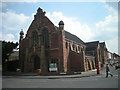
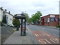
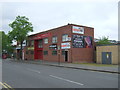
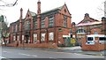
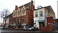
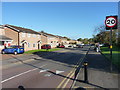
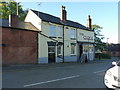
Photos of B12 9WS

Area Information
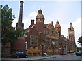
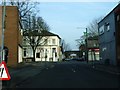
Living in B12 9WS, part of Balsall Heath West in Birmingham, means inhabiting a small residential cluster with a population of 1,215. This area, historically farmland and commons, was annexed into Birmingham in 1891 and reshaped by urban renewal in the late 20th century. Today, it is a compact postcode with a distinct character shaped by its proximity to the city centre and its legacy of 19th-century development. The area’s population is relatively small, reflecting its tight-knit nature, and its residents benefit from proximity to Moseley Road, a historic thoroughfare. Balsall Heath West is notable for its diverse community, including one of Birmingham’s largest Muslim populations, established since the 1940s. Daily life here is defined by a mix of urban convenience and historical architecture, with parks and community spaces offering respite from the city’s pace. The area’s compact size means residents are within easy reach of Birmingham’s transport networks, retail hubs, and cultural landmarks.
- Area Type
- Postcode
- Area Size
- Not available
- Population
- 1215
- Population Density
- 5607 people/km²
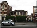
The property market in B12 9WS is characterised by a 39% home ownership rate, placing it firmly in the rental market. Despite this, the predominant accommodation type is houses, which is atypical for a small urban postcode. This suggests a mix of older, larger properties that may have been converted or retained their original form. The area’s compact size means that property availability is limited, and buyers may need to consider nearby areas for more options. The presence of houses rather than flats may appeal to families seeking space, though the low home ownership rate indicates that many residents rent. Potential buyers should note that the area’s history of urban renewal in the 1970s and 1980s may have influenced the current housing stock, with a focus on practical, functional properties rather than luxury developments.
House Prices in B12 9WS
No properties found in this postcode.
Energy Efficiency in B12 9WS
The lifestyle in B12 9WS is shaped by its proximity to retail, transport, and community spaces. Local shops like Lidl Sparkbrook, Aldi Sparkbrook, and Spar City offer everyday essentials, while the nearby rail and metro stations provide seamless access to Birmingham’s commercial and cultural hubs. The area’s historical roots are reflected in its parks, though specific names are not listed in the data. The presence of multiple transport options means residents can easily reach Birmingham’s vibrant city centre or surrounding suburbs. The compact nature of the postcode fosters a sense of community, with shared spaces and local amenities encouraging social interaction. While the data does not detail leisure facilities, the area’s transport links suggest access to broader recreational opportunities beyond its immediate boundaries.
Amenities
Schools
The nearest schools to B12 9WS include Heath Mount Primary School, listed twice in the data. Both entries describe it as a primary school, though no Ofsted ratings are provided. This suggests a limited range of educational options for younger children, with only one primary school available. The absence of secondary schools in the immediate vicinity may require families to consider commuting to nearby areas for secondary education. The single primary school could indicate a smaller catchment area, potentially leading to smaller class sizes or community-focused teaching. However, the lack of diversity in school types raises questions about educational choices for families prioritising multiple options. Parents should investigate further to understand the school’s performance and facilities beyond what is listed here.
| Rank | School | Type | Entry gender | Ages |
|---|
Explore more schools in this area
Go to Schools tabDemographics
The population of B12 9WS has a median age of 47, with the most common age range being adults aged 30–64. This suggests a community of middle-aged and older residents, many of whom may be long-term residents. Home ownership in the area is relatively low at 39%, indicating a rental market that dominates. The predominant accommodation type is houses, which is unusual for a city-centre postcode, suggesting a mix of older, family-oriented housing. The area’s predominant ethnic group is Asian, reflecting broader demographic trends in Birmingham. This diversity shapes the local culture, with community institutions and places of worship playing a central role. The lower home ownership rate may indicate affordability challenges or a preference for rental properties, though the specific reasons are not detailed in the data.
Household Size
Accommodation Type
Tenure
Ethnic Group
Religion
Household Composition
Age
Household Deprivation
NS-SEC
Explore more demographic insights in this area
Go to Demographics tabPlanning
Planning Constraints
- Flood RiskPremium
- Ramsar Wetland SitesPremium
- Area of Outstanding Natural BeautyPremium
- Protected Nature ReservePremium
- Protected WoodlandPremium