Area Overview for B12 9WR
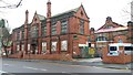
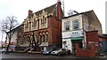
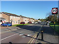
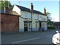
Photos of B12 9WR
Area Information
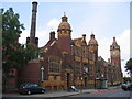
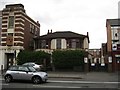
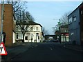
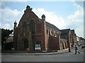
Living in B12 9WR means inhabiting a small, defined postcode area within Birmingham’s Balsall Heath West ward. This urban cluster, part of the city’s south-eastern sprawl, has a population of 1,215, reflecting its compact residential nature. Historically, the broader Balsall Heath area was farmland, later annexed into Birmingham in 1891. Today, it is a neighbourhood shaped by post-war urban renewal and a legacy of diverse communities, including one of the city’s largest Muslim populations. The area’s character blends Victorian-era infrastructure, such as Balsall Heath Park and the 1895 library, with modern retail and transport links. Daily life here is influenced by proximity to Birmingham’s central rail network and a mix of local amenities. While the area’s small size limits expansion, its strategic location near key transport routes and schools makes it a practical choice for those prioritising connectivity over sprawling green spaces.
- Area Type
- Postcode
- Area Size
- Not available
- Population
- 1215
- Population Density
- 5607 people/km²
B12 9WR’s property market is defined by its 39% home ownership rate, which implies a strong rental market. The accommodation type is predominantly houses, a rarity in urban areas, suggesting a focus on family-friendly housing stock. This could indicate a mix of semi-detached or terraced homes, potentially appealing to buyers seeking larger living spaces. However, the area’s small size and limited expansion mean property choices are constrained. For buyers, this dynamic may present both challenges and opportunities: while the rental market could offer steady returns, the scarcity of available properties might drive competition. The presence of houses also suggests a focus on long-term occupancy rather than short-term investment, aligning with the area’s demographic of middle-aged residents. Prospective buyers should consider the balance between rental demand and the limited supply of owner-occupied properties in this compact postcode.
House Prices in B12 9WR
No properties found in this postcode.
Energy Efficiency in B12 9WR
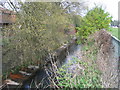
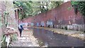
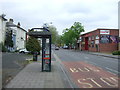
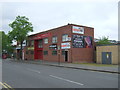
Daily life in B12 9WR is shaped by its proximity to retail, transport, and green spaces. The nearby Lidl Sparkbrook, Aldi Sparkbrook, and Spar City provide essential shopping, while the area’s rail and metro stations—such as Bordesley and Grand Central New Street—offer easy access to Birmingham’s wider network. Parks like Calthorpe Park and Balsall Heath Park, established in the 19th century, provide recreational space with Victorian-era design. The area’s historical legacy includes cultural landmarks like the 1900 College of Art and the Shia Mosque on Clifton Road. While the data does not list dining or leisure venues explicitly, the presence of retail and transport hubs suggests a functional lifestyle focused on connectivity and convenience. The blend of green spaces and urban infrastructure offers a balance between community amenities and practicality.
Amenities
Schools
The nearest school to B12 9WR is Heath Mount Primary School, a primary institution serving the area. While the data lists this school twice, it appears to be the sole named educational institution in proximity. The absence of secondary schools or additional primary options suggests families may need to look beyond the immediate postcode for comprehensive schooling. This could impact the appeal of the area for households with children requiring a full range of educational stages. However, the presence of a primary school indicates some local provision for younger children, reducing the need for long commutes. The lack of detailed Ofsted ratings means the quality of education remains unassessed, leaving prospective residents to rely on local reputation or further research.
| Rank | School | Type | Entry gender | Ages |
|---|
Explore more schools in this area
Go to Schools tabDemographics
The population of B12 9WR has a median age of 47, with the majority aged between 30 and 64 years. This suggests a community skewed towards middle-aged adults, likely including families and professionals. Home ownership rates stand at 39%, indicating that over two-thirds of residents rent their homes. The predominant accommodation type is houses, which is uncommon in densely populated urban areas, hinting at a mix of semi-detached or terraced properties. The predominant ethnic group is Asian_total, reflecting the area’s historical ties to migration patterns in Birmingham. This demographic profile shapes the neighbourhood’s social dynamics, with a focus on community cohesion and intergenerational living. The relatively high proportion of renters may influence local property values and investment opportunities, though the limited data on deprivation means broader quality-of-life implications remain unquantified.
Household Size
Accommodation Type
Tenure
Ethnic Group
Religion
Household Composition
Age
Household Deprivation
NS-SEC
Explore more demographic insights in this area
Go to Demographics tabPlanning
Planning Constraints
- Flood RiskPremium
- Ramsar Wetland SitesPremium
- Area of Outstanding Natural BeautyPremium
- Protected Nature ReservePremium
- Protected WoodlandPremium