Area Overview for B12 9RS
Photos of B12 9RS
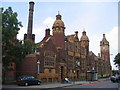
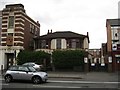
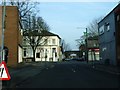
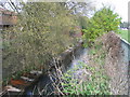


79 photos from this area
Area Information
Key information about the B12 9RS including its size, population, and administrative classification.
- Area Type
- Postcode
- Area Size
- 2111 m²
- Population
- 1607
- Population Density
- 7824 people/km²
House Prices in B12 9RS
12
Properties
£156,333
Average Sold Price
£36,000
Lowest Price
£224,000
Highest Price
Showing 12 properties
| Address | Type | Beds | Baths | Last Sale Price | Last Sale Date | |
|---|---|---|---|---|---|---|
| 281 Mary Street, Sparkbrook, Birmingham, B12 9RS | house | - | - | £224,000 | May 2021 | |
| 279 Mary Street, Sparkbrook, Birmingham, B12 9RS | house | 1 | - | £209,000 | May 2020 | |
| 283 Mary Street, Sparkbrook, Birmingham, B12 9RS | Terraced | 3 | 1 | £36,000 | Nov 2001 | |
| 273 Mary Street, Sparkbrook, Birmingham, B12 9RS | house | 3 | - | - | - | |
| Flat, 269-271 Mary Street, Sparkbrook, Birmingham, B12 9RS | Flat | - | - | - | - | |
| 277 Mary Street, Sparkbrook, Birmingham, B12 9RS | house | - | - | - | - | |
| 275 Mary Street, Sparkbrook, Birmingham, B12 9RS | house | - | - | - | - | |
| 293 Mary Street, Sparkbrook, Birmingham, B12 9RS | house | - | - | - | - | |
| 287 Mary Street, Sparkbrook, Birmingham, B12 9RS | Terraced | 4 | 3 | - | - | |
| 285 Mary Street, Sparkbrook, Birmingham, B12 9RS | house | - | - | - | - |
Page 1 of 2
Energy Efficiency in B12 9RS
Amenities
Schools
| Rank | School | Type | Entry gender | Ages |
|---|
Explore more schools in this area
Go to Schools tabDemographics
Household Size
One person
most common
Accommodation Type
Flats
most common
Tenure
27
majority
Ethnic Group
asian_total
most common
Religion
N/A
most common
Household Composition
N/A
most common
Age
47
median
Adults (30-64 years)
most common
Household Deprivation
N/A
with no deprivation
NS-SEC
24
in Lower managerial occupations
Explore more demographic insights in this area
Go to Demographics tabPlanning
Planning Constraints
- Flood RiskPremium
- Ramsar Wetland SitesPremium
- Area of Outstanding Natural BeautyPremium
- Protected Nature ReservePremium
- Protected WoodlandPremium