Area Overview for B12 9PF
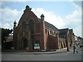
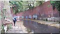
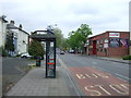
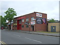
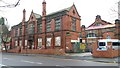
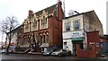
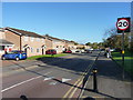
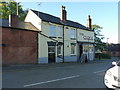
Photos of B12 9PF
Area Information
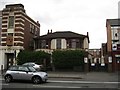
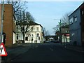
Living in B12 9PF means being part of a small, tightly knit residential cluster in south Birmingham, within the Balsall Heath West electoral ward. With a population of 1,607, the area is compact but historically rich, shaped by 19th-century urban expansion and post-war renewal. Its proximity to Birmingham’s city centre offers easy access to employment, culture, and transport, while its roots in farmland and commons hint at a slower, more grounded pace of life. The community is diverse, with a significant Asian population and a long-established Muslim community dating back to 1940. Daily life here balances practicality with character: Victorian parks like Balsall Heath Park offer green space, while nearby Moseley Road retains echoes of its 19th-century grandeur. Despite its small size, B12 9PF sits at the crossroads of Birmingham’s past and present, blending urban convenience with a distinct local identity. For buyers, it’s a place where affordability meets proximity to essential services, though the area’s challenges—such as high crime rates—require careful consideration.
- Area Type
- Postcode
- Area Size
- Not available
- Population
- 1607
- Population Density
- 7824 people/km²
B12 9PF’s property market is characterised by a high proportion of rental properties, with only 27% of homes owned by residents. This suggests a transient population and limited opportunities for long-term homeownership. The accommodation type is predominantly flats, a legacy of post-war housing developments and the area’s compact footprint. For buyers, this means the market is not geared toward owner-occupation, with fewer options for larger homes or detached properties. The small size of the postcode area also limits availability, making it a niche market for those prioritising proximity to Birmingham’s city centre over property size. Flats in B12 9PF are likely to be in older, purpose-built blocks, which may require renovation or present challenges in terms of space and condition. Prospective buyers should consider the area’s rental dynamics and the potential for limited capital growth, though the location’s connectivity to transport and amenities may offset these factors.
House Prices in B12 9PF
No properties found in this postcode.
Energy Efficiency in B12 9PF
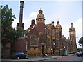
B12 9PF’s lifestyle is defined by its proximity to practical amenities and green spaces. Nearby retail options include Lidl Sparkbrook, Aldi Edgbaston, and Morrisons Daily, offering everyday shopping needs within walking distance. The area’s transport links to railway stations and metro stops make it easy to access Birmingham’s cultural and commercial centres. For leisure, Balsall Heath Park and Calthorpe Park provide open spaces for walking, picnics, and outdoor activities, while historic sites like the Balsall Heath Library and the former College of Art on Moseley Road add a layer of local heritage. The mix of retail, transport, and greenery creates a convenient, if compact, lifestyle. However, the area’s small size means that some amenities—such as larger supermarkets or specialist shops—require a short trip to adjacent neighbourhoods.
Amenities
Schools
The nearest school to B12 9PF is St John and Monica Catholic Primary School, a primary institution with a ‘good’ Ofsted rating. This school serves the local community, offering education for younger children, but families requiring secondary education will need to look beyond the immediate area. The absence of secondary schools within B12 9PF itself means that parents must factor in commuting times or school catchment areas when considering the area. The presence of a single primary school with a strong rating is a positive, but the lack of diversity in school types—no secondary or specialist institutions—may limit options for growing families. This underscores the importance of researching nearby schools in adjacent postcodes to ensure a full range of educational provision.
| Rank | School | Type | Entry gender | Ages |
|---|
Explore more schools in this area
Go to Schools tabDemographics
The population of B12 9PF is predominantly adults aged 30–64, with a median age of 47. This suggests a mature, settled community, though home ownership is low at 27%, indicating that most residents are renters. Flats are the primary accommodation type, reflecting the area’s post-war housing stock and limited space for larger properties. The predominant ethnic group is Asian, a legacy of migration patterns over decades. This demographic profile shapes the area’s social fabric: a mix of long-term residents and newer arrivals, with a focus on family-oriented living. The low home ownership rate means the housing market is largely rental-driven, which can affect stability for buyers. However, the presence of a large Muslim community adds cultural diversity, with institutions like the Shia Mosque on Clifton Road reflecting this. The age distribution also implies a need for accessible healthcare and community services tailored to middle-aged and older adults.
Household Size
Accommodation Type
Tenure
Ethnic Group
Religion
Household Composition
Age
Household Deprivation
NS-SEC
Explore more demographic insights in this area
Go to Demographics tabPlanning
Planning Constraints
- Flood RiskPremium
- Ramsar Wetland SitesPremium
- Area of Outstanding Natural BeautyPremium
- Protected Nature ReservePremium
- Protected WoodlandPremium