Area Overview for B12 9NF
Photos of B12 9NF

Area Information
B12 9NF represents a specific residential cluster within the broader Balsall Heath West ward of Birmingham City Council. This electoral ward covers an urban area to the south of the city centre and holds a population of approximately 11,165 residents. You are looking at a postcode area covering a small residential cluster where history meets modern urban living. The name first recorded as Bordeshale in 1275, the area was historically located between the ancient settlement of Moseley village and the city of Birmingham. Originally part of the Kings Norton Parish in Worcestershire, it formally became part of Birmingham on 1 October 1891. During the 19th century, the area supplied food to the developing town via routes across the heath. Expansion along Moseley Road brought urban development from the 1850s, with horse-drawn omnibuses running along this route from 1846. Today, this postcode sits in an urban environment that was once known for industrial growth but now hosts diverse communities. The ward's creation in 2018 increased Birmingham's wards from 40 to 69, reflecting the evolving administrative landscape. Living in B12 9NF means residing in a neighbourhood with deep historical roots, from its time as farmland to its integration into the modern city fabric.
- Area Type
- Postcode
- Area Size
- Not available
- Population
- 1937
- Population Density
- 12965 people/km²
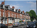
Property life in B12 9NF is defined by a substantial stock of houses, which constitute the primary accommodation type for residents. With a home ownership rate of 49%, nearly half of the households in this postcode area own their properties outright or with a mortgage. This percentage suggests a mixed market where investment and long-term living coexist, rather than a market dominated purely by short-term rentals. The presence of houses indicates that buyers can expect traditional property types, potentially ranging from older Victorian structures to modern renovations common in urban Birmingham settings. The 49% figure serves as a crucial indicator for prospective homebuyers evaluating the稳定性 of the neighbourhood. High ownership rates often correlate with community stability and lower turnover compared to areas with dominant rental markets. When selling later, you may find a robust pool of local buyers who understand the value of owning a house in this specific cluster. The accommodation type data confirms a focus on residential living rather than commercial or transient housing.
House Prices in B12 9NF
No properties found in this postcode.
Energy Efficiency in B12 9NF
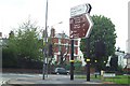
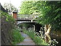
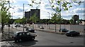
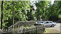
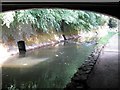
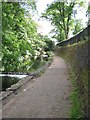
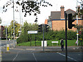
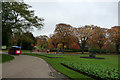
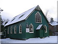
Residents of B12 9NF benefit from immediate access to essential amenities and transport links within practical reach. Retail options include Morrisons Daily, Aldi Edgbaston, and Lidl Sparkbrook, providing convenient shopping for groceries and daily necessities. Five railway stations serve the area closely: Brighton Road, Five Ways, Bordesley, and Birmingham Moor Street Railway Stations. Additionally, tube connections link you to Edgbaston Village, Grand Central New Street, and Centenary Square. This network allows quick travel across Birmingham and beyond. Local green spaces include Calthorpe Park, which opened on 1 June 1857, and Balsall Heath Park, established in 1894. Cultural landmarks such as Balsall Heath Library and Balsall Heath Baths were constructed after the area annexed into Birmingham in 1891. The College of Art opened on Moseley Road in 1900, adding historical interest to the streetscape. A Shia Mosque opened on Clifton Road in 1982, contributing to the area's cultural diversity. Early cinemas like the Triangle on Gooch Street and The Imperial on Moseley Road once shaped social life. Today, these venues and nearby facilities support a varied lifestyle with easy access to food, transport, and leisure.
Amenities
Schools
| Rank | School | Type | Entry gender | Ages |
|---|
Explore more schools in this area
Go to Schools tabDemographics
The community in B12 9NF reflects a distinct demographic profile centred around adults aged 30 to 64 years. The median age for the immediate population is 22, yet the most common age range identifies adults working and raising families between 30 and 64. House ownership stands at 49%, indicating a balanced market where roughly half of residents own their homes. The predominant accommodation type is houses, suggesting free-standing or semi-detached properties form the core of the housing stock. You will find a diverse ethnic mix, with Asian residents forming the predominant ethnic group in this postcode area. While the median age is notably low at 22, the prevalence of families in the 30 to 64 bracket suggests strong community investment in raising children. The 49% home ownership rate points to a stable neighbourhood where long-term residents often stay put. This balance between owner-occupiers and renters creates a dynamic living environment. The demographic data confirms that households are not merely transient but represent a significant portion of the local population structure.
Household Size
Accommodation Type
Tenure
Ethnic Group
Religion
Household Composition
Age
Household Deprivation
NS-SEC
Explore more demographic insights in this area
Go to Demographics tabPlanning
Planning Constraints
- Flood RiskPremium
- Ramsar Wetland SitesPremium
- Area of Outstanding Natural BeautyPremium
- Protected Nature ReservePremium
- Protected WoodlandPremium
- Crime RiskPremium