Area Overview for B12 9AU
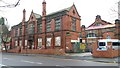
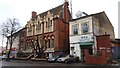
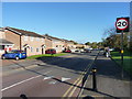
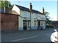
Photos of B12 9AU
Area Information
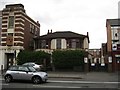
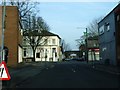
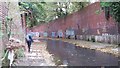
B12 9AU lies in the heart of Balsall Heath West, a small residential cluster within Birmingham’s south-western quadrant. With a population of 1,791, this area reflects a blend of historical significance and modern urban life. Originally farmland, it became part of Birmingham in 1891, later reshaped by post-war urban renewal. Today, it hosts a diverse community, including one of the city’s largest Muslim populations, established since the 1940s. The area’s character is defined by its Victorian-era parks, such as Calthorpe Park and Balsall Heath Park, offering green spaces amid terraced housing. Proximity to Moseley Road, a historic thoroughfare, connects residents to cultural landmarks like the College of Art and Balsall Heath Library. While the postcode covers a compact footprint, its accessibility to Birmingham’s rail network and nearby retail hubs makes it practical for commuters. Living here means navigating a mix of older infrastructure and recent developments, with a community shaped by resilience and reinvention.
- Area Type
- Postcode
- Area Size
- Not available
- Population
- 1791
- Population Density
- 4924 people/km²
B12 9AU’s property market is characterised by a 45% home ownership rate, indicating that less than half of properties are owner-occupied, with the remainder likely in rental or shared ownership. The accommodation type is predominantly houses, though the small postcode area and limited housing stock suggest a constrained market. This may mean buyers face competition for available properties, particularly given the area’s proximity to Birmingham’s core. The mix of older homes and post-war housing creates a varied inventory, but the low home ownership rate implies that rental demand is strong. For buyers, this dynamic could mean higher prices or limited availability, especially for family homes. The area’s compact size also means that proximity to amenities is critical, with properties needing to balance location against space.
House Prices in B12 9AU
No properties found in this postcode.
Energy Efficiency in B12 9AU
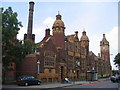
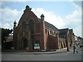
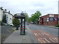
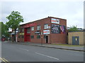
Daily life in B12 9AU is shaped by its proximity to retail, green spaces, and transport. The area’s retail offerings include Lidl Sparkbrook, Spar City, and Aldi Sparkbrook, providing essential shopping within walking distance. Parks such as Calthorpe Park and Balsall Heath Park offer recreational space, with the latter’s Victorian design blending historic charm with modern amenities. The Balsall Heath Library and Baths, opened in the late 19th century, remain landmarks, reflecting the area’s heritage. Cultural and community hubs, such as the College of Art and Balsall Heath City Farm, add to the local character. The mix of retail, leisure, and green spaces supports a balanced lifestyle, though the area’s small size means residents must navigate limited local services. For those prioritising convenience, the proximity to rail and metro stations enhances accessibility to Birmingham’s broader offerings.
Amenities
Schools
B12 9AU is served by a range of educational institutions, including Joseph Chamberlain Sixth Form College, which specialises in post-16 education. For younger students, Redstone Academy for Boys and Redstone Academy for Girls offer independent education with Ofsted ratings of “good,” while Heritage Academy, also independent, holds an “outstanding” rating. This mix of school types provides families with options, from state sixth-form colleges to high-performing independent schools. The presence of multiple academies suggests a focus on quality education, though the area’s smaller size may limit school catchment diversity. Families seeking independent education will find strong options, while those preferring state-run institutions may need to consider nearby wards. The overall provision reflects a commitment to educational choice, though the dominance of independent schools may influence local demographics and school competition.
| Rank | School | Type | Entry gender | Ages |
|---|
Explore more schools in this area
Go to Schools tabDemographics
The median age in B12 9AU is 47, with the majority of residents aged 30–64. This suggests a mature, stable population, though the 45% home ownership rate indicates a significant proportion of renters. The area’s accommodation is predominantly houses, reflecting a mix of older properties and post-war housing stock. The predominant ethnic group is Asian, aligning with broader trends in Birmingham’s south-west. This demographic contributes to the area’s cultural diversity, though it also raises questions about housing affordability and community integration. With 45% of homes owned by residents, the area leans more towards a rental market than owner-occupied living, which may influence property values and investment appeal. The population size—1,791 within the postcode—suggests a tightly knit community, though it is part of a larger ward with 11,165 residents, creating a dynamic interplay between local and broader social networks.
Household Size
Accommodation Type
Tenure
Ethnic Group
Religion
Household Composition
Age
Household Deprivation
NS-SEC
Explore more demographic insights in this area
Go to Demographics tabPlanning
Planning Constraints
- Flood RiskPremium
- Ramsar Wetland SitesPremium
- Area of Outstanding Natural BeautyPremium
- Protected Nature ReservePremium
- Protected WoodlandPremium