Area Overview for B12 8SJ
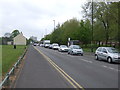
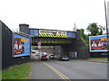
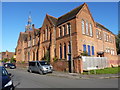
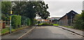
Photos of B12 8SJ


Area Information
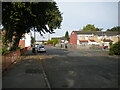
Living in B12 8SJ means being part of a small residential cluster in Birmingham’s Sparkbrook and Balsall Heath East ward, a historically significant area shaped by post-1960s immigration from the Commonwealth. The postcode covers a compact urban area with a population of 1,972, though the wider ward has 27,338 residents. This is a young, culturally diverse community, with a median age of 22 and a majority of residents aged 30–64. The area’s character is defined by its mix of independent shops, small businesses, and community hubs along Stratford Road and Ladypool Road. Balsall Heath Park provides green space, while the ward’s economic profile reflects challenges: it is Birmingham’s most deprived area, with high child poverty rates. Yet, residents show strong entrepreneurial energy, and the area’s cultural richness persists through food, fashion, and religious institutions. Proximity to rail and metro stations, combined with excellent broadband connectivity, makes it accessible for commuters and remote workers. For buyers, this area offers a blend of urban living, community vibrancy, and practical amenities, though economic and social challenges remain evident.
- Area Type
- Postcode
- Area Size
- Not available
- Population
- 1972
- Population Density
- 11179 people/km²
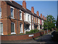
The property market in B12 8SJ reflects a 45% home ownership rate, indicating that nearly half of households are owner-occupied, while the remaining 55% are renters. The area is dominated by houses rather than flats, suggesting a focus on family homes in a compact urban setting. This dynamic points to a mix of long-term residents and those seeking affordable housing in a historically diverse community. Given the ward’s status as Birmingham’s most deprived area, property values may be lower than in more affluent parts of the city. Buyers should consider the limited housing stock, as the postcode covers a small cluster of homes. The presence of independent shops and community hubs suggests a localised, residential market rather than a high-end or speculative investment area. For those seeking owner-occupied properties, the mix of houses and rental demand may create competition, but the area’s cultural and transport advantages could appeal to buyers prioritising community over luxury.
House Prices in B12 8SJ
No properties found in this postcode.
Energy Efficiency in B12 8SJ
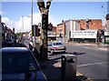
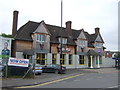
Life in B12 8SJ is shaped by its proximity to retail, transport, and green spaces. Nearby amenities include Lidl Sparkbrook, Aldi Sparkbrook, and Co-op Moseley, offering essential shopping. Rail and metro stations provide easy access to Birmingham’s transport hubs, while Balsall Heath Park offers a local green space for recreation. The area’s character is defined by its small businesses, particularly along Stratford Road and Ladypool Road, where independent shops and community hubs thrive. These streets serve as social and economic anchors, fostering a sense of local identity. While the ward’s economic challenges affect broader opportunities, the availability of basic amenities and transport links ensures a functional lifestyle. Residents can enjoy a mix of urban convenience and community-driven commerce, though the lack of high-end dining or entertainment options may require travel to nearby areas for more varied leisure choices.
Amenities
Schools
The schools near B12 8SJ include St Paul’s Community School, an independent institution; St Paul’s Community Foundation School, a primary school; and St Paul’s School, a special needs school with an Ofsted rating of satisfactory. This mix provides options for families seeking independent education, primary schooling, or specialist support for children with additional needs. The presence of a special school highlights the area’s commitment to inclusive education, though the Ofsted rating for St Paul’s School indicates room for improvement in standards. Families may need to travel beyond the immediate postcode to access high-performing schools, as no top-tier institutions are explicitly noted in the data. The availability of multiple school types reflects the community’s diversity, but buyers should assess the quality of education against their priorities, particularly if they require specific provisions for their children.
| Rank | School | Type | Entry gender | Ages |
|---|
Explore more schools in this area
Go to Schools tabDemographics
B12 8SJ has a median age of 22, significantly younger than Birmingham’s average, with the most common age group being adults aged 30–64. Home ownership stands at 45%, meaning 55% of households are renters. The area is predominantly occupied by houses rather than flats, reflecting its residential character. The dominant ethnic group is Asian, with a higher proportion of Black, Asian, and Minority Ethnic (BAME) residents than the city as a whole. The ward is Birmingham’s most deprived area, with the 8th highest child poverty rate among 69 wards. This context shapes daily life: services and infrastructure may face strain, and employment rates are below the city average. However, the community is marked by resilience and cultural dynamism, with small businesses and faith-based organisations playing central roles. The younger demographic and high BAME presence contribute to a distinct social fabric, though economic deprivation affects access to opportunities and quality of life.
Household Size
Accommodation Type
Tenure
Ethnic Group
Religion
Household Composition
Age
Household Deprivation
NS-SEC
Explore more demographic insights in this area
Go to Demographics tabPlanning
Planning Constraints
- Flood RiskPremium
- Ramsar Wetland SitesPremium
- Area of Outstanding Natural BeautyPremium
- Protected Nature ReservePremium
- Protected WoodlandPremium