Area Overview for B12 8QW
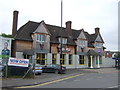
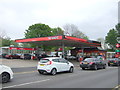
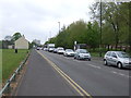
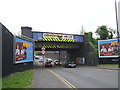
Photos of B12 8QW
Area Information
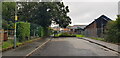
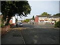
B12 8QW is a small residential postcode in Birmingham’s south, part of the Balsall Heath West electoral ward. With a population of 1,561, it reflects a compact, urban cluster shaped by historical annexation from Worcestershire in 1891. The area’s character is a blend of 19th-century architecture and 20th-century renewal, including Victorian parks like Calthorpe Park and Balsall Heath Park. Once a farming region, it evolved into a hub for Birmingham’s working-class communities, later marked by decline before regeneration efforts reshaped its identity. Today, it hosts a diverse population, including one of Birmingham’s largest Muslim communities, established since the 1940s. The area’s proximity to Moseley Road, a historic thoroughfare, and its mix of retail and transport options make it a practical choice for families and commuters. While the postcode covers a small footprint, it offers access to schools, green spaces, and rail links, reflecting a balance between urban convenience and community roots.
- Area Type
- Postcode
- Area Size
- Not available
- Population
- 1561
- Population Density
- 7377 people/km²
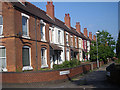
The property market in B12 8QW is characterised by a low home ownership rate of 31%, indicating that most residents rent rather than own their homes. The accommodation type is primarily houses, which is unusual for a postcode in Birmingham’s densely populated zones. This suggests a limited supply of owner-occupied properties, potentially making the area more attractive to renters seeking larger homes. For buyers, the small postcode area and its immediate surroundings may offer fewer opportunities for purchase, with properties likely to be older and requiring maintenance. The predominance of houses could also mean higher demand from families, but the low ownership rate implies competition for available listings. Prospective buyers should consider the area’s rental-focused nature and the practicality of investing in a property that may cater more to long-term tenants than first-time buyers.
House Prices in B12 8QW
No properties found in this postcode.
Energy Efficiency in B12 8QW
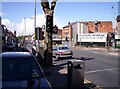
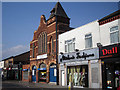
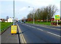
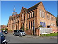
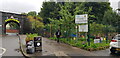
Living in B12 8QW offers a blend of urban convenience and community amenities. Retail options include Lidl Sparkbrook, Co-op Moseley, and Aldi Sparkbrook, providing everyday shopping needs. Parks like Calthorpe Park and Balsall Heath Park offer green spaces for leisure, while historical sites such as the Balsall Heath Library (opened 1895) and the Shia Mosque on Clifton Road reflect the area’s cultural heritage. The nearby Balsall Heath City Farm and community initiatives like the Balsall Heath Forum add to the local character. Rail and metro stations provide easy access to Birmingham’s business districts and beyond. The mix of retail, parks, and cultural landmarks fosters a lifestyle that balances practicality with a sense of place, though the area’s compact size means amenities are concentrated within a short walk or drive.
Amenities
Schools
Residents of B12 8QW have access to a range of schools, including Tindal Junior and Infant School (primary), Ark Tindal Primary Academy (primary, Ofsted-rated ‘good’), and Birmingham Rathbone School of LE (special needs). Independent options include Moseley Women Academy and Sz School, catering to families seeking alternative education. The mix of state and independent schools provides flexibility, with Ark Tindal’s ‘good’ rating offering reassurance for parents prioritising quality. The presence of a special school highlights the area’s commitment to inclusive education. For families, this diversity means choices between free, state-funded education and private institutions, though the limited number of schools may necessitate commuting for certain options. The proximity of these schools to residential areas underscores their role in shaping the community’s daily life and long-term stability.
| Rank | School | Type | Entry gender | Ages |
|---|
Explore more schools in this area
Go to Schools tabDemographics
The population of B12 8QW has a median age of 47, with adults aged 30–64 forming the largest demographic group. Home ownership here is relatively low at 31%, suggesting a rental market dominates. The accommodation type is predominantly houses, which is uncommon in modern Birmingham’s high-density areas. The predominant ethnic group is Asian, reflecting broader trends in Birmingham’s multicultural fabric. This demographic profile indicates a community with established families and a strong presence of older adults. The low home ownership rate may impact property availability for buyers, while the house-centric stock suggests larger, potentially older properties. The area’s history of urban renewal and its current diversity highlight a mix of long-term residents and newer arrivals, shaping a dynamic but tightly knit local environment.
Household Size
Accommodation Type
Tenure
Ethnic Group
Religion
Household Composition
Age
Household Deprivation
NS-SEC
Explore more demographic insights in this area
Go to Demographics tabPlanning
Planning Constraints
- Flood RiskPremium
- Ramsar Wetland SitesPremium
- Area of Outstanding Natural BeautyPremium
- Protected Nature ReservePremium
- Protected WoodlandPremium