Area Overview for B12 8EE
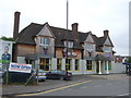
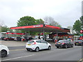
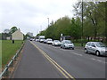
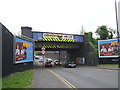
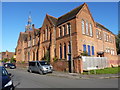
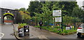
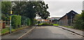
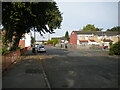
Photos of B12 8EE
Area Information
Living in B12 8EE means inhabiting a small, densely populated residential cluster within Birmingham’s Sparkbrook and Balsall Heath East ward. This area, with a population of 1,791, is part of a larger electoral ward that ranks as Birmingham’s most deprived. Its character is defined by a history of industrial growth and post-1960s migration from the Commonwealth, creating a culturally rich, ethnically diverse community. The ward’s urban fabric is marked by independent shops, small businesses, and community hubs along Stratford Road and Ladypool Road, though economic challenges persist. Despite high unemployment and underinvestment, residents demonstrate resilience, with a focus on local entrepreneurship. The area’s proximity to Balsall Heath Park offers limited green space, but its vibrancy lies in its people—predominantly adults aged 30–64, with a significant Asian population. For buyers, B12 8EE presents a compact, tightly knit environment where daily life revolves around local commerce, community ties, and the pressures of a deprived urban setting.
- Area Type
- Postcode
- Area Size
- Not available
- Population
- 1791
- Population Density
- 4924 people/km²
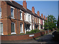
B12 8EE’s property market is defined by a 45% home ownership rate, suggesting that over half of the area’s housing is rented. The predominant accommodation type is houses, though the small postcode area likely contains a limited number of properties. This dynamic points to a rental market dominated by private landlords, with fewer owner-occupied homes. The compact nature of the area means buyers may face competition for a small selection of houses, potentially driving up prices. However, the ward’s deprivation and economic challenges may temper demand, with property values reflecting the broader socioeconomic context. For buyers, the market is niche: properties are likely older, with limited modernization, and proximity to amenities such as schools and transport links could be decisive factors. Immediate surroundings may offer more options, but B12 8EE itself is a tightly contained postcode.
House Prices in B12 8EE
No properties found in this postcode.
Energy Efficiency in B12 8EE
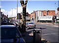
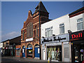
Residents of B12 8EE have access to retail outlets including Spar City, Aldi Sparkbrook, and Lidl Sparkbrook, offering convenience for daily shopping. Nearby rail stations such as Bordesley and Small Heath, along with metro stops like Grand Central New Street, provide connectivity to Birmingham’s transport network. Balsall Heath Park, though not explicitly detailed, is a local green space. The area’s character is shaped by independent shops and community hubs along Stratford Road and Ladypool Road, fostering a sense of local identity. However, the absence of detailed transport or leisure facilities means lifestyle options are inferred from nearby amenities. For buyers, the proximity to retail and transport links is a practical advantage, though the area’s limited size may restrict access to larger leisure or cultural venues.
Amenities
Schools
The nearest schools to B12 8EE include Joseph Chamberlain Sixth Form College, a sixth-form institution, and three independent schools: Redstone Academy for Boys, Redstone Academy for Girls, and Heritage Academy. Heritage Academy holds an Ofsted rating of outstanding, while the other two are rated good. This mix of independent and sixth-form schools caters to families seeking diverse educational options, from secondary education to specialized post-16 provision. The presence of high-rated independent schools may attract families prioritizing academic standards, though the area’s broader deprivation could affect access to resources. For buyers, proximity to these schools is a key consideration, though the ward’s economic challenges may influence school funding and support services.
| Rank | School | Type | Entry gender | Ages |
|---|
Explore more schools in this area
Go to Schools tabDemographics
The population of B12 8EE is 1,791, with a median age of 47, reflecting a mature demographic skewed toward adults aged 30–64. Home ownership here is low at 45%, indicating a rental-heavy market, and the predominant accommodation type is houses, though the small area’s housing stock is likely limited. The ward’s Asian population dominates, contributing to its cultural diversity. However, deprivation is acute: it is Birmingham’s most deprived ward, with the eighth-highest child poverty rate. This context shapes quality of life, with limited economic opportunities and higher unemployment. The community’s age profile and ethnic composition suggest a settled, family-oriented population, though challenges in health, education, and employment persist. For buyers, the area’s demographics highlight both its community resilience and the socioeconomic hurdles that may influence property value and long-term investment.
Household Size
Accommodation Type
Tenure
Ethnic Group
Religion
Household Composition
Age
Household Deprivation
NS-SEC
Explore more demographic insights in this area
Go to Demographics tabPlanning
Planning Constraints
- Flood RiskPremium
- Ramsar Wetland SitesPremium
- Area of Outstanding Natural BeautyPremium
- Protected Nature ReservePremium
- Protected WoodlandPremium