Area Overview for B12 8EB
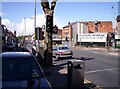
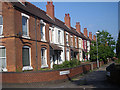
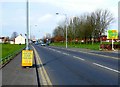
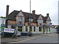
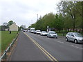
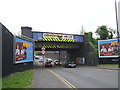
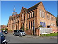
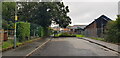
Photos of B12 8EB


Area Information
Living in B12 8EB means being part of a small, tightly knit residential cluster in Birmingham’s Sparkbrook and Balsall Heath East ward. With a population of 1,947, the area is characterised by its urban density and cultural diversity. Historically shaped by post-1960s migration from the Commonwealth, it remains a hub for Black, Asian, and minority ethnic communities. The median age is 22, but the most common age range is 30–64, reflecting a working-age population. Daily life is punctuated by independent shops on Stratford Road and Ladypool Road, where small businesses thrive despite broader economic challenges. Balsall Heath Park offers a green space for recreation, while the ward’s proximity to Birmingham’s city centre provides access to cultural and economic opportunities. However, it is the city’s most deprived ward, with the 8th highest child poverty rate, underscoring systemic issues in employment and investment. Despite this, the area’s entrepreneurial spirit and community cohesion create a distinct, resilient character.
- Area Type
- Postcode
- Area Size
- Not available
- Population
- 1947
- Population Density
- 8102 people/km²
The property market in B12 8EB is defined by a 45% home ownership rate, with houses being the dominant accommodation type. This suggests a mix of owner-occupied and rental properties, though the relatively low ownership rate may indicate a reliance on private rentals or shared living arrangements. The presence of houses rather than flats implies a focus on family homes, though the area’s small size limits housing stock diversity. For buyers, this means a constrained market with limited options for new builds or larger properties. The ward’s deprivation status may also influence property values, with potential challenges in securing mortgages or investment. Proximity to Birmingham’s city centre could offer appeal for commuters, but the area’s economic underinvestment may deter long-term capital growth.
House Prices in B12 8EB
No properties found in this postcode.
Energy Efficiency in B12 8EB
Residents of B12 8EB have access to a range of amenities within practical reach, including retail outlets like Aldi Sparkbrook, Spar City, and Lidl Sparkbrook. These stores provide everyday essentials, supporting a convenience-focused lifestyle. Nearby rail and metro stations—Small Heath, Bordesley, Tyseley, Grand Central New Street, Corporation Street, and Bull Street—offer easy access to Birmingham’s wider urban network. Balsall Heath Park serves as a local green space for leisure and exercise, while the area’s independent shops on Stratford Road and Ladypool Road reflect its entrepreneurial character. The combination of retail, transport, and open space creates a functional environment, though the lack of major leisure venues or cultural hubs may require travel for broader entertainment options.
Amenities
Schools
The nearest schools to B12 8EB include Conway Primary School and Ladypool Primary School, both offering primary education. Ladypool Primary School holds a ‘good’ Ofsted rating, while Conway Primary School is listed twice in the data, though no rating is specified for the second entry. The presence of two primary schools suggests a focus on early education, but the absence of secondary schools nearby means families may need to travel for older children’s schooling. This mix of school types indicates a community prioritising early education, though the lack of secondary options could be a practical challenge for families with older children. The quality of primary education, particularly at Ladypool, may be a draw for parents seeking established schools in the area.
| Rank | School | Type | Entry gender | Ages |
|---|
Explore more schools in this area
Go to Schools tabDemographics
B12 8EB’s population of 1,947 is predominantly young, with a median age of 22, though the most common age range is 30–64 years. This suggests a working-age demographic, though the area’s child poverty rate is among Birmingham’s highest. Home ownership is relatively low at 45%, with houses being the primary accommodation type. The predominant ethnic group is Asian, reflecting the ward’s historical role as a migration hub. However, the area’s deprivation status—being Birmingham’s most deprived ward—impacts quality of life, with limited access to high-quality services and employment opportunities. This context means residents often face challenges in health, education, and economic mobility, though community networks and local businesses offer resilience. The high proportion of BAME residents and younger population also shape the area’s cultural vibrancy and social dynamics.
Household Size
Accommodation Type
Tenure
Ethnic Group
Religion
Household Composition
Age
Household Deprivation
NS-SEC
Explore more demographic insights in this area
Go to Demographics tabPlanning
Planning Constraints
- Flood RiskPremium
- Ramsar Wetland SitesPremium
- Area of Outstanding Natural BeautyPremium
- Protected Nature ReservePremium
- Protected WoodlandPremium