Area Overview for B12 8DH
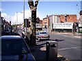
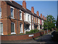
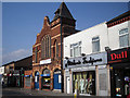
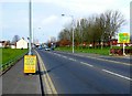
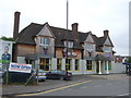
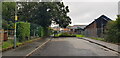
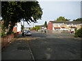
Photos of B12 8DH


Area Information
Living in B12 8DH means being part of a small, tightly knit residential cluster in Birmingham’s Sparkbrook and Balsall Heath East ward. This area, with a population of 1,775 in its postcode, sits within a larger electoral ward of 27,338 residents, known for its cultural diversity and historical roots as a hub for post-1960s Commonwealth migrants. The community thrives on a mix of small businesses, independent shops, and community hubs along Stratford Road and Ladypool Road. While the ward faces challenges like high deprivation and unemployment, it retains a strong sense of local identity. Residents benefit from proximity to Balsall Heath Park and a network of retail and transport links, though the area’s urban character means it lacks green spaces beyond what is already provided. Daily life here balances the vibrancy of a multicultural community with the practicalities of a densely populated inner-city location. For buyers, B12 8DH offers a chance to live in a historically significant, socially dynamic part of Birmingham, though potential buyers should consider the area’s economic and social challenges alongside its cultural assets.
- Area Type
- Postcode
- Area Size
- Not available
- Population
- 1775
- Population Density
- 11571 people/km²
The property market in B12 8DH is characterised by a 41% home ownership rate, with houses being the predominant accommodation type. This suggests a focus on owner-occupied properties rather than a rental market, though the relatively low home ownership percentage indicates a significant portion of the housing stock is rented. The area’s small size means the housing stock is concentrated, with properties likely to be older and requiring maintenance. Buyers should consider the economic challenges of the ward, including high unemployment and underinvestment, which may affect property values and long-term appreciation. The presence of houses rather than flats or apartments suggests a preference for larger, family-oriented homes, though the limited data does not specify property sizes or price ranges. For those seeking a home in this area, the market offers a blend of traditional housing stock and proximity to local amenities, but potential buyers must weigh the community’s socio-economic context against its cultural and historical appeal.
House Prices in B12 8DH
No properties found in this postcode.
Energy Efficiency in B12 8DH
The lifestyle in B12 8DH is shaped by its proximity to retail hubs like Aldi Sparkbrook, Lidl Sparkbrook, and Asda Sparkhill, offering convenient shopping options. The area’s small businesses and independent shops, particularly along Stratford Road and Ladypool Road, contribute to a distinct local character. Balsall Heath Park provides a green space for recreation, though the ward lacks larger parks or leisure facilities. Public transport access to rail and metro stations enhances mobility, allowing residents to reach Birmingham’s cultural and commercial centres. However, the absence of detailed transport data means reliance on nearby stations for longer journeys. The community’s entrepreneurial energy and cultural diversity are reflected in local amenities, though the area’s economic challenges may limit the range of services. Overall, B12 8DH offers a blend of practical convenience and urban vibrancy, ideal for those seeking a mix of retail, transport, and community-focused living.
Amenities
Schools
The nearest school to B12 8DH is Nelson Mandela School, a primary school with an Ofsted rating of ‘good’. This provides families with a locally rated educational option for younger children. However, the data does not include secondary schools or other educational institutions in the immediate vicinity. The presence of a single primary school with a positive rating is a key consideration for families prioritising early education, though parents may need to look further afield for secondary schooling. The ward’s demographic profile, with a significant proportion of adults aged 30–64, suggests that many residents may have established careers, potentially reducing the demand for secondary education within the area. For those seeking a school within walking distance, Nelson Mandela School offers a reliable option, but additional research would be needed to assess broader educational provision.
| Rank | School | Type | Entry gender | Ages |
|---|
Explore more schools in this area
Go to Schools tabDemographics
The population of B12 8DH has a median age of 47, with the most common age range being adults aged 30–64. Home ownership stands at 41%, suggesting a mix of owner-occupied and rented properties. The predominant accommodation type is houses, reflecting the area’s residential character. The ward’s demographic profile is shaped by a significant Asian population, which constitutes the largest ethnic group. This aligns with the broader history of Sparkbrook and Balsall Heath as centres for post-1960s migration from the Commonwealth. However, the ward is Birmingham’s most deprived, with the 8th highest child poverty rate across the city’s 69 wards. This context influences access to services and opportunities, though the community’s entrepreneurial spirit and cultural richness persist. The higher proportion of Black, Asian, and Minority Ethnic (BAME) residents, combined with a younger age profile than the city average, defines a dynamic but economically challenged environment.
Household Size
Accommodation Type
Tenure
Ethnic Group
Religion
Household Composition
Age
Household Deprivation
NS-SEC
Explore more demographic insights in this area
Go to Demographics tabPlanning
Planning Constraints
- Flood RiskPremium
- Ramsar Wetland SitesPremium
- Area of Outstanding Natural BeautyPremium
- Protected Nature ReservePremium
- Protected WoodlandPremium