Area Overview for B12 8AT
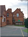
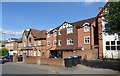
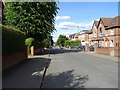
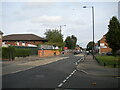
Photos of B12 8AT


Area Information
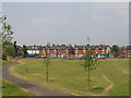
B12 8AT represents a specific residential cluster within the broader south-western fabric of Birmingham. This postcode covers an area of 4,506 square metres and supports a population of 1,413 residents. While the area bears the B12 identifier on maps, the surrounding research context points to the historic transformation of nearby Moseley from an independent village into a mature middle-class suburb by the turn of the 20th century. Before becoming part of Birmingham in 1911, this region evolved through distinct phases of proto-suburbanisation and initial development between 1800 and 1900. The legacy of this history is visible in the local infrastructure, including the Moseley Tunnel, which was constructed in the mid-19th century to shield St Mary's Church from railway vibrations. Residents here benefit from a setting that blends historical significance with modern utility. The area offers a compact living environment where every postcode zone is closely knitted to the wider community. Whether you are seeking a home near the historic woodbridge road or looking to buy in a cluster defined by specific local boundaries, this location connects you to the established rhythms of west-midlands life. The small size of the cluster means you live within a tight-knit pocket of the city, yet you retain access to the extensive networks that serve the larger borough.
- Area Type
- Postcode
- Area Size
- 4506 m²
- Population
- 1413
- Population Density
- 12181 people/km²
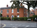
Homes in B12 8AT are characterised by a stock that is primarily composed of houses. This fact indicates that if you choose to live in this postcode, you are likely looking at a traditional house rather than a flat or apartment. With an accommodation type dominated by houses, the selling points of detached or semi-detached living are prevalent. The area features a 52% home ownership rate, which is a substantial majority. This high percentage of owner-occupiers implies that the neighbourhood is stable, with fewer temporary residents passing through frequently. For you, as a potential buyer, this suggests you will be joining a community where many people have put down roots. The small size of the area, covering only 4,506 square metres, means that the housing stock is concentrated. You may find it easier to view properties in person compared to larger, sprawling districts. The fact that houses are the main accommodation type means the streetscapes will reflect the architectural choices of homeowners. This environment suits those who prefer the space and feel associated with house ownership over the density of apartment living.
House Prices in B12 8AT
Showing 1 properties
| Address | Type | Beds | Baths | Last Sale Price | Last Sale Date | |
|---|---|---|---|---|---|---|
| The Caretakers Flat, T A Centre, Stoney Lane, Sparkbrook, Birmingham, B12 8AT | Flat | - | - | - | - |
Energy Efficiency in B12 8AT
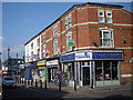
Living in B12 8AT places you within practical reach of significant retail hubs and transport links. For shopping, Asda Sparkhill, Aldi Sparkbrook, and Lidl Sparkbrook are the notable retailers within easy access. These supermarkets provide a comprehensive choice for weekly groceries and household needs. Your daily commute options are extensive, drawing from five notable railway stations including Small Heath Railway Station, Bordesley Railway Station, and Tyseley Railway Station. Furthermore, the Birmingham Metro network connects you to five key locations such as Grand Central New Street, Corporation Street, and Town Hall. This network allows you to travel across the city with ease. While the historical context mentions Moseley Park and Pool as a local feature, your immediate accessible amenities will rely on the Sparkhill and Sparkbrook clusters listed for this postcode. The combination of major supermarkets and multiple railway stations means you can run errands quickly and access wider Birmingham without long waits. This connectivity supports a lifestyle where professional commitments and shopping trips coexist smoothly in your daily routine.
Amenities
Schools
Your options for education when living near B12 8AT are anchored by specific local institutions. Anderton Park Primary School is the nearest primary school listed for the area. This institution holds an Ofsted rating of good, confirming its standard of education. Because the school type is primary and the area has a median age of 47, you must look beyond immediate boundaries if you have children of school age. The demographic data shows that adults aged 30 to 64 are the most common residents, meaning many neighbours may not have primary school-aged children at home. Consequently, while Anderton Park Primary School is a confirmed option with a good rating, your search for schools near B12 8AT should include other nearby catchment zones to find secondary education or locations suitable for younger families. The presence of a good-rated primary school is a positive baseline fact for families considering this specific postcode, even if the immediate demographic does not reflect a high concentration of young dependents.
| Rank | School | Type | Entry gender | Ages |
|---|
Explore more schools in this area
Go to Schools tabDemographics
The community living in B12 8AT is defined by a settled population with a median age of 47 years. Adults aged between 30 and 64 constitute the most common age range, indicating a neighbourhood dominated by established households rather than families raising young children or pensioners. Over half of the residents, specifically 52%, own their homes, suggesting a market where many people remain in the area for the long term. The predominant accommodation type consists of houses, which aligns with the ownership figures and the demographic profile of adult homeowners. Ethnic diversity is marked, with the total Asian population being the predominant ethnic group in the locality. This demographic mix creates a mature community where residents have likely built their lives and assets in the area over many decades. The high level of home ownership relative to the population size suggests stability. You are looking to join a group of neighbours who are invested in their property rather than transient renters. The absence of significant young family demographics, indicated by the age profile, means the atmosphere is likely quieter compared to areas with a higher concentration of school-age children.
Household Size
Accommodation Type
Tenure
Ethnic Group
Religion
Household Composition
Age
Household Deprivation
NS-SEC
Explore more demographic insights in this area
Go to Demographics tabPlanning
Planning Constraints
- Flood RiskPremium
- Ramsar Wetland SitesPremium
- Area of Outstanding Natural BeautyPremium
- Protected Nature ReservePremium
- Protected WoodlandPremium