Area Overview for B12 0XQ
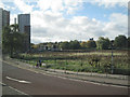
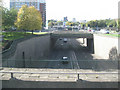
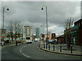
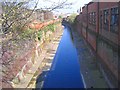
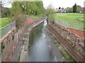
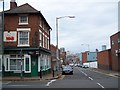
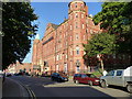
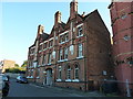
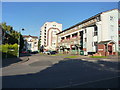
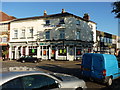
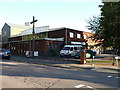
Photos of B12 0XQ

Area Information
B12 0XQ lies in the heart of Birmingham, within the Bordesley and Highgate electoral ward, a historically significant area shaped by centuries of industrial and urban development. With a population of 1,655, this small postcode area is a compact residential cluster nestled east of the city centre, bordering Digbeth, Highgate, and Deritend. The area’s name traces back to Old English, reflecting its origins as a cleared forested space for farming. Today, it is a hub of 19th-century industrial heritage, with remnants of rope-making and paint manufacturing still echoing in its streets. Daily life here is defined by proximity to Birmingham’s core, offering easy access to rail networks, retail, and cultural amenities. Despite its modest size, the area has a distinct character, blending historic architecture with modern living. Its compact nature means residents are close to essential services, though the community’s young median age of 22 contrasts with the most common age range of 30–64, suggesting a mix of students, professionals, and families. This postcode is ideal for those seeking urban convenience without sacrificing historical depth.
- Area Type
- Postcode
- Area Size
- Not available
- Population
- 1655
- Population Density
- 4932 people/km²
The property market in B12 0XQ is characterised by a low home ownership rate of 18%, indicating that the majority of residents are renters rather than homeowners. The accommodation type is predominantly flats, a legacy of the area’s 19th-century industrial past and its development as a compact residential cluster. This suggests a limited supply of owner-occupied homes, with the market likely skewed towards rental properties. For buyers, this small postcode area offers few opportunities for purchase, as the housing stock is primarily flats in multi-unit buildings. The lack of high home ownership may reflect the area’s affordability or its status as a transitional zone for those seeking proximity to Birmingham’s core. Buyers should consider the limited availability of private residences and the potential for long-term rental commitments. The focus on flats also means that property searches in this area should prioritise leasehold options and consider the practicalities of living in a densely populated urban setting.
House Prices in B12 0XQ
No properties found in this postcode.
Energy Efficiency in B12 0XQ
The lifestyle in B12 0XQ is shaped by its proximity to retail, transport, and urban amenities. Within practical reach are five retail outlets, including Spar City, Morrisons Daily Bristol, and Co-op Birmingham, providing essential shopping options for daily needs. The area’s transport network is a key feature, with five railway stations and five metro stops, including Bordesley Railway Station and Grand Central New Street, facilitating easy access to Birmingham’s business district and cultural hubs. While the data does not specify parks or leisure facilities, the presence of multiple retail and transport nodes suggests a focus on convenience over expansive green spaces. The compact nature of the area means that residents can access shops, dining, and public transport within short distances, though the absence of named parks or recreational facilities may limit opportunities for outdoor activities. The mix of retail and transport infrastructure supports a practical, urban lifestyle, ideal for those prioritising accessibility over expansive leisure options.
Amenities
Schools
Residents of B12 0XQ have access to a range of educational institutions, including St Anne’s Catholic Primary School, which holds an Ofsted rating of ‘good’. This school provides a solid foundation for younger children, though its capacity may be limited given the area’s population size. The Harper Bell Adventist School is an independent institution, offering a distinct educational approach but likely catering to a smaller, specific demographic. For special needs education, Calthorpe School Sports College and Calthorpe Academy serve students with specific learning requirements, though their exact capacities and facilities are not detailed. However, the Harper Bell Seventh-day Adventist School, a primary school with an Ofsted rating of ‘inadequate’, raises concerns about the quality of education available in some local institutions. Families seeking schools in this area should weigh the availability of both state and independent options, while being mindful of the varying standards. The presence of special needs schools suggests a focus on inclusivity, but the inadequate rating at one primary school highlights the need for careful research when selecting a school for children.
| Rank | School | Type | Entry gender | Ages |
|---|
Explore more schools in this area
Go to Schools tabDemographics
The population of B12 0XQ is predominantly adults aged 30–64, despite a median age of 22, indicating a balance between younger residents and older households. Home ownership is low at 18%, meaning most residents are renters, a trend common in urban areas with limited housing stock. The accommodation type is primarily flats, reflecting the area’s density and historical development as a working-class suburb. The predominant ethnic group is Black, highlighting the community’s diversity. While specific deprivation data is not provided, the low home ownership rate and high proportion of renters may suggest economic pressures, though this is not explicitly stated. The age profile suggests a mix of established families and younger professionals, creating a dynamic but potentially transient community. The presence of schools catering to both primary and special needs further indicates a focus on family-oriented living, though the demographic data does not clarify the exact proportion of children in the area.
Household Size
Accommodation Type
Tenure
Ethnic Group
Religion
Household Composition
Age
Household Deprivation
NS-SEC
Explore more demographic insights in this area
Go to Demographics tabPlanning
Planning Constraints
- Flood RiskPremium
- Ramsar Wetland SitesPremium
- Area of Outstanding Natural BeautyPremium
- Protected Nature ReservePremium
- Protected WoodlandPremium