Area Overview for B12 0XD
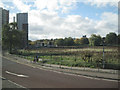
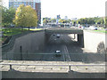
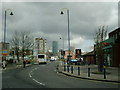
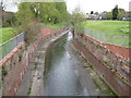
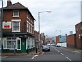
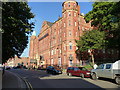
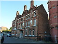
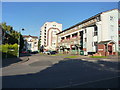
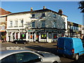
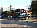
Photos of B12 0XD


Area Information
B12 0XD lies at the heart of Birmingham, within the Bordesley and Highgate electoral ward, a historically significant area shaped by centuries of industrial and urban development. With a population of 1,444, this small postcode cluster sits east of the city centre, encompassing parts of Digbeth, Highgate, and Bordesley—areas steeped in history from medieval manors to 19th-century manufacturing. The ward’s origins trace back to Old English, with its name reflecting early agricultural settlement. Today, it blends historic character with modern infrastructure, offering proximity to Birmingham’s cultural and commercial hubs. Residents benefit from a compact, walkable environment with easy access to rail and metro links, while the area’s industrial past lingers in its architecture and community identity. Though small, B12 0XD is strategically positioned, bridging the city’s historic core with its evolving urban landscape. Its mix of residential flats and proximity to amenities make it a practical choice for those seeking affordability and connectivity in central Birmingham.
- Area Type
- Postcode
- Area Size
- Not available
- Population
- 1444
- Population Density
- 6808 people/km²
B12 0XD’s property market is characterised by a high proportion of rental properties, with only 17% of homes owned by residents. Flats dominate the housing stock, reflecting the area’s compact, urban layout. This suggests a market primarily catering to renters, particularly young professionals or those seeking affordability in central Birmingham. The limited availability of owner-occupied homes may make it challenging for buyers seeking long-term investment or family housing. Given the postcode’s small size, the surrounding areas likely offer similar housing dynamics, with flats and rental properties forming the backbone of the local real estate scene. Prospective buyers should consider the area’s transient nature and focus on proximity to transport links, which may outweigh the limitations of a narrow housing stock.
House Prices in B12 0XD
No properties found in this postcode.
Energy Efficiency in B12 0XD
The lifestyle in B12 0XD is defined by accessibility to essential amenities. Five retail outlets, including Spar City, Morrisons Daily Bristol, and Tesco Birmingham, offer convenient shopping options. Nearby rail stations like Bordesley and Five Ways, along with metro stops such as Corporation Street, ensure easy travel for work or leisure. While the area lacks detailed information on parks or leisure facilities, its proximity to Birmingham’s urban core means residents can access cultural and recreational opportunities in the city. The combination of retail, transport, and central location fosters a practical, service-oriented lifestyle, ideal for those prioritising convenience over expansive green spaces.
Amenities
Schools
B12 0XD is served by a range of primary and academy schools, including Percy Shurmer Primary School and St Albans CofE Specialist Engineering College, both offering primary education. For secondary options, Ark St Alban’s Academy and Percy Shurmer Academy provide academy-led education, with the latter achieving an outstanding Ofsted rating. The presence of both traditional state schools and high-performing academies offers families choice, though the focus on primary education suggests the area may appeal more to households with younger children. The mix of school types reflects a blend of conventional and specialist education, potentially catering to diverse academic needs. However, the absence of secondary schools within the postcode itself may require families to travel for older children’s schooling.
| Rank | School | Type | Entry gender | Ages |
|---|
Explore more schools in this area
Go to Schools tabDemographics
The population of B12 0XD skews towards adults aged 30–64, with a median age of 22, reflecting a community dominated by working-age individuals. Home ownership is low at 17%, indicating a rental-heavy market, with flats comprising the predominant accommodation type. The Black population forms the largest ethnic group, contributing to the area’s cultural diversity. This demographic profile suggests a transient or economically mobile population, with limited long-term residential stability. The absence of specific deprivation data means quality of life factors like access to services or employment opportunities remain unquantified, but the area’s proximity to transport and retail hubs may offset potential challenges. The age distribution hints at a workforce-oriented community, though the low homeownership rate may impact local investment and property value trends.
Household Size
Accommodation Type
Tenure
Ethnic Group
Religion
Household Composition
Age
Household Deprivation
NS-SEC
Explore more demographic insights in this area
Go to Demographics tabPlanning
Planning Constraints
- Flood RiskPremium
- Ramsar Wetland SitesPremium
- Area of Outstanding Natural BeautyPremium
- Protected Nature ReservePremium
- Protected WoodlandPremium