Area Overview for B12 0WD
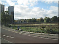
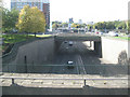
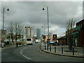
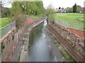
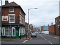
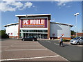
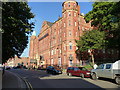
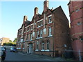
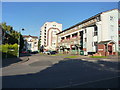
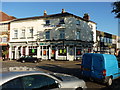
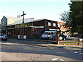
Photos of B12 0WD

Area Information
B12 0WD is a small, tightly defined postcode area in central Birmingham, encompassing parts of Bordesley, Highgate, and Digbeth. With a population of 1,655, it is a compact residential cluster situated near the city’s core, blending historic character with modern urban living. The area’s name derives from Old English, reflecting its long-standing roots as a clearing for agriculture, later evolving into a hub of industry and trade. Today, it is part of the Birmingham Ladywood parliamentary constituency and lies within walking distance of the city’s landmarks. Daily life here is shaped by proximity to Birmingham’s transport networks, including multiple railway stations and metro stops. The area’s mix of older housing stock and recent developments caters to a community that includes young professionals, families, and students, with a median age of 22 but a majority of residents aged 30–64. Living in B12 0WD means navigating a dense urban environment with limited green spaces but strong connectivity to the city’s economic and cultural centres.
- Area Type
- Postcode
- Area Size
- Not available
- Population
- 1655
- Population Density
- 4932 people/km²
The property market in B12 0WD is characterised by a high proportion of rental flats, with only 18% of homes owner-occupied. This suggests a market skewed towards tenants rather than buyers, likely due to the area’s small size and limited housing stock. The predominance of flats indicates a focus on high-density living, which may appeal to those seeking affordability or proximity to transport. However, the low home ownership rate implies limited opportunities for long-term investment or equity growth. Buyers considering this area should be aware of the limited availability of owner-occupied properties and the potential for a competitive rental market. The compact nature of B12 0WD means that property choices are restricted to a narrow range of flats, with little scope for expansion or development.
House Prices in B12 0WD
No properties found in this postcode.
Energy Efficiency in B12 0WD
Life in B12 0WD is shaped by its urban density and proximity to retail and transport hubs. Nearby amenities include Spar City, Tesco Birmingham, and other retail outlets, offering convenience for daily shopping. The area’s historical industrial roots are reflected in its infrastructure, though modern amenities like metro stations and railway links dominate daily routines. Parks and green spaces are limited, but the compact layout ensures that essential services are within walking distance. The presence of multiple schools and transport stops adds to the area’s practicality, though the lack of expansive leisure facilities may require residents to travel further for recreation. The mix of retail and transport options supports a lifestyle centred on convenience and connectivity.
Amenities
Schools
Near B12 0WD are several schools catering to different educational needs. St Anne’s Catholic Primary School (Ofsted rating: good) and Harper Bell Seventh-day Adventist School (Ofsted rating: inadequate) serve primary education, while Calthorpe School Sports College and Calthorpe Academy are special needs institutions. The Harper Bell Adventist School is an independent option. The mix of state and independent schools provides families with choices, though the inadequate rating at one primary school raises concerns about educational quality. The presence of special schools suggests the area accommodates diverse needs, but parents should scrutinise the performance of individual institutions. The proximity of multiple schools within practical reach is a practical advantage for families.
| Rank | School | Type | Entry gender | Ages |
|---|
Explore more schools in this area
Go to Schools tabDemographics
The population of B12 0WD is predominantly adults aged 30–64, with a median age of 22, indicating a mix of younger and middle-aged residents. Home ownership is low at 18%, suggesting most residents rent their accommodation, which is primarily flats. This reflects a community shaped by rental housing and possibly transient populations. The predominant ethnic group is Black, highlighting the area’s diversity. The demographic profile implies a workforce-oriented population, with many likely employed in Birmingham’s city centre or nearby industries. The low home ownership rate may indicate affordability challenges or a transient demographic, though the area’s compact size and proximity to amenities could attract those prioritising convenience over long-term property investment.
Household Size
Accommodation Type
Tenure
Ethnic Group
Religion
Household Composition
Age
Household Deprivation
NS-SEC
Explore more demographic insights in this area
Go to Demographics tabPlanning
Planning Constraints
- Flood RiskPremium
- Ramsar Wetland SitesPremium
- Area of Outstanding Natural BeautyPremium
- Protected Nature ReservePremium
- Protected WoodlandPremium