Area Overview for B12 0UH
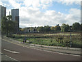
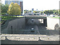
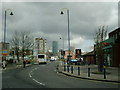
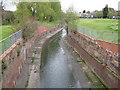
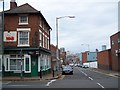
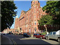
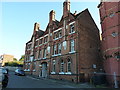
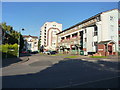
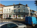
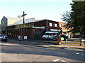
Photos of B12 0UH


Area Information
B12 0UH is a small, compact postcode area in the heart of Birmingham, England, encompassing parts of Bordesley, Highgate, and nearby districts like Digbeth. With a population of 1,655, it reflects the city’s dense urban fabric, where historic industrial roots meet modern residential living. The area’s proximity to Birmingham’s central business district offers easy access to employment, culture, and transport networks. Bordesley itself has a long history, dating back to the 7th century, with its name derived from Old English. Today, it is a mix of older housing stock and newer developments, though its character remains defined by its role as a hub for trade and industry. The area’s small size means it is tightly integrated with surrounding neighbourhoods, creating a tightly knit community. However, its compact nature also means that amenities and services are concentrated within a short walk or cycle ride, making it practical for those who prioritise convenience over sprawling landscapes.
- Area Type
- Postcode
- Area Size
- Not available
- Population
- 1655
- Population Density
- 4932 people/km²
The property market in B12 0UH is characterised by a low rate of home ownership—just 18% of residents own their homes. This suggests that the area is primarily a rental market, with flats being the dominant accommodation type. The limited number of owner-occupied properties may make it challenging for buyers seeking long-term investment or family homes, particularly in a small postcode area where housing stock is constrained. The prevalence of flats reflects the area’s urban density and historical development as a residential cluster. For prospective buyers, this means that available properties are likely to be smaller, with limited scope for expansion or renovation. The immediate surroundings also offer few alternatives, as the area is tightly integrated with adjacent neighbourhoods. Those considering purchase should factor in the high proportion of renters and the potential for competition in a market where demand may outstrip supply.
House Prices in B12 0UH
No properties found in this postcode.
Energy Efficiency in B12 0UH
Living in B12 0UH offers a blend of urban convenience and practical amenities. The area’s retail landscape includes major supermarkets like Tesco and Morrisons, ensuring easy access to groceries and daily essentials. Nearby rail and metro stations, such as Bordesley and Grand Central New Street, facilitate swift travel to Birmingham’s core and beyond. While the area lacks expansive parks, its proximity to historic districts like Digbeth and Deritend provides cultural and industrial heritage. The presence of multiple schools and community services suggests a focus on family-friendly living, though the density of the area means green spaces are limited. For residents, the compact layout ensures that shops, transport, and services are within walking or cycling distance, reducing reliance on cars. The mix of retail, transport, and educational facilities makes B12 0UH a practical choice for those prioritising accessibility and efficiency in daily life.
Amenities
Schools
Residents of B12 0UH have access to a range of schools, including St Anne’s Catholic Primary School, which holds a ‘good’ Ofsted rating, and Harper Bell Seventh-day Adventist School, which is rated ‘inadequate’. The area also includes Calthorpe School Sports College and Calthorpe Academy, both special schools catering to students with specific educational needs. The mix of primary, independent, and special schools provides families with options, though the presence of an ‘inadequate’ school raises concerns about educational quality in some institutions. For parents prioritising high standards, St Anne’s offers a reliable option, while the special schools ensure support for students with diverse learning requirements. However, the disparity in school ratings underscores the importance of visiting campuses and reviewing Ofsted reports before enrolling children. The proximity of multiple schools within a short distance also makes the area appealing for families seeking convenience.
| Rank | School | Type | Entry gender | Ages |
|---|
Explore more schools in this area
Go to Schools tabDemographics
The population of B12 0UH is relatively young, with a median age of 22, though the most common age range is adults aged 30–64. This suggests a mix of young professionals and families. Home ownership is low at 18%, indicating that the area is predominantly a rental market, likely influenced by its urban setting and limited availability of owner-occupied properties. The primary accommodation type is flats, which aligns with the area’s compact layout and historical development as a residential cluster. The predominant ethnic group is Black residents, reflecting the diversity of Birmingham’s inner-city wards. While specific deprivation data is not provided, the high proportion of renters and younger demographics may imply a reliance on local services and community support networks. The presence of multiple schools and transport links suggests that the area is designed to meet the needs of families and workers, though the low home ownership rate could impact long-term stability for some residents.
Household Size
Accommodation Type
Tenure
Ethnic Group
Religion
Household Composition
Age
Household Deprivation
NS-SEC
Explore more demographic insights in this area
Go to Demographics tabPlanning
Planning Constraints
- Flood RiskPremium
- Ramsar Wetland SitesPremium
- Area of Outstanding Natural BeautyPremium
- Protected Nature ReservePremium
- Protected WoodlandPremium