Area Overview for B12 0SZ
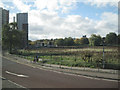
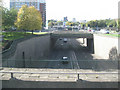
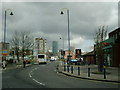
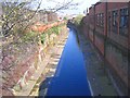
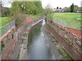
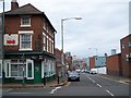
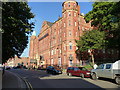
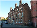
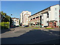
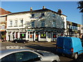
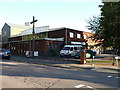
Photos of B12 0SZ

Area Information
Living in B12 0SZ means residing within a specific postcode cluster that forms part of the Bordesley and Highgate ward in central Birmingham. This small residential area sits immediately east of the city centre, encompassing historic urban districts such as Digbeth, Highgate, and Deritend. The location encompasses some of the oldest parts of the city, with a population of 1,655 people. The area was established as an electoral ward in December 2017 following boundary changes that expanded Birmingham's total ward count from 40 to 69. Historically, the name Bordesley derives from Old English for a clearing tended by a person named Bord. By the 19th century, the area had evolved into a suburb developed through trade and manufactures. Today, the immediate surroundings include notable industrial sites from the past, such as the former Artillery Street Paint and Varnish Works and the Universe Works rope manufacturing facility. The ward falls within the Birmingham Ladywood UK Parliament constituency, reflecting its established position in the urban fabric of the West Midlands.
- Area Type
- Postcode
- Area Size
- Not available
- Population
- 1655
- Population Density
- 4932 people/km²
The property market in B12 0SZ is characterised by a significant reliance on rental accommodation rather than private ownership. Only 18 per cent of residents own their homes, meaning the vast majority live in rented properties. The predominant accommodation type in this specific postcode cluster is flats, which distinguishes it from areas dominated by detached or semi-detached houses. This high concentration of flats and low home ownership rate suggests a market driven by affordability and accessibility for younger tenants or students rather than families seeking to build equity through a single-family home. Prospective buyers looking at this small area and its immediate surroundings should expect a landscape defined by urban living arrangements. The scarcity of owner-occupied homes indicates that new purchases would primarily involve buying into a block of flats or acquiring a leasehold property. This structure limits the traditional move-up market often found in suburban neighbourhoods with larger family homes.
House Prices in B12 0SZ
No properties found in this postcode.
Energy Efficiency in B12 0SZ
Residents of B12 0SZ benefit from immediate access to a range of retail and transport amenities within practical reach. The local area contains five railway stations, five retail outlets, and five metro stops. Notable retail options include Tesco Birmingham, Spar City, and Morrisons Daily Bristol, providing convenient access to groceries and daily essentials without the need for extensive travel. Transport links are prominent, with Bordesley Railway Station and Birmingham Moor Street Railway Station among the five key rail hubs nearby. Five metro stations serve the locality, with Grand Central New Street and Corporation Street acting as major urban connectors. The presence of Brownhills Daily Bristol, or Morrisons Daily Bristol as noted, adds variety to food shopping options. These amenities demonstrate that daily life in this cluster involves easy access to essential services. The proximity of major transport nodes like Snow Hill allows for straightforward connections across the city for work or leisure.
Amenities
Schools
Families considering homes in this area have access to several educational institutions nearby, ranging from state sectors to independent and special schools. St Anne's Catholic Primary School holds a Ofsted rating of good, offering a state-funded education for younger children. In contrast, Harper Bell Seventh-day Adventist School carries an inadequate Ofsted rating; this is a primary independent option within the vicinity. For families requiring additional support, the area is served by two special schools: Calthorpe School Sports College and Calthorpe Academy. These facilities cater to students with special educational needs. The Harper Bell Seventh-day Adventist School also operates as a primary institution but is not rated by Ofsted in the available records. The mix of school types means residents can choose between state primary education, independent schooling, and special needs provision depending on their requirements. No secondary schools are listed in the immediate vicinity of this specific postcode cluster.
| Rank | School | Type | Entry gender | Ages |
|---|
Explore more schools in this area
Go to Schools tabDemographics
The community within the B12 0SZ postcode cluster displays a distinct age profile, with a median age of 22 years. While adults aged between 30 and 64 years represent the most common age range in the broader surroundings, the specific cluster suggests a younger demographic presence. Home ownership stands at just 18 per cent, indicating that the majority of households in this area do not own their homes outright. The predominant form of accommodation in this cluster consists of flats, which aligns with the low rate of private ownership. This housing style often correlates with a higher proportion of tenants rather than owner-occupiers. The area's ethnic composition is notably diverse, with the black total group identified as the predominant ethnic group. These statistics present a clear picture of a young, predominantly renting community living in predominantly flat properties within a specific, small residential zone.
Household Size
Accommodation Type
Tenure
Ethnic Group
Religion
Household Composition
Age
Household Deprivation
NS-SEC
Explore more demographic insights in this area
Go to Demographics tabPlanning
Planning Constraints
- Flood RiskPremium
- Ramsar Wetland SitesPremium
- Area of Outstanding Natural BeautyPremium
- Protected Nature ReservePremium
- Protected WoodlandPremium