Area Overview for B12 0SS
Photos of B12 0SS
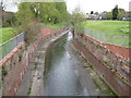
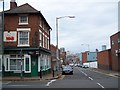

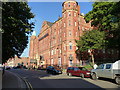
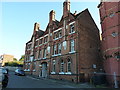
100 photos from this area
Area Information
Key information about the B12 0SS including its size, population, and administrative classification.
- Area Type
- Postcode
- Area Size
- 1.4 hectares
- Population
- 1582
- Population Density
- 3153 people/km²
House Prices in B12 0SS
21
Properties
£170,621
Average Sold Price
£67,500
Lowest Price
£318,000
Highest Price
Showing 21 properties
| Address | Type | Beds | Baths | Last Sale Price | Last Sale Date | |
|---|---|---|---|---|---|---|
| 42 Vaughton Street, Birmingham, B12 0SS | Retail | 4 | 1 | £262,000 | Mar 2023 | |
| 36 Vaughton Street, Birmingham, B12 0SS | Semi-detached | 4 | 1 | £315,000 | Nov 2022 | |
| 20 Vaughton Street, Birmingham, B12 0SS | house | - | - | £318,000 | Jul 2022 | |
| 8 Vaughton Street, Birmingham, B12 0SS | house | - | - | £150,000 | Sep 2015 | |
| 4 Vaughton Street, Birmingham, B12 0SS | Semi-detached | 4 | 1 | £124,950 | Jul 2015 | |
| 30 Vaughton Street, Birmingham, B12 0SS | house | - | - | £180,000 | Oct 2011 | |
| 22 Vaughton Street, Birmingham, B12 0SS | Terraced | - | - | £240,000 | Nov 2007 | |
| 38 Vaughton Street, Birmingham, B12 0SS | house | - | - | £147,000 | Apr 2007 | |
| 6 Vaughton Street, Birmingham, B12 0SS | Semi-detached | - | - | £105,000 | Jan 2003 | |
| 12 Vaughton Street, Birmingham, B12 0SS | house | - | - | £68,000 | Jul 2000 |
Page 1 of 3
Energy Efficiency in B12 0SS
Amenities
Schools
| Rank | School | Type | Entry gender | Ages |
|---|
Explore more schools in this area
Go to Schools tabDemographics
Household Size
One person
most common
Accommodation Type
Flats
most common
Tenure
20
majority
Ethnic Group
White
most common
Religion
N/A
most common
Household Composition
N/A
most common
Age
22
median
Adults (30-64 years)
most common
Household Deprivation
N/A
with no deprivation
NS-SEC
28
in Lower managerial occupations
Explore more demographic insights in this area
Go to Demographics tabPlanning
Planning Constraints
- Flood RiskPremium
- Ramsar Wetland SitesPremium
- Area of Outstanding Natural BeautyPremium
- Protected Nature ReservePremium
- Protected WoodlandPremium