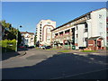
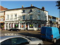
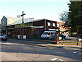
Area Overview for B12 0SA
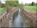
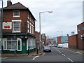
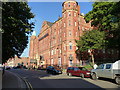
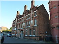
Photos of B12 0SA

Area Information
B12 0SA represents a distinct residential cluster situated within the historic core of Birmingham. This specific postcode covers a small area with a total population of 1582 people. The location is embedded in the Bordesley and Highgate ward, an urban zone located immediately east of the city centre. This ward encompasses the older districts of Digbeth and Deritend, areas that have evolved from their 19th-century industrial roots into modern residential zones. You are buying into a community with deep historical significance, where the name itself derives from Old English roots meaning a cleared forest land earmarked for crops and livestock centuries ago. The landscape here is defined by its proximity to the city's central business functions rather than rural separation. Daily life for residents involves navigating these dense urban streets, which serve as a gateway to the wider metropolitan hub. The area functions as part of the Birmingham Ladywood parliamentary constituency, placing it firmly within the city's political and social fabric. Living here means engaging directly with one of the oldest parts of Birmingham, offering a sense of place rooted in centuries of continuous habitation and industrial development.
- Area Type
- Postcode
- Area Size
- Not available
- Population
- 1582
- Population Density
- 3153 people/km²
The housing landscape in B12 0SA is defined by its high-density urban character. Flats are the predominant accommodation type, indicating that detached or semi-detached houses are rare or non-existent within this specific postcode boundary. Residents primarily rely on multi-unit dwellings suitable for city living. With only 20 per cent of residents owning their homes, the market operates with a significant lean towards renting. This statistic suggests that investors or private landlords play a major role in providing housing stock here. For buyers considering homes in B12 0SA, the scarcity of traditional freehold properties is a defining constraint. You will likely find modern conversion flats or purpose-built blocks rather than Victorian terraces or post-war estates typical of surrounding wards. The small population of 1582 means this is a hyper-localised micro-market. Purchasing here often requires flexibility regarding property type and a willingness to navigate the complexities of apartment living. If equity building is a primary goal, the 20 per cent ownership rate suggests strong competition for the few available sales opportunities against the larger rental pool.
House Prices in B12 0SA
No properties found in this postcode.
Energy Efficiency in B12 0SA
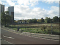
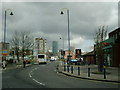
Life in B12 0SA offers direct access to essential services and retail outlets within practical reach. You will find five local train stations to manage your commute, with Bordesley Railway Station being one of the key gateways. Retail convenience is high, with five shops located nearby, including a Spar, Tesco Birmingham, and Morrisons Daily Bristol. For leisure and dining, the area boasts five metro stations like Grand Central New Street and Bull Street, placing you on the main arteries of Birmingham's nightlife and culture. The ward includes the historic district of Digbeth, which historically housed significant industrial sites like the Artillery Street Paint and Varnish Works. Today, these areas have evolved into a mix of historic character and modern urban living. You can shop at a local Spar or stock groceries at Tesco figures nearby. The presence of such major chains confirms that you do not need to travel far for daily necessities. The historic backdrop of Garrison Lane School and Bordesley Hall adds a layer of local intrigue to your daily routine. Living here means immediate access to a mature urban infrastructure that supports a varied and active lifestyle.
Amenities
Schools
Families looking at B12 0SA have access to specific educational institutions nearby. The primary option listed for this area is Chandos Primary School for children. This institution holds an Ofsted rating of satisfactory, indicating it meets the required standards for primary education. Currently, there are no secondary schools or academies listed within the immediate data provided for this specific postcode. Consequently, you would need to rely on this one primary option for early years education before exploring further schooling options in the wider Bordesley and Highgate ward. The availability of just one named primary school limits local choice for young families residing strictly within B12 0SA. You must plan your route through the school admission process carefully, as the single listed option, Chandos Primary School, serves as the main local provision. The absence of other named schools in the data means you cannot rely on a diverse mix of academies or faith schools without researching the immediate townscape beyond this specific boundary.
| Rank | School | Type | Entry gender | Ages |
|---|
Explore more schools in this area
Go to Schools tabDemographics
The community within B12 0SA is relatively young, with a median age of just 22 years. Despite this low median, the most common age range among the population consists of adults between 30 and 64 years. The broader demographic data indicates that White is the predominant ethnic group in this location. Home ownership rates stand at 20 per cent, suggesting that rental arrangements are far more common than owner-occupied tenure in this specific cluster. The accommodation type is dominated by flats, reflecting the high-density nature of urban living in this postcode. These statistics paint a picture of a transient or young professional population rather than established families with multi-generational housing. The low ownership figure of 20 per cent contrasts sharply with suburbs where older demographics typically accumulate equity. You should consider whether a rental-heavy environment aligns with your long-term plans. The concentration of younger adults alongside a significant cohort of older workers suggests a dynamic but potentially less settled community compared to areas with higher average age profiles.
Household Size
Accommodation Type
Tenure
Ethnic Group
Religion
Household Composition
Age
Household Deprivation
NS-SEC
Explore more demographic insights in this area
Go to Demographics tabPlanning
Planning Constraints
- Flood RiskPremium
- Ramsar Wetland SitesPremium
- Area of Outstanding Natural BeautyPremium
- Protected Nature ReservePremium
- Protected WoodlandPremium