Area Overview for B12 0RH
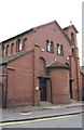
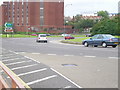
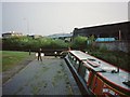
Photos of B12 0RH

Area Information
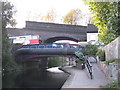
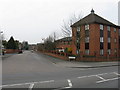
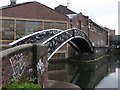
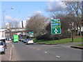
B12 0RH is a small residential postcode cluster in Birmingham’s heart, encompassing parts of Bordesley, Highgate, and Digbeth. With a population of 1,051, it is a compact area defined by its proximity to the city centre and historic roots. The ward was formed in 2017 as part of Birmingham’s boundary reforms, merging older districts like Digbeth, known for its industrial heritage and vibrant street culture. Living here means navigating a mix of urban convenience and historical layers, from 19th-century manufacturing sites to modern retail hubs. The area’s compact size means amenities are within practical reach, though its character is shaped by its role as a transitional zone between Birmingham’s industrial past and its evolving urban landscape. Residents benefit from proximity to multiple railway stations, including Bordesley and Birmingham Moor Street, which link to broader transport networks. However, the area’s small scale also means it lacks the sprawling infrastructure of larger districts, requiring residents to balance convenience with the density of city life.
- Area Type
- Postcode
- Area Size
- Not available
- Population
- 1051
- Population Density
- 6044 people/km²
B12 0RH’s property market is characterised by low home ownership, with just 18% of residents owning their homes. This suggests a rental market, where flats dominate the housing stock. The area’s small size and urban setting mean properties are likely to be modest in scale, catering to commuters or those prioritising city access over space. Flats in B12 0RH may be concentrated in purpose-built blocks or converted industrial spaces, reflecting the area’s historical use for manufacturing. For buyers, the limited home ownership rate indicates limited availability of owner-occupied properties, potentially making the area more attractive to investors seeking rental yields. However, the compact nature of the postcode means competition for properties could be fierce, especially near transport hubs like Bordesley Railway Station. Proximity to Birmingham’s city centre may offset the lack of space, but buyers should consider the area’s density and potential for long-term rental demand.
House Prices in B12 0RH
No properties found in this postcode.
Energy Efficiency in B12 0RH
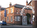
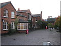
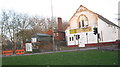
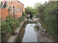
Residents of B12 0RH have access to a range of amenities within walking or short transit distance. Retail options include Spar City, Spar, and Tesco Birmingham, providing everyday shopping needs. The area’s proximity to metro stops like Corporation Street and Bull Street adds to its convenience, linking residents to Birmingham’s broader commercial and cultural hubs. While specific parks or leisure facilities are not detailed in the data, the area’s historical industrial sites—such as the former Artillery Street Paint and Varnish Works—suggest a blend of urban and utilitarian character. The presence of multiple railway stations and retail outlets indicates a functional, commuter-focused lifestyle, though the absence of named parks or recreational spaces may limit options for outdoor activities. For those prioritising accessibility over green space, B12 0RH offers a compact, well-connected environment with direct links to Birmingham’s city centre.
Amenities
Schools
| Rank | School | Type | Entry gender | Ages |
|---|
Explore more schools in this area
Go to Schools tabDemographics
The population of B12 0RH is predominantly adults aged 30–64, with a median age of 47. Home ownership is low, at 18%, suggesting a rental-dominated market. Flats are the primary accommodation type, reflecting the area’s compact, urban layout. The predominant ethnic group is White, though specific diversity metrics are not provided. The age profile indicates a mature community, likely with established professionals or families seeking proximity to city amenities. The low home ownership rate may reflect the area’s history as a working-class suburb, with limited new housing developments. For buyers, this suggests a market skewed toward renters, with limited opportunities for long-term property investment. The demographic composition also implies a stable, low-turnover community, though the absence of detailed diversity data means broader social dynamics remain unexplored.
Household Size
Accommodation Type
Tenure
Ethnic Group
Religion
Household Composition
Age
Household Deprivation
NS-SEC
Explore more demographic insights in this area
Go to Demographics tabPlanning
Planning Constraints
- Flood RiskPremium
- Ramsar Wetland SitesPremium
- Area of Outstanding Natural BeautyPremium
- Protected Nature ReservePremium
- Protected WoodlandPremium