Area Overview for B12 0PF
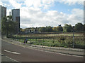
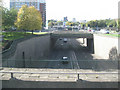
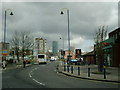
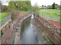
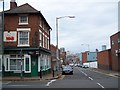
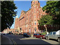
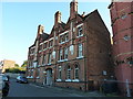
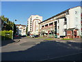
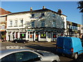
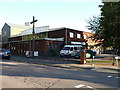
Photos of B12 0PF


Area Information
B12 0PF is a small residential postcode in the heart of Birmingham, covering a compact cluster of homes in the Bordesley and Highgate area. With a population of 1,582, it sits in a historically significant part of the city, near the boundaries of Digbeth and Deritend. This area has roots stretching back to the 7th century, with Bordesley’s name derived from Old English, reflecting its long-standing role as a hub of trade and industry. Today, it blends urban convenience with pockets of heritage, though its modern character is defined by its proximity to transport links and retail hubs. The area’s compact size means residents live close to amenities, including multiple railway stations and metro stops, which connect them to Birmingham’s broader network. While the population is relatively small, the area’s location near the city centre ensures it is well-served by both local services and regional infrastructure. Living here offers a mix of practicality and accessibility, though the community’s dynamics are shaped by its rental-focused housing market and the presence of younger and middle-aged residents.
- Area Type
- Postcode
- Area Size
- Not available
- Population
- 1582
- Population Density
- 3153 people/km²
The property market in B12 0PF is characterised by a low home ownership rate of 20%, meaning the majority of residents rent their homes. The accommodation type is predominantly flats, reflecting a housing stock that prioritises high-density living over detached or semi-detached properties. This suggests the area is more suited to renters, particularly younger professionals or families seeking proximity to Birmingham’s city centre without the financial burden of homeownership. The limited number of owner-occupied homes may also indicate a lack of long-term investment in the area, which could affect property value stability. For buyers, the small postcode area and surrounding neighbourhoods offer few opportunities for purchase, with most properties available on the rental market. This dynamic may make the area more attractive to those prioritising location over ownership, though it could also limit options for those seeking to build equity in a home.
House Prices in B12 0PF
No properties found in this postcode.
Energy Efficiency in B12 0PF
The lifestyle in B12 0PF is shaped by its proximity to retail, transport, and urban hubs. Residents have access to five retail outlets, including Spar and Tesco Birmingham, which provide essentials and convenience shopping. Metro stations like Corporation Street and Bull Street add to the area’s connectivity, making it easy to navigate Birmingham’s city centre or nearby districts. While specific parks or leisure facilities are not listed in the data, the area’s integration with Birmingham’s transport network suggests access to broader recreational opportunities. The presence of multiple railway stations and retail options contributes to a practical, urban lifestyle, ideal for those prioritising ease of movement and proximity to services. The compact nature of the postcode means daily life is centred around nearby amenities, though the lack of detailed information on green spaces or cultural venues may limit insights into leisure options.
Amenities
Schools
The nearest school to B12 0PF is Chandos Primary School, which serves the local community with primary education. The school holds an Ofsted rating of satisfactory, indicating it meets basic standards but may have areas for improvement. As the only named school in the data, Chandos Primary School is a key educational resource for families in the area. Its presence suggests that the area caters to younger residents, though no secondary schools or additional educational institutions are listed. The single primary school may place pressure on its resources, particularly given the area’s population size and the potential for families with children to rely on it. For parents, the school’s rating provides a baseline for expectations, though further details about its performance or facilities are not included in the data.
| Rank | School | Type | Entry gender | Ages |
|---|
Explore more schools in this area
Go to Schools tabDemographics
The demographic profile of B12 0PF is shaped by a median age of 22, though the most common age group is adults aged 30–64, suggesting a mix of younger and established residents. Only 20% of homes are owner-occupied, indicating a rental-dominated market, which may reflect the area’s compact size and limited housing stock. The predominant accommodation type is flats, aligning with the high proportion of rental properties. The ethnic composition is largely White, though specific diversity metrics are not provided. This age distribution and housing pattern suggest a community that includes professionals, students, and families seeking affordable urban living. The low home ownership rate may also indicate a transient population, with residents relying on rental properties for flexibility. While no data on deprivation is explicitly stated, the area’s reliance on rental housing and its proximity to transport could influence affordability and quality of life for residents.
Household Size
Accommodation Type
Tenure
Ethnic Group
Religion
Household Composition
Age
Household Deprivation
NS-SEC
Explore more demographic insights in this area
Go to Demographics tabPlanning
Planning Constraints
- Flood RiskPremium
- Ramsar Wetland SitesPremium
- Area of Outstanding Natural BeautyPremium
- Protected Nature ReservePremium
- Protected WoodlandPremium