Area Overview for B12 0EG
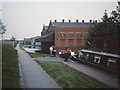
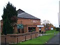
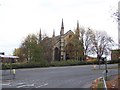
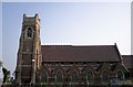
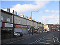
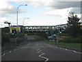
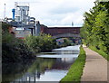
Photos of B12 0EG

Area Information
Living in B12 0EG means being part of a compact, urban postcode area in Birmingham’s heart, encompassing parts of Bordesley, Highgate, Digbeth, and Deritend. With a population of 1,655, it is a small, tightly knit residential cluster shaped by centuries of industrial and social history. The area’s roots trace back to the 7th century, with Bordesley’s name derived from an ancient clearing. Today, it sits within Birmingham’s Ladywood parliamentary constituency, close to the city centre and major transport hubs. Daily life here is defined by proximity to retail, public transport, and a mix of historic and modern infrastructure. While the area is small, it offers a blend of older urban fabric and contemporary amenities, making it accessible for commuters and those seeking a central location. Its position near key railway lines and the city’s cultural districts adds to its practical appeal, though its character is as much about its past as its present.
- Area Type
- Postcode
- Area Size
- Not available
- Population
- 1655
- Population Density
- 4932 people/km²
The property market in B12 0EG is characterised by low home ownership and a reliance on rental housing. With only 18% of homes owned by residents, the area functions more as a rental market than an owner-occupied one. The predominant accommodation type is flats, which aligns with the area’s compact layout and historical development as a dense urban cluster. This makes B12 0EG an attractive option for renters seeking affordable housing near Birmingham’s core, but less so for buyers seeking long-term investment. The limited availability of owner-occupied properties means that those looking to purchase a home in the area may need to consider nearby suburbs or larger developments. The flat-dominated stock also suggests that the market caters to individuals or small households rather than families requiring larger homes.
House Prices in B12 0EG
No properties found in this postcode.
Energy Efficiency in B12 0EG
Life in B12 0EG is shaped by its proximity to retail and transport hubs. Nearby amenities include Spar City, Iceland Birmingham, and other retail outlets, offering convenience for daily shopping. The area’s railway stations and metro stops provide easy access to Birmingham’s cultural and commercial districts, while the compact layout ensures that essential services are within practical reach. Though there is no mention of parks or leisure facilities in the data, the presence of multiple schools and transport links suggests a focus on practicality over expansive recreational spaces. The area’s character is defined by its urban density and accessibility, making it ideal for those prioritising convenience over sprawling green spaces. The mix of retail and transport options supports a lifestyle centred on efficiency and connectivity.
Amenities
Schools
The schools near B12 0EG include St Anne’s Catholic Primary School, which holds a ‘good’ Ofsted rating, and Harper Bell Seventh-day Adventist School, a primary school with an ‘inadequate’ rating. Independent options are represented by The Harper Bell Adventist School, while special schools such as Calthorpe School Sports College and Calthorpe Academy cater to specific educational needs. This mix of school types offers families a range of choices, from faith-based institutions to specialist provision. However, the presence of an ‘inadequate’ Ofsted-rated school raises concerns about educational quality for some households. Parents should consider visiting schools and reviewing inspection reports to assess suitability for their children’s needs. The area’s proximity to multiple schools reflects its role as a residential hub for families seeking access to diverse educational opportunities.
| Rank | School | Type | Entry gender | Ages |
|---|
Explore more schools in this area
Go to Schools tabDemographics
B12 0EG has a median age of 22, though the most common age range among residents is 30–64 years. This suggests a community skewed toward working-age adults, with a notable presence of families and professionals. Home ownership is low at 18%, indicating that the majority of households are renters. The accommodation type is predominantly flats, reflecting the area’s density and historical development as a working-class suburb. The predominant ethnic group is Black, highlighting the area’s cultural diversity. While specific deprivation data is not provided, the high proportion of renters and the age profile suggest a population focused on employment and affordability. This dynamic shapes the area’s social fabric, with a mix of transient and long-term residents navigating urban living in a historically industrialised part of Birmingham.
Household Size
Accommodation Type
Tenure
Ethnic Group
Religion
Household Composition
Age
Household Deprivation
NS-SEC
Explore more demographic insights in this area
Go to Demographics tabPlanning
Planning Constraints
- Flood RiskPremium
- Ramsar Wetland SitesPremium
- Area of Outstanding Natural BeautyPremium
- Protected Nature ReservePremium
- Protected WoodlandPremium