Area Overview for B12 0DN
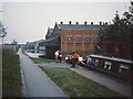
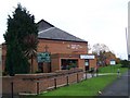
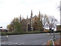
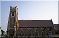
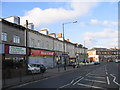
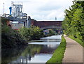
Photos of B12 0DN

Area Information
Living in B12 0DN means being part of a small residential cluster in Birmingham’s Sparkbrook and Balsall Heath East ward. This area, with a population of 1,791, sits in Birmingham’s inner city, south-east of the city centre. Its character is defined by cultural diversity, with a predominantly Asian population and a younger age profile than the city as a whole. The ward’s history as an economic and cultural hub for Commonwealth migrants since the 1960s continues to shape its identity today. While it faces challenges like high deprivation and unemployment, the community thrives through small businesses along Stratford Road and Ladypool Road. Balsall Heath Park offers green space, and the area’s proximity to Birmingham’s commercial and transport networks makes it a practical choice for those seeking a mix of urban living and community spirit.
- Area Type
- Postcode
- Area Size
- Not available
- Population
- 1791
- Population Density
- 4924 people/km²
The property market in B12 0DN is dominated by houses, with 45% of homes owner-occupied. This suggests a balance between private ownership and rental properties, though the small area’s limited size means housing stock is constrained. The predominance of houses, rather than flats, aligns with the ward’s urban yet residential character. For buyers, this implies a focus on family homes rather than high-density living. However, the area’s economic challenges, including high unemployment and lower GVA per head, may affect property values and investment potential. Proximity to transport hubs and amenities like Balsall Heath Park could offset some of these factors, but buyers should consider the broader context of deprivation and limited infrastructure investment.
House Prices in B12 0DN
Showing 2 properties
| Address | Type | Beds | Baths | Last Sale Price | Last Sale Date | |
|---|---|---|---|---|---|---|
| Apartment 203, Lockwood, 203 Camp Hill, Birmingham, B12 0DN | Retail | - | - | - | - | |
| Apartment 107, Lockwood, 203 Camp Hill, Birmingham, B12 0DN | Flat | - | - | - | - |
Energy Efficiency in B12 0DN
Residents of B12 0DN benefit from nearby amenities, including retail outlets like Spar City, Aldi Sparkbrook, and Lidl Sparkbrook. Rail stations such as Bordesley and Birmingham Moor Street, along with metro stops like Corporation Street and Town Hall, provide transport links to the city. Balsall Heath Park offers recreational space, while the area’s commercial hubs on Stratford Road and Ladypool Road host independent shops and eateries. This blend of retail, transport, and green space supports a practical lifestyle, though the ward’s economic challenges mean amenities are more modest compared to wealthier parts of Birmingham.
Amenities
Schools
Residents of B12 0DN have access to a range of educational institutions. Joseph Chamberlain Sixth Form College offers post-16 education, while Redstone Academy for Boys and Redstone Academy for Girls are independent schools with Ofsted ratings of ‘good’. Heritage Academy, also independent, holds an ‘outstanding’ rating. This mix of state and independent options provides families with choices, from specialist sixth-form provision to high-performing primary and secondary schools. The presence of multiple schools within the area suggests a focus on education, though the ward’s broader challenges in employment and deprivation may influence long-term outcomes for students.
| Rank | School | Type | Entry gender | Ages |
|---|
Explore more schools in this area
Go to Schools tabDemographics
The median age in B12 0DN is 47, with the most common age range being adults aged 30–64. Home ownership stands at 45%, indicating a mix of owner-occupied and rental properties. The predominant accommodation type is houses, reflecting a residential character distinct from high-density housing. The area’s demographic is heavily influenced by its Asian population, which constitutes the largest ethnic group. However, the ward is Birmingham’s most deprived, with the eighth-highest child poverty rate. This context shapes daily life, where community initiatives and local businesses play a vital role in addressing economic challenges. The younger age profile and high BAME population contribute to a dynamic social fabric, though residents face systemic issues like limited employment opportunities and underinvestment.
Household Size
Accommodation Type
Tenure
Ethnic Group
Religion
Household Composition
Age
Household Deprivation
NS-SEC
Explore more demographic insights in this area
Go to Demographics tabPlanning
Planning Constraints
- Flood RiskPremium
- Ramsar Wetland SitesPremium
- Area of Outstanding Natural BeautyPremium
- Protected Nature ReservePremium
- Protected WoodlandPremium