Area Overview for B11 4WA
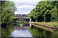
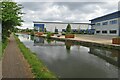
Photos of B11 4WA


Area Information
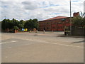
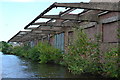
Living in B11 4WA means inhabiting a small, tightly knit residential cluster in the east of Birmingham, England. This postcode area, home to 1,789 people, sits between Small Heath and South Yardley, bisected by the A45 Coventry Road. Historically part of Worcestershire, it became Birmingham in 1911 and retains echoes of its industrial past, notably through the legacy of Webster Horsfall’s wire-drawing empire. Today, the area balances its heritage with modern initiatives like Tyseley Energy Park, a hub for green innovation. Daily life here is shaped by proximity to rail links, retail outlets, and the River Cole. The community, predominantly adults aged 30–64, reflects a mature demographic with a strong focus on home ownership. While the area lacks natural beauty designations, its strategic transport links and historical depth make it a practical yet characterful place to live.
- Area Type
- Postcode
- Area Size
- Not available
- Population
- 1789
- Population Density
- 2149 people/km²
The property market in B11 4WA is characterised by a 50% home ownership rate, with houses forming the majority of accommodation types. This suggests a community where owner-occupation is common, though the other 50% likely consists of rental properties. The area’s small size means housing stock is limited, potentially increasing competition for available homes. Given the predominance of houses, the market may cater more to families than to young professionals or students. Buyers should consider the area’s proximity to rail networks and retail amenities, which could enhance property value. However, the lack of flats or apartments may limit options for those seeking smaller or more flexible living arrangements.
House Prices in B11 4WA
No properties found in this postcode.
Energy Efficiency in B11 4WA
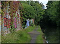
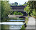
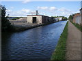
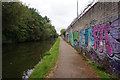
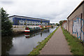
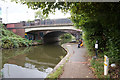
Life in B11 4WA revolves around accessible amenities and historical context. Retailers such as Iceland, Lidl, and Asda provide everyday shopping convenience, while nearby rail stations like Tyseley and Spring Road offer links to Birmingham and beyond. The area’s industrial heritage is palpable, with sites like Hay Hall—a Grade II-listed medieval hall—adding historical depth. Tyseley Energy Park, a focus for green innovation, hints at forward-thinking development. Though parks or leisure facilities are not explicitly named in the data, the proximity to the River Cole and the Grand Union Canal suggests potential for outdoor activities. The mix of retail, transport, and heritage creates a practical yet distinct lifestyle, blending convenience with a sense of place.
Amenities
Schools
| Rank | A + A* % | School | Type | Entry gender | Ages |
|---|
Explore more schools in this area
Go to Schools tabDemographics
The population of B11 4WA is 1,789, with a median age of 47, indicating a mature community. The most common age range is 30–64 years, suggesting a mix of middle-aged professionals and families. Home ownership stands at 50%, with houses being the primary accommodation type. The predominant ethnic group is White, though specific data on diversity is not provided. This age profile implies a stable, established population with long-term ties to the area. The lack of detailed deprivation data means quality of life factors like access to services or employment opportunities are not quantified here. However, the presence of rail stations, retail outlets, and historical sites suggests a functional, if modest, living environment.
Household Size
Accommodation Type
Tenure
Ethnic Group
Religion
Household Composition
Age
Household Deprivation
NS-SEC
Explore more demographic insights in this area
Go to Demographics tabPlanning
Planning Constraints
- Flood RiskLocked
- Ramsar Wetland SitesLocked
- Area of Outstanding Natural BeautyLocked
- Protected Nature ReserveLocked
- Protected WoodlandLocked
- Crime RiskLocked