Area Overview for B11 4QG
Photos of B11 4QG
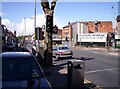
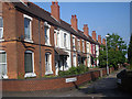
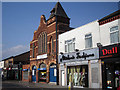
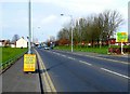
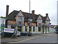
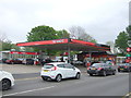
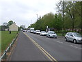
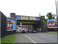
63 photos from this area
Area Information
Key information about the B11 4QG including its size, population, and administrative classification.
- Area Type
- Postcode
- Area Size
- 3851 m²
- Population
- 1775
- Population Density
- 11571 people/km²
House Prices in B11 4QG
20
Properties
£137,977
Average Sold Price
£30,000
Lowest Price
£246,000
Highest Price
Showing 20 properties
| Address | Type | Beds | Baths | Last Sale Price | Last Sale Date | |
|---|---|---|---|---|---|---|
| 68 Fulham Road, Birmingham, B11 4QG | house | 3 | 2 | £246,000 | Dec 2023 | |
| 70 Fulham Road, Birmingham, B11 4QG | Terraced | 3 | 2 | £230,000 | Feb 2023 | |
| 66 Fulham Road, Birmingham, B11 4QG | Terraced | 4 | 1 | £174,500 | Jun 2017 | |
| 38 Fulham Road, Birmingham, B11 4QG | Terraced | 4 | 1 | £119,000 | Feb 2014 | |
| 36 Fulham Road, Birmingham, B11 4QG | house | - | - | £145,000 | Mar 2011 | |
| 72 Fulham Road, Birmingham, B11 4QG | house | 3 | - | £160,000 | Feb 2011 | |
| 30 Fulham Road, Birmingham, B11 4QG | Terraced | 4 | 2 | £160,000 | Feb 2008 | |
| 40 Fulham Road, Birmingham, B11 4QG | Terraced | 4 | 1 | £145,000 | Jan 2005 | |
| 32 Fulham Road, Birmingham, B11 4QG | house | - | - | £55,000 | Sep 2002 | |
| 54 Fulham Road, Birmingham, B11 4QG | Terraced | - | - | £53,250 | Jun 1998 |
Page 1 of 2
Energy Efficiency in B11 4QG
Amenities
Schools
| Rank | School | Type | Entry gender | Ages |
|---|
Explore more schools in this area
Go to Schools tabDemographics
Household Size
Family (3-5 people)
most common
Accommodation Type
Houses
most common
Tenure
41
majority
Ethnic Group
asian_total
most common
Religion
N/A
most common
Household Composition
N/A
most common
Age
47
median
Adults (30-64 years)
most common
Household Deprivation
N/A
with no deprivation
NS-SEC
10
in Lower managerial occupations
Explore more demographic insights in this area
Go to Demographics tabPlanning
Planning Constraints
- Flood RiskPremium
- Ramsar Wetland SitesPremium
- Area of Outstanding Natural BeautyPremium
- Protected Nature ReservePremium
- Protected WoodlandPremium