Area Overview for B11 4NA
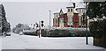
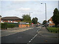
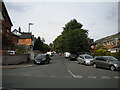
Photos of B11 4NA

Area Information
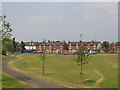
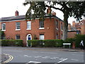
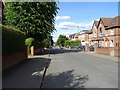
Living in B11 4NA means calling Sparkhill home, a distinct inner-city cluster in Birmingham that bridges the communities of Springfield, Hall Green, and Sparkbrook. This specific postcode covers a small residential cluster with a population of 1,877 residents. Historically, the area evolved from rural farmland during the Middle Ages to a working-class housing estate by the late 19th century. It was annexed by Birmingham under the Greater Birmingham Act in 1911. Today, the neighbourhood retains historic character visible in 1880s architecture and converted council houses, alongside modern developments built after World War II replacements. Daily life revolves around the area's status as a main centre of the city's Balti Triangle. You will find numerous Asian eateries reflecting the large South Asian population, yet the community has also been shaped by Irish, Afro-Caribbean, and Romanian migration waves. The area is situated at coordinates 52.456576, -1.866038 within the West Midlands region. It offers a blend of urban convenience and local history, anchored by landmarks like St John's Church and the historic Mermaid Inn. This postcode represents a mature residential environment where history meets contemporary multicultural living.
- Area Type
- Postcode
- Area Size
- Not available
- Population
- 1877
- Population Density
- 9837 people/km²
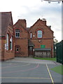
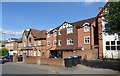
The housing stock in B11 4NA is defined by a robust private market rather than a transient rental scene. Seven out of every ten households are owner-occupied, creating a stable environment where property values rest on long-term investments rather than short-term shifts. The predominant accommodation type is houses, meaning you are looking primarily at attached rows or detached family homes rather than high-rise flats or student quarters. This mix includes the working-class terraced houses built from the 1860s onwards and larger properties constructed for the wealthy middle class. When searching for homes in this area, you should expect to find properties that reflect their historical timeline. Some homes feature original elements like coal sheds and back gardens, while others, such as those at 180 to 190 Osborne Road, were replaced after World War II bombing. The high percentage of owner occupants suggests that many current residents have lived here for decades, cultivating deep local roots. This stability often translates into a quieter, more insulated residential experience compared to areas dominated by tenanted blocks. Buyers here are typically purchasing a legacy dwelling rather than a temporary accommodation.
House Prices in B11 4NA
No properties found in this postcode.
Energy Efficiency in B11 4NA
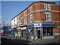
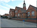
Residents of B11 4NA enjoy immediate access to diverse retail and leisure options within practical reach. You have five retail venues nearby, including Asda Sparkhill, Aldi Sparkbrook, and M&S Moseley, ensuring daily shopping needs are met without long journeys. The area also benefits from five rail stations and five metro locations, duplicating vital transport links onto your doorstep. Beyond commerce, the neighbourhood's character is defined by its rich dining scene, specifically the numerous Balti restaurants located in the area. Cultural life centres around historical landmarks that remain active community spaces. St John's Church, designed by Martin and Chamberlain in 1888, serves as the local Anglican Parish Church and houses the Narthex Sparkhill charity. You can also visit Sparkhill Library, which originally opened as the Yardley District Council house in 1923 and features notable double-glazed windows. Historic pubs like the Mermaid Inn, which dates back to the 17th century, continue to contribute to the local atmosphere, though some have transitioned to serve food. This blend of historic architecture and modern choice creates a functional and culturally vibrant daily routine.
Amenities
Schools
| Rank | School | Type | Entry gender | Ages |
|---|
Explore more schools in this area
Go to Schools tabDemographics
The community in B11 4NA displays a mature profile, with a median age of 47 years. Adults aged between 30 and 64 years comprise the most common age range within the local population. This demographic structure suggests a neighbourhood where stability and longevity are common among residents. Ownership features strongly in this community, with home ownership standing at 72%. This high figure indicates that the vast majority of households have purchased their residences rather than renting. The predominant accommodation type is houses, which aligns with the historical construction of uniform terraced properties and larger middle-class homes bounded by streets such as Stoney Lane and Durham Road. While specific data on deprivation levels is not provided in the current records, the high home ownership rate generally correlates with established communities. The area is noted for ethnic diversity, with the Asian total group being the predominant ethnic group. This diversity is not merely statistical but is visibly evident in the cultural identity of Sparkhill, influencing local businesses and social interactions.
Household Size
Accommodation Type
Tenure
Ethnic Group
Religion
Household Composition
Age
Household Deprivation
NS-SEC
Explore more demographic insights in this area
Go to Demographics tabPlanning
Planning Constraints
- Flood RiskPremium
- Ramsar Wetland SitesPremium
- Area of Outstanding Natural BeautyPremium
- Protected Nature ReservePremium
- Protected WoodlandPremium