Area Overview for B11 4LT
Photos of B11 4LT

Area Information
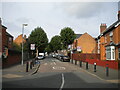
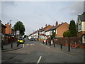
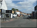
Living in B11 4LT, part of Sparkhill in Birmingham, means inhabiting a small but historically rich postcode area. With a population of 2,004, this urban cluster lies between Springfield, Hall Green, and Sparkbrook, a location shaped by centuries of industrial and social change. Sparkhill’s name may derive from the Sparke family or Spark Brook, a stream that once flowed through the area. Today, it is a hub of ethnic diversity, influenced by waves of migration from Ireland, the Caribbean, South Asia, and more recently, Somalia and Romania. The area is a key part of Birmingham’s “Balti Triangle,” where South Asian cuisine and culture thrive. Despite its compact size, B11 4LT offers proximity to major transport routes, retail hubs, and historic sites like St John’s Church and Sparkhill Library. Its mix of terraced housing and community character makes it a distinctive part of Birmingham’s inner-city fabric.
- Area Type
- Postcode
- Area Size
- Not available
- Population
- 2004
- Population Density
- 8305 people/km²
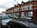
B11 4LT is characterised by a home ownership rate of 63%, with houses forming the primary accommodation type. This suggests a market skewed towards owner-occupied properties, potentially offering buyers a range of family homes or semi-detached residences. The area’s compact size means property options may be limited to existing terraced or detached houses, with fewer new developments. For buyers, this could present opportunities to purchase in a historically significant part of Birmingham, though the small postcode area may require careful consideration of nearby locations for more choice. The presence of established housing stock also implies a mature market with potential for long-term value retention.
House Prices in B11 4LT
No properties found in this postcode.
Energy Efficiency in B11 4LT
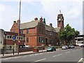
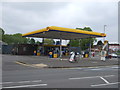
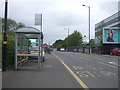
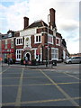
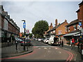
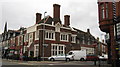
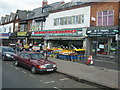
Life in B11 4LT offers a blend of urban convenience and community character. Nearby amenities include retail outlets like Asda Sparkhill, Aldi Sparkbrook, and Lidl Sparkbrook, ensuring daily essentials are within reach. The area’s proximity to rail and metro stations, such as Spring Road and Bull Street, enhances mobility. Sparkhill’s cultural identity is evident in its historic pubs, including the Mermaid Inn and The Bear, which reflect the area’s architectural heritage. St John’s Church and Sparkhill Library provide community spaces, while the Balti Triangle nearby offers a vibrant dining scene. This mix of practicality and local charm contributes to a distinctive lifestyle in a compact, connected postcode.
Amenities
Schools
Near B11 4LT, families have access to St John’s CofE Primary School, which holds an outstanding Ofsted rating. This primary school provides a high standard of education for younger children. Additionally, the City of Birmingham School, though not specified further, likely serves older students. The presence of a primary school with an outstanding rating is a strong draw for families prioritising quality education. However, the absence of secondary schools in the immediate area may require commuting to nearby districts. The mix of primary and other educational institutions reflects a practical approach to meeting the needs of different age groups within the community.
| Rank | School | Type | Entry gender | Ages |
|---|
Explore more schools in this area
Go to Schools tabDemographics
The population of B11 4LT has a median age of 47, with the majority of residents falling into the 30-64 age range. This suggests a mature, settled community, likely with a strong presence of middle-aged and older adults. Home ownership stands at 63%, indicating a mix of long-term residents and property investors. The area is predominantly composed of houses, which may reflect a preference for family homes or larger dwellings. The predominant ethnic group is South Asian, a legacy of migration patterns that have shaped Sparkhill’s cultural identity. While no specific deprivation data is provided, the high proportion of home ownership and the presence of established community institutions suggest a stable, though not affluent, quality of life.
Household Size
Accommodation Type
Tenure
Ethnic Group
Religion
Household Composition
Age
Household Deprivation
NS-SEC
Explore more demographic insights in this area
Go to Demographics tabPlanning
Planning Constraints
- Flood RiskPremium
- Ramsar Wetland SitesPremium
- Area of Outstanding Natural BeautyPremium
- Protected Nature ReservePremium
- Protected WoodlandPremium