Area Overview for B11 4HD
Photos of B11 4HD

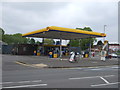
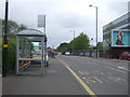
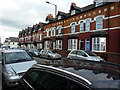
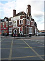

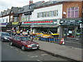
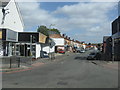
50 photos from this area
Area Information
Key information about the B11 4HD including its size, population, and administrative classification.
- Area Type
- Postcode
- Area Size
- 1.1 hectares
- Population
- 1723
- Population Density
- 14146 people/km²
House Prices in B11 4HD
46
Properties
£123,425
Average Sold Price
£45,000
Lowest Price
£207,500
Highest Price
Showing 46 properties
| Address | Type | Beds | Baths | Last Sale Price | Last Sale Date | |
|---|---|---|---|---|---|---|
| 124 Oakwood Road, Springfield, Birmingham, B11 4HD | house | 3 | - | £174,000 | Jan 2020 | |
| 92 Oakwood Road, Springfield, Birmingham, B11 4HD | Detached | 3 | 2 | £207,500 | Apr 2017 | |
| 84A Oakwood Road, Springfield, Birmingham, B11 4HD | Detached | 5 | - | £149,950 | Apr 2005 | |
| 164 Oakwood Road, Springfield, Birmingham, B11 4HD | Terraced | - | - | £207,500 | Jun 2004 | |
| 146 Oakwood Road, Springfield, Birmingham, B11 4HD | house | - | - | £110,000 | Apr 2004 | |
| 126 Oakwood Road, Springfield, Birmingham, B11 4HD | Semi-detached | - | - | £135,000 | Sep 2003 | |
| 86 Oakwood Road, Springfield, Birmingham, B11 4HD | Semi-detached | 5 | 1 | £135,000 | Nov 2002 | |
| 144 Oakwood Road, Springfield, Birmingham, B11 4HD | Terraced | - | - | £125,000 | Aug 2002 | |
| 154 Oakwood Road, Springfield, Birmingham, B11 4HD | house | - | - | £180,000 | Oct 2001 | |
| 148 Oakwood Road, Springfield, Birmingham, B11 4HD | house | - | - | £74,000 | Jan 2000 |
Page 1 of 5
Energy Efficiency in B11 4HD
Amenities
Schools
| Rank | School | Type | Entry gender | Ages |
|---|
Explore more schools in this area
Go to Schools tabDemographics
Household Size
Family (3-5 people)
most common
Accommodation Type
Houses
most common
Tenure
67
majority
Ethnic Group
asian_total
most common
Religion
N/A
most common
Household Composition
N/A
most common
Age
47
median
Adults (30-64 years)
most common
Household Deprivation
N/A
with no deprivation
NS-SEC
14
in Lower managerial occupations
Explore more demographic insights in this area
Go to Demographics tabPlanning
Planning Constraints
- Flood RiskPremium
- Ramsar Wetland SitesPremium
- Area of Outstanding Natural BeautyPremium
- Protected Nature ReservePremium
- Protected WoodlandPremium