Area Overview for B11 4EF
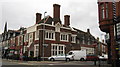
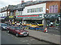
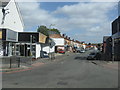
Photos of B11 4EF

Area Information
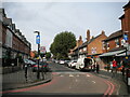
Living in B11 4EF means inhabiting a small, defined postcode area within Sparkhill, a historically rural district now transformed into a densely populated urban hub of Birmingham. With a population of 2004 residents, this area is compact but rich in character. Sparkhill’s roots trace back to the Domesday Book, with its name possibly derived from a medieval family or a stream called Spark Brook. The area became a working-class housing estate in the 1850s, later annexed by Birmingham in 1911. Today, it is a vibrant, ethnically diverse community, shaped by waves of migration from Ireland, the Caribbean, South Asia, and more recently, Somalia and Romania. The Balti Triangle, a culinary and cultural hub, is a defining feature, with South Asian eateries lining the streets. Residents benefit from proximity to transport networks, including rail and metro lines, and a mix of retail and community amenities. The area’s compact size means it is both a microcosm of Birmingham’s history and a dynamic, evolving neighbourhood.
- Area Type
- Postcode
- Area Size
- Not available
- Population
- 2004
- Population Density
- 8305 people/km²
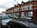
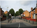
The property market in B11 4EF is characterised by a high rate of home ownership (63%), with houses being the primary accommodation type. This suggests a mix of older, terraced properties built during the 19th century and post-war housing developments, such as the 1940s replacements for homes damaged during World War II. The area’s compact size means housing stock is limited, and buyers may need to consider nearby postcode areas for more options. The presence of houses rather than flats indicates a preference for family-friendly living, though the small population size means demand is likely concentrated among local residents. For buyers, this could mean competition for available properties, particularly in well-maintained older homes. The area’s historical architecture and proximity to transport may also influence property values.
House Prices in B11 4EF
No properties found in this postcode.
Energy Efficiency in B11 4EF
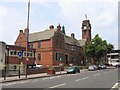
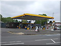
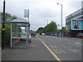
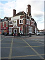
Residents of B11 4EF enjoy a range of amenities within practical reach, including retail hubs like Asda Sparkhill and Aldi Sparkbrook, which cater to daily shopping needs. The area’s historic character is complemented by cultural landmarks such as St John’s Church and Sparkhill Library, one of the earliest public buildings with double-glazed windows. Pubs like the Mermaid Inn and The Bear, with art deco and sculpted features, add to the local charm. The proximity to the Balti Triangle ensures a vibrant dining scene with South Asian cuisine. For leisure, the area’s walkability to rail and metro stations, combined with nearby parks and open spaces, supports an active lifestyle. The mix of historic sites, retail, and cultural diversity contributes to a distinctive, community-focused environment.
Amenities
Schools
Residents of B11 4EF have access to St John’s CofE Primary School, which holds an Ofsted rating of outstanding, and the City of Birmingham School, a secondary institution. The primary school’s high rating reflects strong academic performance and community engagement, making it a key draw for families. The presence of both primary and secondary education within the area reduces the need for long commutes, though parents should verify catchment areas for specific schools. The mix of school types ensures a range of educational options, from early years to secondary education. For families prioritising high-quality schooling, St John’s CofE Primary’s outstanding rating is a significant advantage, though the overall school landscape is shaped by the area’s diverse demographics.
| Rank | School | Type | Entry gender | Ages |
|---|---|---|---|---|
| 1 | City of Birmingham School | other | N/A | N/A |
| 2 | St John's CofE Primary School | primary | N/A | N/A |
| 3 | St John's CofE Primary School | primary | N/A | N/A |
Explore more schools in this area
Go to Schools tabDemographics
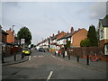
B11 4EF has a median age of 47, with the majority of residents aged between 30 and 64. This suggests a stable, middle-aged population, many of whom are likely long-term residents. Home ownership stands at 63%, indicating a significant proportion of residents live in their own homes, though rental properties also exist. The accommodation type is predominantly houses, which is unusual for inner-city areas, reflecting a mix of older terraced housing and post-war developments. The predominant ethnic group is South Asian, a legacy of 20th-century migration patterns. This diversity shapes the area’s cultural fabric, with visible influences in local businesses and community institutions. The population size of 2004 means the area is small enough to foster a close-knit community but large enough to support essential services.
Household Size
Accommodation Type
Tenure
Ethnic Group
Religion
Household Composition
Age
Household Deprivation
NS-SEC
Explore more demographic insights in this area
Go to Demographics tabPlanning
Planning Constraints
- Flood RiskPremium
- Ramsar Wetland SitesPremium
- Area of Outstanding Natural BeautyPremium
- Protected Nature ReservePremium
- Protected WoodlandPremium
- Crime RiskPremium