Area Overview for B11 4DW
Photos of B11 4DW

Area Information
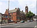
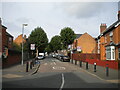
Living in B11 4DW, part of Sparkhill in Birmingham, means inhabiting a compact, historically rich urban area. With a population of 1,799, this postcode reflects a blend of working-class housing and post-war development. Sparkhill’s roots trace to the Domesday Book, with its name possibly derived from the Sparke family or Spark Brook, a stream that once flowed through the region. Today, the area is a hub of cultural diversity, shaped by successive waves of migration, including Irish, Afro-Caribbean, South Asian, and more recent Somali and Romanian communities. This has made it a key part of Birmingham’s famed “Balti Triangle,” where South Asian cuisine and culture thrive. The area’s compact size means amenities are within walking distance, while its proximity to rail and metro lines ensures easy access to the city’s broader networks. For residents, daily life balances urban convenience with a strong sense of community, though the small footprint means the area’s character is defined by its close-knit, historically layered environment.
- Area Type
- Postcode
- Area Size
- Not available
- Population
- 1799
- Population Density
- 11230 people/km²
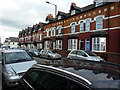
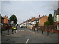
The property market in B11 4DW is characterised by a 50% home ownership rate, with houses forming the majority of accommodation types. This suggests a mix of owner-occupied and rental properties, though the precise balance is unclear. Given the area’s small size and historical development as terraced housing, the available properties are likely to be modest in scale, with limited scope for large-scale redevelopment. For buyers, the compact nature of the postcode means the housing stock is finite, and competition may be keen. The presence of houses rather than flats indicates a preference for traditional, family-friendly layouts. However, the area’s small footprint means buyers should consider proximity to nearby districts for broader options. The 50% ownership rate also implies a significant rental market, which could influence property values and availability.
House Prices in B11 4DW
No properties found in this postcode.
Energy Efficiency in B11 4DW
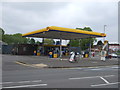
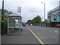
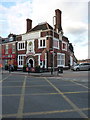
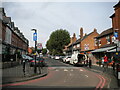
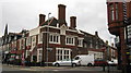
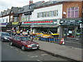
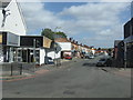
The lifestyle in B11 4DW is shaped by its proximity to retail, transport, and historic sites. Nearby shops include Asda Sparkhill, Co-op Sparkhill, and Tesco Hall, offering everyday essentials. Rail and metro stations provide easy access to Birmingham’s wider networks, while the area’s historical character is preserved in landmarks like St John’s Church and Sparkhill Library. The local pub culture, with historic venues such as the Mermaid Inn and The Bear, adds to the area’s social fabric. Though parks are not explicitly mentioned in the data, the presence of nearby green spaces is implied by the absence of planning constraints related to protected areas. The blend of retail, transport, and heritage creates a convenient, culturally rich environment for residents.
Amenities
Schools
Residents of B11 4DW have access to multiple primary schools, including Springfield Junior School, Springfield Infant School, Springfield Primary School, and Springfield Primary Academy, which holds an Ofsted rating of “good.” This concentration of primary education options is a significant draw for families, ensuring proximity to schooling for younger children. However, the absence of secondary schools in the immediate area means students may need to travel to nearby districts for higher education. The presence of multiple primary schools also suggests a focus on early education, potentially supporting community cohesion and parental convenience. The quality of the Springfield Primary Academy, in particular, offers reassurance for families prioritising educational standards.
| Rank | School | Type | Entry gender | Ages |
|---|
Explore more schools in this area
Go to Schools tabDemographics
B11 4DW has a median age of 22, though the most common age range among residents is 30–64 years. This suggests a mix of younger individuals and established adults, likely reflecting the area’s working-class origins and ongoing migration patterns. Home ownership stands at 50%, with houses being the predominant accommodation type. The area’s demographic profile is heavily influenced by its history as a migration destination: the predominant ethnic group is Asian_total, a reflection of decades of South Asian settlement. While no specific deprivation data is provided, the presence of multiple primary schools and accessible transport suggests a functional infrastructure. The age distribution and ownership rate indicate a community where families and long-term residents coexist, with housing stock primarily comprising owner-occupied properties.
Household Size
Accommodation Type
Tenure
Ethnic Group
Religion
Household Composition
Age
Household Deprivation
NS-SEC
Explore more demographic insights in this area
Go to Demographics tabPlanning
Planning Constraints
- Flood RiskPremium
- Ramsar Wetland SitesPremium
- Area of Outstanding Natural BeautyPremium
- Protected Nature ReservePremium
- Protected WoodlandPremium