Area Overview for B11 4DQ
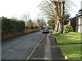
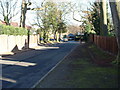
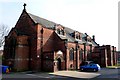
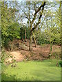
Photos of B11 4DQ


Area Information
B11 4DQ lies within Sparkhill, a historically significant inner-city area of Birmingham, England. With a population of 1,695, this small residential cluster is defined by its proximity to Springfield, Hall Green, and Sparkbrook. The area’s roots trace back to the Domesday Book, with its name likely derived from the Sparke family or Spark Brook, a stream that once flowed through the region. While industrial development transformed Sparkhill in the 19th century, its character today reflects a blend of urban living and historical legacy. The area is marked by terraced housing, a legacy of 19th-century building societies, and a vibrant cultural mix shaped by successive waves of migration. Residents benefit from nearby amenities, including retail hubs like Asda Sparkhill and Co-op Sparkhill, as well as multiple rail and metro stations. Living in B11 4DQ means navigating a compact, accessible urban environment with a distinct identity shaped by its past and present diversity.
- Area Type
- Postcode
- Area Size
- Not available
- Population
- 1695
- Population Density
- 5539 people/km²
The property market in B11 4DQ is defined by a 50% home ownership rate, suggesting a balance between owner-occupied homes and rental properties. The accommodation type is primarily houses, which is unusual for a small urban postcode area but aligns with Sparkhill’s historical development of terraced housing. This mix of housing stock may appeal to buyers seeking family homes or those prioritising private space over high-density living. The relatively low population density and presence of nearby amenities like retail hubs and transport links could make the area attractive for those valuing convenience without the pressures of larger cities. However, the small size of the postcode means the immediate surroundings are critical for assessing housing options, with potential variations in property types and availability across adjacent areas.
House Prices in B11 4DQ
No properties found in this postcode.
Energy Efficiency in B11 4DQ
Living in B11 4DQ offers access to a range of amenities within practical reach. Retail options include Asda Sparkhill, Co-op Sparkhill, and Tesco Hall, providing everyday shopping convenience. The area’s transport links—rail stations like Hall Green and Tyseley, and metro stops such as Grand Central New Street—facilitate easy travel to Birmingham’s commercial and cultural hubs. While the data does not specify parks or leisure facilities, the historical presence of St John’s Church and the former Birmingham Women’s Hospital suggests a mix of community and heritage spaces. The area’s character is shaped by its ethnic diversity and proximity to the Balti Triangle, offering a dynamic, culturally rich environment with practical amenities for daily life.
Amenities
Schools
The nearest school to B11 4DQ is Moseley School and Sixth Form, a primary school with an Ofsted rating of ‘good’. This institution serves the local community, offering education for younger children and contributing to the area’s appeal for families. The presence of a primary school with a positive rating indicates a baseline level of educational provision, though the absence of secondary schools or additional educational facilities in the data means families may need to look further afield for comprehensive schooling. The school’s rating suggests that it meets acceptable standards, but prospective residents should consider the broader educational landscape beyond the immediate area when planning for long-term needs.
| Rank | School | Type | Entry gender | Ages |
|---|
Explore more schools in this area
Go to Schools tabDemographics
The population of B11 4DQ has a median age of 47, with the most common age range being adults aged 30–64. This suggests a mature, established community with a strong presence of middle-aged residents. Home ownership stands at 50%, indicating a balanced mix of owner-occupied and rental properties. The accommodation type is predominantly houses, reflecting a residential character that contrasts with high-density urban areas. The predominant ethnic group is Asian_total, highlighting the area’s cultural diversity. This demographic profile shapes a community where families and long-term residents coexist, with services and amenities tailored to an adult population. The absence of specific deprivation data means the quality of life is not explicitly quantified, but the mix of housing and age groups implies a stable, functional local environment.
Household Size
Accommodation Type
Tenure
Ethnic Group
Religion
Household Composition
Age
Household Deprivation
NS-SEC
Explore more demographic insights in this area
Go to Demographics tabPlanning
Planning Constraints
- Flood RiskPremium
- Ramsar Wetland SitesPremium
- Area of Outstanding Natural BeautyPremium
- Protected Nature ReservePremium
- Protected WoodlandPremium