Area Overview for B11 4DF
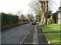
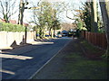
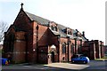
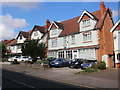
Photos of B11 4DF


Area Information
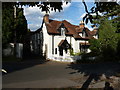
Living in B11 4DF, a small residential cluster in Birmingham, offers a blend of urban convenience and historical character. The area, part of Sparkhill, is nestled between Springfield, Hall Green, and Sparkbrook, with a population of 1,695 residents. Historically a rural village, it transformed during the Industrial Revolution into a working-class housing estate, later annexed by Birmingham in 1911. Today, it is a vibrant urban neighbourhood with a strong South Asian influence, reflecting waves of migration over the 20th century. The Balti Triangle, a hub of Asian cuisine, underscores its cultural diversity. Daily life here is shaped by proximity to retail, transport, and community amenities. While the area’s compact size means it is best suited for those prioritising convenience over sprawling landscapes, its rich history and active community offer a distinct sense of place. Residents benefit from nearby schools, rail links, and a mix of historic and modern infrastructure, making it a practical choice for those seeking a connected, multicultural environment.
- Area Type
- Postcode
- Area Size
- Not available
- Population
- 1695
- Population Density
- 5539 people/km²
The property market in B11 4DF is characterised by a 50% home ownership rate, with houses forming the majority of the housing stock. This suggests a balance between owner-occupied properties and rental units, though the exact proportion of the latter is not specified. Given the area’s compact size and historical development as terraced housing, the available properties are likely to be traditional, multi-family homes rather than modern apartments. Buyers should expect a focus on established housing with potential for renovation or long-term investment. The small postcode area means that properties are closely grouped, and proximity to transport links and amenities may drive demand. However, the lack of specific data on property prices or recent market trends means that buyers must consider the area’s practical advantages—such as ease of access to rail and retail—against its urban density and limited green space.
House Prices in B11 4DF
No properties found in this postcode.
Energy Efficiency in B11 4DF
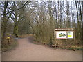
Life in B11 4DF is shaped by its proximity to a range of amenities, from retail to transport hubs. The area’s retail offerings include Asda Sparkhill, Co-op Sparkhill, and Tesco Hall, providing access to everyday essentials. For dining, the Balti Triangle’s influence is evident, with numerous South Asian eateries offering diverse culinary options. Historic landmarks such as St John’s Church and Sparkhill Library add cultural depth, while traditional pubs like the Mermaid Inn and The Antelope offer social spaces with heritage appeal. The area’s rail and metro connections ensure easy access to Birmingham’s wider network, supporting both work and leisure activities. While green spaces are not explicitly mentioned, the presence of historic public houses and community-focused venues suggests a lifestyle centred on local engagement and convenience. Residents benefit from a compact, well-serviced environment that balances urban living with historical character.
Amenities
Schools
The nearest school to B11 4DF is Moseley School and Sixth Form, a primary school with an Ofsted rating of ‘good’. This provides families with access to a well-regarded educational institution for younger children, though no secondary schools are listed in the data. The presence of a primary school with a positive rating is a significant advantage for parents seeking quality education within walking distance. However, the absence of secondary school options may require families to consider commuting to nearby areas. The school’s rating suggests a focus on academic standards and student welfare, which aligns with the area’s emphasis on community and stability. For those prioritising schools, B11 4DF offers a reliable foundation for early education, though further research would be needed to assess secondary options.
| Rank | School | Type | Entry gender | Ages |
|---|
Explore more schools in this area
Go to Schools tabDemographics
The community in B11 4DF is predominantly composed of adults aged 30–64, with a median age of 47. This suggests a stable, established population, likely with strong ties to local institutions and long-term residency. Home ownership rates stand at 50%, with houses being the primary accommodation type, indicating a mix of owner-occupied properties and rental units. The area’s predominant ethnic group is South Asian, reflecting its historical role as a migration hub. This diversity shapes the social fabric, with cultural influences evident in local businesses and community events. While no specific deprivation data is provided, the demographic profile suggests a population that is largely middle-aged and settled, with potential for intergenerational living. The absence of younger households may impact local services catering to children, though the presence of Moseley School and Sixth Form indicates some provision for families.
Household Size
Accommodation Type
Tenure
Ethnic Group
Religion
Household Composition
Age
Household Deprivation
NS-SEC
Explore more demographic insights in this area
Go to Demographics tabPlanning
Planning Constraints
- Flood RiskPremium
- Ramsar Wetland SitesPremium
- Area of Outstanding Natural BeautyPremium
- Protected Nature ReservePremium
- Protected WoodlandPremium