Area Overview for B11 4BX
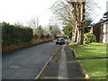
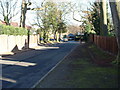
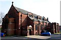
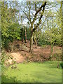
Photos of B11 4BX
Area Information
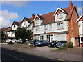
Living in B11 4BX means being part of Sparkhill, a small residential cluster in Birmingham’s inner city. With a population of 1,763, this area is compact yet rich in history and cultural diversity. Sparkhill lies between Springfield, Hall Green, and Sparkbrook, historically part of Worcestershire before being annexed by Birmingham in 1911. Daily life here blends urban convenience with a strong sense of community, shaped by its role as a hub of Birmingham’s “Balti Triangle,” where South Asian influences are prominent in local cuisine and culture. The area’s terraced housing, built in the 1850s–1860s, reflects its working-class roots, though newer developments have emerged over time. Proximity to rail networks and retail hubs makes it practical for commuters, while its low flood risk and lack of environmental constraints offer reassurance. For buyers, B11 4BX represents a blend of affordability, accessibility, and a vibrant, multicultural environment, ideal for those seeking a dynamic yet grounded urban lifestyle.
- Area Type
- Postcode
- Area Size
- Not available
- Population
- 1763
- Population Density
- 12109 people/km²
The property market in B11 4BX is dominated by owner-occupied homes, with 64% of residents living in properties they own. The area’s housing stock consists primarily of houses, a rarity in many parts of Birmingham, which often features flats. This suggests a mix of older terraced homes built in the 1850s–1860s and newer developments, offering buyers a range of options. The prevalence of houses may appeal to families seeking more space, though the small postcode area means inventory is limited. For buyers, this could mean competitive pricing and a need to consider nearby suburbs for additional choices. The high home ownership rate also indicates a stable market, with properties likely retaining value due to their scarcity and the area’s connectivity to transport networks.
House Prices in B11 4BX
No properties found in this postcode.
Energy Efficiency in B11 4BX
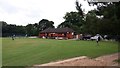
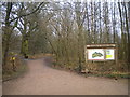
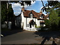
Life in B11 4BX is supported by a range of nearby amenities. Retail options include Asda Sparkhill, Tesco Hall, and Co-op Sparkhill, providing everyday shopping convenience. The area’s proximity to rail stations like Hall Green and Tyseley makes it easy to access Birmingham’s wider retail and cultural hubs. Sparkhill’s identity as part of the “Balti Triangle” is reflected in its dining scene, with numerous South Asian eateries catering to the community’s tastes. Historic sites such as St John’s Church and Sparkhill Library add character, while pubs like the Mermaid Inn and The Bear offer social spaces with heritage value. Though parks are not explicitly mentioned, the area’s industrial past and proximity to the River Cole suggest opportunities for outdoor activities nearby. This mix of practical amenities and cultural richness creates a convenient, dynamic lifestyle.
Amenities
Schools
| Rank | School | Type | Entry gender | Ages |
|---|
Explore more schools in this area
Go to Schools tabDemographics
The community in B11 4BX is predominantly composed of adults aged 30–64, with a median age of 22, reflecting a mix of younger and middle-aged residents. Home ownership here is strong, with 64% of households owning their homes, compared to 36% renting. The area is characterised by a high proportion of houses, contrasting with other parts of Birmingham where flats dominate. Ethnically, the population is heavily influenced by South Asian communities, with the Asian_total group forming the predominant ethnic category. This diversity shapes the area’s cultural fabric, evident in local businesses and social dynamics. While no specific deprivation data is provided, the high home ownership rate and presence of amenities suggest a stable, self-sufficient community. However, the median age of 22 indicates a younger demographic, which may influence local services and housing demand.
Household Size
Accommodation Type
Tenure
Ethnic Group
Religion
Household Composition
Age
Household Deprivation
NS-SEC
Explore more demographic insights in this area
Go to Demographics tabPlanning
Planning Constraints
- Flood RiskPremium
- Ramsar Wetland SitesPremium
- Area of Outstanding Natural BeautyPremium
- Protected Nature ReservePremium
- Protected WoodlandPremium