Area Overview for B11 4AS
Photos of B11 4AS

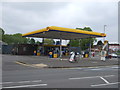
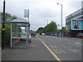
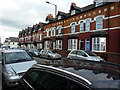
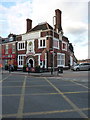

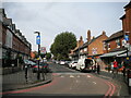
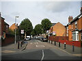
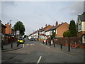

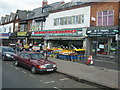
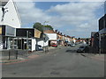
50 photos from this area
Area Information
Key information about the B11 4AS including its size, population, and administrative classification.
- Area Type
- Postcode
- Area Size
- 3888 m²
- Population
- 1915
- Population Density
- 12792 people/km²
House Prices in B11 4AS
36
Properties
£129,869
Average Sold Price
£35,000
Lowest Price
£235,000
Highest Price
Showing 36 properties
| Address | Type | Beds | Baths | Last Sale Price | Last Sale Date | |
|---|---|---|---|---|---|---|
| 678 Stratford Road, Springfield, Birmingham, B11 4AS | Terraced | 5 | 2 | £225,000 | Dec 2025 | |
| 674 Stratford Road, Springfield, Birmingham, B11 4AS | Terraced | 4 | 1 | £235,000 | Jan 2023 | |
| 652 Stratford Road, Springfield, Birmingham, B11 4AS | Terraced | - | - | £75,000 | Dec 2013 | |
| 668 Stratford Road, Springfield, Birmingham, B11 4AS | house | 4 | - | £145,000 | Oct 2010 | |
| 662 Stratford Road, Springfield, Birmingham, B11 4AS | Terraced | - | - | £194,000 | Mar 2007 | |
| 658 Stratford Road, Springfield, Birmingham, B11 4AS | house | - | - | £35,000 | Nov 2000 | |
| 672 Stratford Road, Springfield, Birmingham, B11 4AS | house | - | - | £70,000 | Dec 1999 | |
| 666 Stratford Road, Springfield, Birmingham, B11 4AS | Terraced | - | - | £59,950 | Sep 1997 | |
| Flat 1, 676 Stratford Road, Springfield, Birmingham, B11 4AS | Flat | 5 | - | - | - | |
| First Floor And Second Floor Flat, 662 Stratford Road, Springfield, Birmingham, B11 4AS | Flat | - | - | - | - |
Page 1 of 4
Energy Efficiency in B11 4AS
Amenities
Schools
| Rank | School | Type | Entry gender | Ages |
|---|
Explore more schools in this area
Go to Schools tabDemographics
Household Size
Family (3-5 people)
most common
Accommodation Type
Houses
most common
Tenure
47
majority
Ethnic Group
asian_total
most common
Religion
N/A
most common
Household Composition
N/A
most common
Age
22
median
Adults (30-64 years)
most common
Household Deprivation
N/A
with no deprivation
NS-SEC
10
in Lower managerial occupations
Explore more demographic insights in this area
Go to Demographics tabPlanning
Planning Constraints
- Flood RiskPremium
- Ramsar Wetland SitesPremium
- Area of Outstanding Natural BeautyPremium
- Protected Nature ReservePremium
- Protected WoodlandPremium