Area Overview for B11 3RY
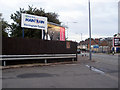
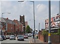
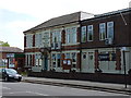
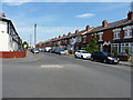
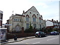
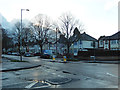
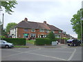
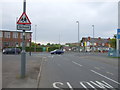
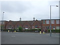
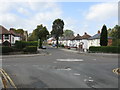
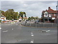
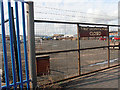
Photos of B11 3RY
Area Information
Living in B11 3RY means being part of Sparkbrook and Balsall Heath East, an electoral ward in Birmingham’s inner city. This small residential cluster, home to 1,736 people, is defined by its urban density and cultural diversity. The area’s history as a hub for post-1960s Commonwealth migrants continues to shape its identity, with a vibrant mix of food, faith, and community life. Despite being Birmingham’s most deprived ward, it thrives on entrepreneurial energy, with independent shops and cafes lining Stratford Road and Ladypool Road. Balsall Heath Park offers green space, while nearby rail stations like Tyseley and Small Heath provide connectivity. The median age of 22 contrasts with the dominant 30-64 age group, reflecting a dynamic community of families and young professionals. While challenges like high unemployment persist, the area’s strong social fabric and proximity to Birmingham’s city centre make it a distinctive choice for those seeking affordability and cultural richness.
- Area Type
- Postcode
- Area Size
- Not available
- Population
- 1736
- Population Density
- 19462 people/km²
B11 3RY’s property market is characterised by 52% home ownership, with houses forming the primary accommodation type. This suggests a community of long-term residents rather than a transient rental market. The presence of houses, as opposed to flats, indicates a focus on family homes, which may appeal to buyers seeking space and stability. However, the area’s small size means the housing stock is limited, and buyers should consider proximity to nearby amenities and transport links. The high deprivation level may influence property values, but the area’s cultural vibrancy and proximity to Birmingham’s city centre could offset this. For those prioritising community and affordability, B11 3RY offers a distinct alternative to more affluent parts of the city, though potential buyers should weigh economic challenges against the area’s social assets.
House Prices in B11 3RY
No properties found in this postcode.
Energy Efficiency in B11 3RY
Life in B11 3RY revolves around its compact network of amenities. Residents can access retail options like Asda Sparkhill, Asda Small, and Lidl Acocks, while metro stations such as Corporation Street and Bull Street provide links to Birmingham’s transport arteries. Balsall Heath Park offers a vital green space for recreation, complemented by the area’s small businesses and independent shops along Stratford Road and Ladypool Road. The presence of community hubs and faith-based organisations fosters a sense of cohesion. While the ward’s economic challenges are evident, the convenience of nearby amenities and the vibrancy of local commerce create a functional, if resource-constrained, lifestyle. The area’s character is defined by its blend of urban practicality and cultural diversity, making it suitable for those prioritising affordability and community over luxury.
Amenities
Schools
The nearest school to B11 3RY is Yardleys School, a primary institution serving the local community. While no Ofsted rating is provided, the presence of a primary school highlights the area’s focus on family needs. Families requiring secondary education may need to look further afield, as no secondary schools are listed in the data. The single primary school suggests a reliance on nearby institutions for older students, which could impact convenience for households with multiple children. However, the ward’s cultural diversity and community hubs may complement formal education with informal learning opportunities. Parents should assess the broader school network in surrounding areas to ensure alignment with their children’s educational requirements.
| Rank | School | Type | Entry gender | Ages |
|---|
Explore more schools in this area
Go to Schools tabDemographics
B11 3RY’s population of 1,736 is predominantly Asian, with 52% of residents owning their homes. The median age of 22 belies a community where 30-64-year-olds make up the largest demographic group, suggesting a mix of young families and established households. The ward’s higher BAME population share and younger age profile contrast with Birmingham’s average, reflecting its history as a migrant settlement. However, it is the city’s most deprived ward, with the 8th highest child poverty rate among 69 wards. This context shapes daily life: while small businesses flourish, economic challenges like high unemployment and underinvestment persist. Despite this, the area’s residents exhibit strong community spirit, evident in local initiatives and the presence of faith-based organisations. Homeownership at 52% indicates a stable housing market, though the predominance of houses over flats suggests a focus on family-oriented living.
Household Size
Accommodation Type
Tenure
Ethnic Group
Religion
Household Composition
Age
Household Deprivation
NS-SEC
Explore more demographic insights in this area
Go to Demographics tabPlanning
Planning Constraints
- Flood RiskPremium
- Ramsar Wetland SitesPremium
- Area of Outstanding Natural BeautyPremium
- Protected Nature ReservePremium
- Protected WoodlandPremium