Area Overview for B11 3ET
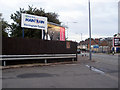
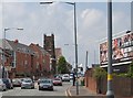
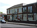
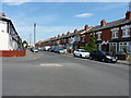
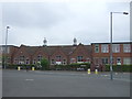
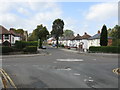
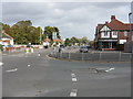
Photos of B11 3ET
Area Information
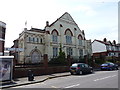
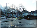
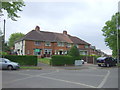
B11 3ET is a small, tightly knit postcode area within Birmingham’s Hall Green district, known for its suburban charm and historical character. With a population of 1,988, it reflects a community rooted in early 20th-century development, featuring low red brick boundary walls, tree-lined streets, and homes from the interwar period. The area’s safety is a notable draw, with Hall Green North Ward designated as one of Birmingham’s safest districts. Daily life here balances residential tranquillity with proximity to amenities, including five railway stations and a range of retail outlets. The presence of historic sites like the Friends Meeting House and the Church of the Ascension adds cultural depth, while the area’s blend of older housing and modern infrastructure caters to families and professionals. Living in B11 3ET means enjoying a mix of heritage and convenience, with schools rated good to outstanding and digital connectivity rated excellent for broadband. It is a place where historical legacy meets practical modernity, ideal for those seeking a stable, community-oriented environment.
- Area Type
- Postcode
- Area Size
- Not available
- Population
- 1988
- Population Density
- 6337 people/km²
The property market in B11 3ET is characterised by a 52% home ownership rate, indicating a mix of owner-occupied and rental properties. The area’s accommodation type is predominantly houses, reflecting a suburban layout with older, historically significant homes from the early 20th century and interwar periods. This contrasts with newer developments, such as Petersfield Court’s Art Deco flats, which add architectural diversity. The small postcode area means housing stock is limited, with properties often located near key amenities like schools and transport links. For buyers, this suggests a focus on established homes with historical value, though the market may be less dynamic due to the area’s compact size. Proximity to Hall Green’s safe environment and well-connected transport networks could enhance appeal, but potential buyers should consider the area’s limited expansion potential and reliance on nearby commercial hubs for employment.
House Prices in B11 3ET
No properties found in this postcode.
Energy Efficiency in B11 3ET
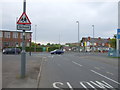
The lifestyle in B11 3ET is shaped by its mix of historic architecture and accessible amenities. Residents can shop at nearby Lidl Acocks, Asda Merestones, and Asda Sparkhill, providing everyday essentials within walking distance. The area’s proximity to five railway stations and metro stops ensures easy access to Birmingham’s cultural and commercial centres, while the presence of the Church of the Ascension (1704) and the Friends Meeting House adds historical and social value. Parks and green spaces are not explicitly detailed, but the tree-lined streets and low-density housing suggest a focus on outdoor living. The community’s character is defined by its safe environment, historic buildings, and the blend of residential and commercial activity. For those seeking a balance between heritage and modern convenience, B11 3ET offers a compact yet well-connected lifestyle.
Amenities
Schools
Residents of B11 3ET have access to two notable schools within practical reach. Yardleys School, an academy rated good by Ofsted, serves the local community with a focus on academic and personal development. Nearby, The Olive School in Birmingham is an academy with an outstanding Ofsted rating, reflecting high standards in education and student outcomes. The mix of academy schools provides families with options that balance traditional and progressive teaching methods. Both institutions are within walking or short transit distance, reducing the need for long commutes. The presence of a school rated outstanding underscores the area’s appeal for families prioritising quality education. For those considering homes in B11 3ET, proximity to these schools is a significant advantage, aligning with the ward’s reputation as a safe, family-friendly district.
| Rank | School | Type | Entry gender | Ages |
|---|
Explore more schools in this area
Go to Schools tabDemographics
The population of B11 3ET is 1,988, with a median age of 22, though the most common age range is adults aged 30–64. This suggests a community skewed toward working-age individuals, likely balancing younger residents with families. Home ownership stands at 52%, indicating a mix of owner-occupied and rental properties. The predominant accommodation type is houses, reflecting a residential character distinct from high-density housing. The area’s ethnic composition is dominated by the Asian population, though specific proportions are not quantified. Deprivation data is not explicitly provided, but the ward’s above-average employment rates and low unemployment suggest a relatively stable economic profile. For quality of life, the presence of schools rated good and outstanding, combined with low flood risk, supports a balanced environment. However, the moderate crime risk (score 49/100) means residents should maintain standard security measures.
Household Size
Accommodation Type
Tenure
Ethnic Group
Religion
Household Composition
Age
Household Deprivation
NS-SEC
Explore more demographic insights in this area
Go to Demographics tabPlanning
Planning Constraints
- Flood RiskPremium
- Ramsar Wetland SitesPremium
- Area of Outstanding Natural BeautyPremium
- Protected Nature ReservePremium
- Protected WoodlandPremium