Area Overview for B11 3DX
Photos of B11 3DX
Area Information
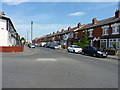
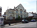
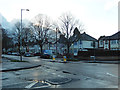
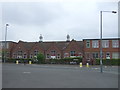
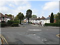
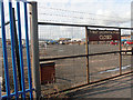
Living in B11 3DX, part of Tyseley and Hay Mills in Birmingham, means inhabiting a historically industrious yet evolving residential cluster. With a population of 2,612, it is a small, tightly knit area shaped by its proximity to the River Cole and the A45 Coventry Road. The ward’s name derives from Old English *gehaeg*, reflecting its origins as hedged land, while its modern identity is marked by the legacy of 19th-century manufacturing, including the pioneering wire-drawing firm Webster Horsfall. Today, the area balances historical sites like Grade II-listed Hay Hall with contemporary initiatives such as Tyseley Energy Park, a hub for green innovation. Daily life here is defined by its connectivity: rail stations like Spring Road and Tyseley offer swift access to Birmingham’s core, while nearby retail outlets and transport links cater to both local needs and commuter demands. The area’s compact size and mix of residential and industrial heritage make it a distinctive choice for those seeking a blend of tradition and progress.
- Area Type
- Postcode
- Area Size
- Not available
- Population
- 2612
- Population Density
- 7077 people/km²
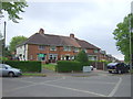
The property market in B11 3DX is characterised by a 56% home ownership rate, suggesting a mix of owner-occupied properties and rental stock. The accommodation type is primarily houses, which is notable in a city like Birmingham, where terraced housing is more common. This indicates a niche market for family homes or those seeking more space. Given the area’s small size and the prevalence of single-family dwellings, the housing stock is likely limited, meaning buyers may need to consider nearby areas for broader options. The predominance of houses also implies a focus on private, semi-detached or detached properties, which could appeal to those prioritising privacy and space. However, the limited supply may lead to competition among buyers, particularly for properties with modern amenities or proximity to transport links. The area’s industrial heritage may also influence property values, with some homes benefiting from historical features or proximity to green initiatives like Tyseley Energy Park.
House Prices in B11 3DX
No properties found in this postcode.
Energy Efficiency in B11 3DX
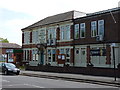
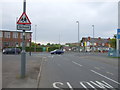
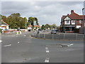
Residents of B11 3DX have access to a range of amenities within practical reach, including supermarkets like Lidl Acocks, Asda Merestones, and Tesco Hall, which cater to daily shopping needs. The area’s transport links extend beyond commuting, with rail stations such as Spring Road and Tyseley offering connections to cultural and commercial hubs. Nearby, the historic Hay Hall and Tyseley Energy Park provide a contrast between heritage and innovation, while the presence of Vintage Trains at the Tyseley Traction Maintenance Depot adds a unique local attraction. The compact nature of the area ensures that essential services are within walking or short driving distance, fostering a convenient lifestyle. The blend of retail, transport, and historical sites contributes to a dynamic yet manageable daily routine, ideal for those seeking accessibility without the congestion of larger urban centres.
Amenities
Schools
| Rank | School | Type | Entry gender | Ages |
|---|
Explore more schools in this area
Go to Schools tabDemographics
The community in B11 3DX is predominantly composed of adults aged 30–64, with a median age of 22, suggesting a mix of younger professionals and families. Home ownership stands at 56%, indicating a stable residential base, while the predominant ethnic group is Asian, reflecting the area’s cultural diversity. This demographic profile shapes a community with established roots and a focus on family-oriented living. The age range suggests a balance between working-age residents and those nearing retirement, though the relatively low median age may hint at a younger population, possibly influenced by nearby educational institutions or employment opportunities. The absence of specific deprivation data means quality of life factors like access to services and infrastructure must be inferred from the availability of amenities and transport links. The area’s diversity and moderate population size contribute to a sense of community without the density of larger urban centres.
Household Size
Accommodation Type
Tenure
Ethnic Group
Religion
Household Composition
Age
Household Deprivation
NS-SEC
Explore more demographic insights in this area
Go to Demographics tabPlanning
Planning Constraints
- Flood RiskPremium
- Ramsar Wetland SitesPremium
- Area of Outstanding Natural BeautyPremium
- Protected Nature ReservePremium
- Protected WoodlandPremium