Area Overview for B11 3DN
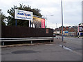
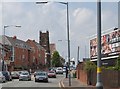
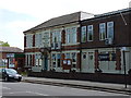
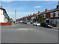
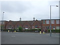
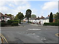
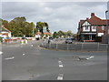
Photos of B11 3DN
Area Information
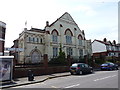
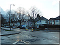
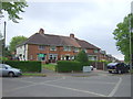
Living in B11 3DN means being part of a small, tightly knit residential cluster in Birmingham’s Hall Green North Ward. With a population of 2,612, the area blends suburban tranquillity with proximity to the city’s vibrancy. This ward is characterised by early 20th-century housing, tree-lined streets, and a safe environment, making it a sought-after place for families and professionals. The area’s history is rich: from Victorian villas in The Hamlet development to the 1704 Church of the Ascension, there is a tangible sense of heritage. Residents benefit from a mix of modern amenities and historical landmarks, such as Hall Green Junior School and the Friends Meeting House. The community’s slightly above-average employment rates and low unemployment suggest a stable local economy. B11 3DN is not just a postcode—it is a place where tradition meets practicality, offering a quiet yet connected lifestyle in one of Birmingham’s safer districts.
- Area Type
- Postcode
- Area Size
- Not available
- Population
- 2612
- Population Density
- 7077 people/km²
The property market in B11 3DN is defined by a 56% home ownership rate, indicating that nearly half of residents live in owner-occupied homes. The area is predominantly composed of houses, with a notable absence of flats or apartments. This suggests a market skewed towards single-family dwellings, likely appealing to families and professionals seeking stability. Given the small size of the postcode area, the housing stock is limited, which may create a competitive environment for buyers. The presence of early 20th-century and interwar properties, such as those in The Hamlet development, adds historical value to homes. However, the lack of newer developments could mean fewer options for those seeking modern housing. Buyers should consider the limited availability of properties and the potential for long-term appreciation in a historically preserved area.
House Prices in B11 3DN
No properties found in this postcode.
Energy Efficiency in B11 3DN
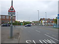
Life in B11 3DN is enriched by a mix of practical amenities and historical landmarks. Nearby retail options include Lidl Acocks, Asda Merestones, and Tesco Hall, providing everyday shopping convenience. The area’s transport links also grant access to Birmingham’s cultural and commercial hubs. Historically significant sites, such as the 1704 Church of the Ascension and the Victorian Friends Meeting House, contribute to a distinct local character. Hall Green Junior School, established in 1893, serves the community’s educational needs, while Petersfield Court, a 1937 Art Deco housing block, adds architectural variety. Parks and green spaces, though not explicitly named in the data, are implied by the tree-lined streets and well-planted surroundings described in the research. This blend of heritage, practicality, and accessibility fosters a lifestyle that is both rooted in tradition and adaptable to modern needs.
Amenities
Schools
| Rank | School | Type | Entry gender | Ages |
|---|
Explore more schools in this area
Go to Schools tabDemographics
The population of B11 3DN has a median age of 22, though the most common age range is adults aged 30–64, indicating a mix of younger and middle-aged residents. Home ownership stands at 56%, suggesting a balance between owner-occupied properties and rental stock. The area is predominantly composed of houses, reflecting a focus on single-family homes rather than flats or apartments. The predominant ethnic group is Asian, contributing to the area’s cultural diversity. While specific deprivation data is not provided, the ward’s slightly above-average employment rates and low unemployment suggest a generally stable quality of life. The demographic profile hints at a community that is both established and evolving, with a strong presence of working-age adults and a lower proportion of elderly residents. This mix supports a dynamic local economy and social environment.
Household Size
Accommodation Type
Tenure
Ethnic Group
Religion
Household Composition
Age
Household Deprivation
NS-SEC
Explore more demographic insights in this area
Go to Demographics tabPlanning
Planning Constraints
- Flood RiskPremium
- Ramsar Wetland SitesPremium
- Area of Outstanding Natural BeautyPremium
- Protected Nature ReservePremium
- Protected WoodlandPremium