Area Overview for B11 3BH
Photos of B11 3BH
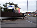
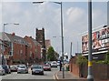
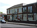
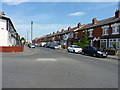
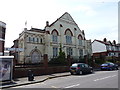
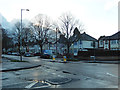
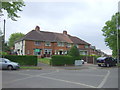
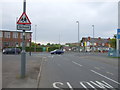

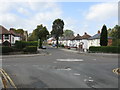
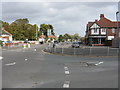
18 photos from this area
Area Information
Key information about the B11 3BH including its size, population, and administrative classification.
- Area Type
- Postcode
- Area Size
- 2.0 hectares
- Population
- 2148
- Population Density
- 5062 people/km²
House Prices in B11 3BH
61
Properties
£157,829
Average Sold Price
£43,000
Lowest Price
£335,000
Highest Price
Showing 61 properties
| Address | Type | Beds | Baths | Last Sale Price | Last Sale Date | |
|---|---|---|---|---|---|---|
| 73 Leominster Road, Birmingham, B11 3BH | Semi-detached | 3 | 2 | £290,000 | Apr 2025 | |
| 67 Leominster Road, Birmingham, B11 3BH | Terraced | 3 | 2 | £240,000 | Feb 2025 | |
| 101 Leominster Road, Birmingham, B11 3BH | Semi-detached | 4 | 2 | £331,000 | Mar 2024 | |
| 9 Leominster Road, Birmingham, B11 3BH | Terraced | 3 | 1 | £218,000 | Mar 2024 | |
| 119 Leominster Road, Birmingham, B11 3BH | Semi-detached | 3 | 1 | £335,000 | Feb 2024 | |
| 77 Leominster Road, Birmingham, B11 3BH | house | - | - | £240,000 | Jan 2024 | |
| 19 Leominster Road, Birmingham, B11 3BH | Retail | 3 | 1 | £212,000 | Jun 2022 | |
| 65 Leominster Road, Birmingham, B11 3BH | Terraced | 3 | 2 | £191,000 | Sep 2021 | |
| 91 Leominster Road, Birmingham, B11 3BH | Semi-detached | 5 | 2 | £271,000 | Jul 2020 | |
| 93 Leominster Road, Birmingham, B11 3BH | Semi-detached | 3 | - | £250,000 | Dec 2019 |
Page 1 of 7
Energy Efficiency in B11 3BH
Amenities
Schools
| Rank | School | Type | Entry gender | Ages |
|---|
Explore more schools in this area
Go to Schools tabDemographics
Household Size
Family (3-5 people)
most common
Accommodation Type
Houses
most common
Tenure
66
majority
Ethnic Group
asian_total
most common
Religion
N/A
most common
Household Composition
N/A
most common
Age
22
median
Adults (30-64 years)
most common
Household Deprivation
N/A
with no deprivation
NS-SEC
15
in Lower managerial occupations
Explore more demographic insights in this area
Go to Demographics tabPlanning
Planning Constraints
- Flood RiskPremium
- Ramsar Wetland SitesPremium
- Area of Outstanding Natural BeautyPremium
- Protected Nature ReservePremium
- Protected WoodlandPremium