Area Overview for B11 3AU
Photos of B11 3AU

Area Information
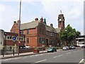
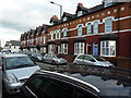
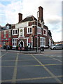
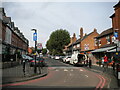
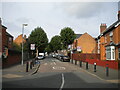
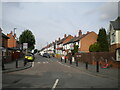
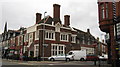
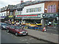
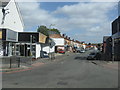
Living in B11 3AU, a small postcode area in Birmingham’s Sparkhill district, means inhabiting a compact urban cluster with a distinct character shaped by its history and demographics. With a population of 1,915, the area is part of a broader residential stretch between Springfield, Hall Green, and Sparkbrook. Historically a rural village annexed by Birmingham in 1911, Sparkhill now thrives as a hub of cultural diversity. Its proximity to the River Cole and the legacy of 19th-century terraced housing define its physical layout. The area’s identity is deeply tied to its South Asian community, reflected in the Balti Triangle’s influence, with restaurants and shops catering to this demographic. Daily life here balances urban convenience with pockets of historical architecture, from St John’s Church to the converted Mermaid Inn. Residents benefit from proximity to rail and metro networks, while the postcode’s small size means a tight-knit community feel.
- Area Type
- Postcode
- Area Size
- Not available
- Population
- 1915
- Population Density
- 12792 people/km²
The property market in B11 3AU is defined by its 47% home ownership rate, indicating a strong rental market with limited owner-occupied properties. The area’s accommodation type is primarily houses, though the small postcode’s urban setting suggests these are likely terraced or semi-detached homes built during the 19th and 20th centuries. This mix of older housing stock and proximity to Birmingham’s industrial past means property values may reflect historical construction quality and location. Buyers should consider the area’s compact size and limited new developments, which may restrict options. The presence of rental properties could benefit those seeking short-term stays or investment opportunities, though the 47% ownership rate suggests competition for available homes. Proximity to transport links and amenities may offset the area’s smaller footprint, appealing to those prioritising convenience over expansive living space.
House Prices in B11 3AU
No properties found in this postcode.
Energy Efficiency in B11 3AU
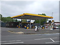
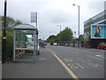
Life in B11 3AU offers a blend of urban convenience and historical charm. Nearby amenities include retail options like Asda Sparkhill, Tesco Hall, and Aldi Sparkbrook, ensuring everyday shopping needs are met. The area’s rail and metro links provide easy access to Birmingham’s broader network, while its proximity to the Balti Triangle means a wealth of South Asian cuisine and cultural experiences. Historic sites such as St John’s Church and the converted Mermaid Inn add character, and Sparkhill Library stands as a notable example of early 20th-century architecture. Parks and open spaces are less explicitly detailed, but the area’s industrial past suggests pockets of greenery or recreational areas nearby. The mix of retail, transport, and cultural hubs supports a dynamic lifestyle, particularly for those valuing accessibility and diversity.
Amenities
Schools
| Rank | School | Type | Entry gender | Ages |
|---|
Explore more schools in this area
Go to Schools tabDemographics
B11 3AU has a median age of 22, though the most common age range among residents is 30–64 years, indicating a mix of young professionals and families. Home ownership stands at 47%, suggesting a majority of households are renters, likely influenced by the area’s urban character and limited housing stock. The predominant accommodation type is houses, though the small postcode area’s density suggests terraced or semi-detached properties dominate. The largest ethnic group is Asian_total, reflecting Sparkhill’s long-standing role as a destination for migration waves, from Irish and Afro-Caribbean communities in the 20th century to South Asians and more recent arrivals. This diversity shapes the area’s cultural and culinary landscape, particularly in the Balti Triangle. While specific deprivation data is absent, the combination of rental prevalence and historical housing stock may influence affordability and living costs.
Household Size
Accommodation Type
Tenure
Ethnic Group
Religion
Household Composition
Age
Household Deprivation
NS-SEC
Explore more demographic insights in this area
Go to Demographics tabPlanning
Planning Constraints
- Flood RiskPremium
- Ramsar Wetland SitesPremium
- Area of Outstanding Natural BeautyPremium
- Protected Nature ReservePremium
- Protected WoodlandPremium