Area Overview for B11 2RL
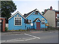
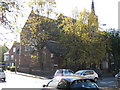
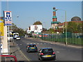
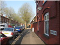
Photos of B11 2RL


Area Information
Sparkbrook and Balsall Heath East form a specific postcode area of B11 2RL that sits in the inner city to the south-east of Birmingham's city centre. This urban cluster has a distinct identity shaped by a population of 1,669, with 46% of residents owning their homes outright. The area serves as an economic and cultural hub, particularly following boundary changes in 2018 that increased the ward count across the city. It has seen significant residential growth, maintaining a status as the second most populous ward in Birmingham with 27,338 residents across its wider boundaries. Life here moves at a faster pace than the wider city average, driven by a younger demographic and a high concentration of BAME communities. The ward's character is defined by a vibrant food culture and entrepreneurial spirit, particularly along Stratford Road and Ladypool Road. Independent shops and small businesses thrive in these commercial hubs, creating a distinct rhythm to daily life that differs from suburban Living in B11 2RL means navigating a diverse, densely populated environment where community life is central to the local identity. The area combines historic roots from the industrial boom period with modern vitality, offering a setting where cultural richness and urban energy intersect closely.
- Area Type
- Postcode
- Area Size
- Not available
- Population
- 1669
- Population Density
- 2801 people/km²
Homes in B11 2RL are primarily houses, forming the backbone of the local housing stock. Market data shows that 46% of the local population holds their homes through ownership. This percentage indicates a significant portion of residents are homeowners rather than tenants, which often stabilises a neighbourhood. The presence of independent shops and small businesses along Stratford Road and Ladypool Road supports the local economy, which has a Gross Value Added of £368 million. The area represents a market driven by small enterprises and independent retail rather than large corporate high streets. While employment rates are below the city average, the residential character remains residential-focused. Buyers looking at this small area find a mix of homeowners who have settled in the inner city environment. The GVA per head sits at £14,341, which places the ward economy at the 17th largest in the city. For prospective buyers, the high ownership rate suggests a settled community rather than a transient rental sector. The accommodation type of houses aligns with the demographic needs of a population with a median age of 22, yet one where adults 30 to 64 form the largest age group. The market reflects a working-class urban centre where property values and stability intertwine with the broader challenges of economic deprivation that affect many areas in the ward.
House Prices in B11 2RL
No properties found in this postcode.
Energy Efficiency in B11 2RL
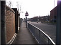
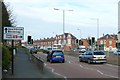
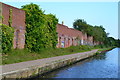
Residents of B11 2RL benefit from a wide range of amenities within practical reach, supporting an active urban lifestyle. The area has access to five rail stations, including Small Heath Railway Station, Tyseley Railway Station, and Bordesley Railway Station, facilitating easy travel across the city. Retail options are plentiful, with five major out-of-town and city centre stores nearby. Aldi Sparkbrook, Asda Small, and Iceland Heybarnes provide residents with convenient access to groceries and household essentials. Five major metro stations serve the area, including Corporation Street, Grand Central New Street, and Bull Street. These hubs connect B11 2RL to the wider transportation network, reducing the need for private car use. The combination of rail and metro access means you can reach key city locations quickly. This transport matrix supports the area's reputation as a functional city centre residential zone. The lifestyle is enriched by local enterprise, with small businesses thriving along commercial streets. Balsall Heath Park offers green space for residents to relax nearby. The area's character is defined by this mix of extensive transport links and independent retail, creating a vibrant atmosphere despite the challenges of inner-city living.
Amenities
Schools
Families considering schools near B11 2RL have three specific options within the local catchment area. Golden Hillock School operates as a primary institution serving younger children in the community. Birmingham Muslim School functions as an independent academy, offering an alternative educational path for families seeking faith-based or private schooling. Ark Boulton Academy stands as a secondary academy and currently holds an Ofsted rating of 'good'. The mix of school types provides a range of educational environments. The presence of an independent school indicates a market for private education alongside state provisions. Golden Hillock School caters to specific local needs, while Ark Boulton Academy's 'good' rating offers reassurance for parents concerned about secondary education quality. Birmingham Muslim School adds diversity to the local educational landscape, reflecting the cultural makeup of the area. For residents, this selection means options exist without needing to look far beyond the immediate neighbourhood. The combination of primary, independent, and academy secondary schools creates a continuous educational pathway. This range is vital for the area's younger population, where the median age of 22 reflects a high concentration of young families and single parents. Choosing schools near B11 2RL allows families to remain rooted in their community while accessing varying educational philosophies and standards.
| Rank | School | Type | Entry gender | Ages |
|---|
Explore more schools in this area
Go to Schools tabDemographics
The community profile for living in B11 2RL is sharply defined by age and diversity. The median age stands at just 22 years, indicating a significantly younger population than the city as a whole. Despite this low median figure, adults aged 30 to 64 represent the most common age range, suggesting a steady core of working families alongside a large cohort of young residents. Accommodation consists primarily of houses, providing structure for this growing household base. Ownership levels reveal a mixed market with 46% of residents owning their homes. This figure suggests a blend of long-term investors, established families, and those navigating the property ladder. The area's ethnic composition is diverse, with Asian groups forming the predominant demographic. This diversity is a defining feature of the neighbourhoods, influencing everything from religious institutions to local fashion trends. However, the demographic landscape includes significant socioeconomic challenges. The ward faces issues related to health and economic deprivation, ranking as the city's most deprived area. It holds the 8th highest child poverty rate out of Birmingham's 69 wards. These statistics paint a complex picture for families considering homes in B11 2RL, where strong community spirit coexists with underlying economic pressures that affect quality of life.
Household Size
Accommodation Type
Tenure
Ethnic Group
Religion
Household Composition
Age
Household Deprivation
NS-SEC
Explore more demographic insights in this area
Go to Demographics tabPlanning
Planning Constraints
- Flood RiskPremium
- Ramsar Wetland SitesPremium
- Area of Outstanding Natural BeautyPremium
- Protected Nature ReservePremium
- Protected WoodlandPremium