Area Overview for B11 2PZ
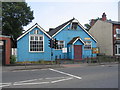
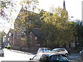
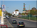
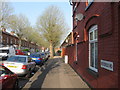
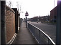
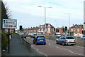
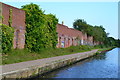
Photos of B11 2PZ


Area Information
Living in B11 2PZ means being part of a small, tightly knit residential cluster in Birmingham’s Sparkbrook and Balsall Heath East ward. With a population of 1,669, this area is characterised by its urban density and cultural diversity, shaped by decades of immigration from the Commonwealth. The ward’s history as an industrial and economic hub for migrant communities continues to influence its vibrant food culture, religious institutions, and entrepreneurial spirit. While challenges like high child poverty and economic deprivation persist, the area thrives on community cohesion, with independent shops and businesses clustered along Stratford Road and Ladypool Road. Balsall Heath Park offers a green space for residents, and nearby retail hubs like Asda and Aldi provide daily convenience. However, the area’s most deprived status in Birmingham means residents face higher rates of unemployment and underinvestment, despite the ward’s 17th-largest economy in the city. For buyers, B11 2PZ offers a compact, culturally rich environment with a distinct sense of local identity.
- Area Type
- Postcode
- Area Size
- Not available
- Population
- 1669
- Population Density
- 2801 people/km²
The property market in B11 2PZ is defined by a 46% home ownership rate, with houses making up the majority of accommodation. This suggests a mix of owner-occupied and rental properties, though the data does not specify the proportion of rentals. The area’s small size means housing stock is limited, with limited scope for expansion. For buyers, this creates a competitive market for existing homes, particularly as the ward’s economic challenges may influence property values. The predominance of houses over flats or apartments could appeal to families seeking space, but the lack of detailed information on property types or prices means buyers must rely on local agents for specific insights. Given the area’s deprivation status, investment in property may carry risks related to long-term value retention.
House Prices in B11 2PZ
No properties found in this postcode.
Energy Efficiency in B11 2PZ
Daily life in B11 2PZ revolves around its commercial hubs, particularly Stratford Road and Ladypool Road, where independent shops and community businesses thrive. Retail options include Asda Small, Asda Sparkhill, and Aldi Sparkbrook, catering to everyday needs. The nearby Balsall Heath Park provides a green space for recreation, while the area’s proximity to rail and metro stations ensures access to Birmingham’s transport network. The ward’s cultural diversity is reflected in its food and retail offerings, though economic challenges mean not all residents benefit equally from these amenities. Despite deprivation, the presence of community hubs and faith-based organisations fosters a sense of cohesion. For buyers, the area’s compact size means amenities are within walking distance, though the lack of major roads or motorways may affect commuting for those reliant on cars.
Amenities
Schools
B11 2PZ is served by three schools: Golden Hillock School, a primary school with no Ofsted rating listed; Birmingham Muslim School, an independent institution; and Ark Boulton Academy, an academy rated ‘good’ by Ofsted. This mix of school types offers families options ranging from state-funded education to independent and academy settings. The presence of Ark Boulton Academy, with its positive rating, may be a draw for families prioritising academic performance, while the independent school caters to specific community needs. However, the lack of detailed performance data for Golden Hillock School means prospective parents should investigate further. The diversity of educational provision reflects the area’s broader cultural and demographic profile.
| Rank | School | Type | Entry gender | Ages |
|---|
Explore more schools in this area
Go to Schools tabDemographics
B11 2PZ has a median age of 22, with the most common age range being adults aged 30–64. This suggests a population skewed towards working-age individuals, though the area’s child poverty rate ranks 8th highest in Birmingham. Home ownership stands at 46%, lower than the city average, with houses being the predominant accommodation type. The Asian community constitutes the largest ethnic group, reflecting the ward’s historical role as a settlement for Commonwealth migrants. Despite its diversity, the area faces significant deprivation, with employment rates well below the Birmingham average and claimant count unemployment proportions notably higher. This context shapes daily life, where community resilience is evident in local businesses and faith-based organisations, but access to services and economic opportunities remains uneven.
Household Size
Accommodation Type
Tenure
Ethnic Group
Religion
Household Composition
Age
Household Deprivation
NS-SEC
Explore more demographic insights in this area
Go to Demographics tabPlanning
Planning Constraints
- Flood RiskPremium
- Ramsar Wetland SitesPremium
- Area of Outstanding Natural BeautyPremium
- Protected Nature ReservePremium
- Protected WoodlandPremium