Area Overview for B11 2NL
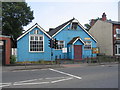
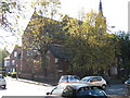
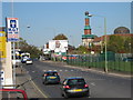
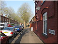
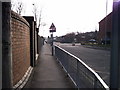
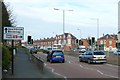
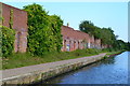
Photos of B11 2NL


Area Information
Living in B11 2NL means being part of a small residential cluster in Birmingham’s Sparkbrook and Balsall Heath East ward, a historically significant area shaped by industrial growth and post-1960s migration from the Commonwealth. The postcode covers 1,669 residents, reflecting a dense urban environment with a strong cultural identity. This area is defined by its diversity, with a predominantly Asian population and a younger demographic skewed toward adults aged 30–64. Daily life revolves around community hubs, independent shops, and the vibrant retail strips of Stratford Road and Ladypool Road. While the ward is the most deprived in Birmingham, it thrives on entrepreneurial energy and a sense of local pride. Balsall Heath Park offers green space, and nearby amenities like Asda Sparkhill and rail stations provide practical convenience. The area’s character blends historical legacy with contemporary challenges, making it a complex yet dynamic place to live.
- Area Type
- Postcode
- Area Size
- Not available
- Population
- 1669
- Population Density
- 2801 people/km²
The property market in B11 2NL is characterised by a 46% home ownership rate, suggesting a significant rental market. Houses, rather than flats, dominate the housing stock, which is typical of older urban areas. This mix of owner-occupied and rented properties reflects the area’s economic dynamics, with limited investment in new developments. The small size of the postcode area means the housing stock is concentrated within a tight radius, often near retail corridors like Stratford Road. Buyers should consider the ward’s deprivation status, which may affect property values and long-term growth. While houses are available, the lack of newer builds and the presence of older stock may appeal to those seeking affordable family homes. The market is not driven by luxury or high-end properties, but rather by practicality and proximity to local amenities.
House Prices in B11 2NL
No properties found in this postcode.
Energy Efficiency in B11 2NL
Residents of B11 2NL have access to a range of amenities within walking or short driving distance. Retail options include Asda Sparkhill, Aldi Sparkbrook, and Asda Small, catering to everyday needs. The area’s small businesses, particularly along Stratford Road and Ladypool Road, contribute to a distinct local character. Balsall Heath Park offers green space for recreation, while rail stations like Small Heath and Tyseley provide transport links. The metro stops at Corporation Street and Bull Street add to connectivity. The mix of retail, transport, and green space supports a practical lifestyle, though the lack of detailed information on dining or leisure venues means residents may need to travel further for specialised services. The presence of community hubs and faith-based organisations also plays a role in daily life, reinforcing the area’s social fabric.
Amenities
Schools
B11 2NL is served by a mix of school types, including Golden Hillock School, a primary school with no Ofsted rating listed, and Birmingham Muslim School, an independent institution. Ark Boulton Academy, an academy with a ‘good’ Ofsted rating, adds a state-funded option for secondary education. This variety allows families to choose between state and independent education, though the absence of a rated primary school may raise concerns. Ark Boulton Academy’s ‘good’ rating indicates a reliable secondary education option, which is crucial for families prioritising academic outcomes. However, the lack of detailed data on school performance or capacity means prospective residents should verify current standards and availability. The presence of multiple school types reflects the area’s diverse community and its emphasis on educational choice.
| Rank | School | Type | Entry gender | Ages |
|---|
Explore more schools in this area
Go to Schools tabDemographics
B11 2NL has a median age of 22, though the most common age range is 30–64 years, indicating a working-age population. Home ownership here is 46%, lower than the national average, with houses being the predominant accommodation type. The area’s demographic profile is marked by a significantly higher proportion of Black, Asian, and Minority Ethnic (BAME) residents, with the Asian community forming the largest group. The ward is Birmingham’s most deprived, with the eighth-highest child poverty rate among its 69 wards. This context shapes daily life, with limited economic opportunities and higher unemployment rates. Despite these challenges, the community’s resilience is evident in the thriving small businesses along Stratford Road and the active presence of faith-based organisations. The younger age profile and high BAME share reflect a long-standing pattern of immigration and cultural integration.
Household Size
Accommodation Type
Tenure
Ethnic Group
Religion
Household Composition
Age
Household Deprivation
NS-SEC
Explore more demographic insights in this area
Go to Demographics tabPlanning
Planning Constraints
- Flood RiskPremium
- Ramsar Wetland SitesPremium
- Area of Outstanding Natural BeautyPremium
- Protected Nature ReservePremium
- Protected WoodlandPremium