Area Overview for B11 2LD
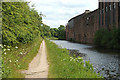
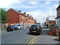
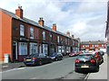
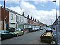
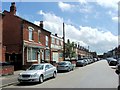
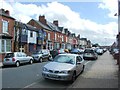
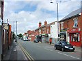
Photos of B11 2LD


Area Information
Living in B11 2LD means inhabiting a small, tightly knit residential cluster in Birmingham’s West Midlands region. With a population of 1,854, this area is characterised by its compact size and historical roots. First mentioned in 1285 as *La Grene de Bordeslei*, it evolved from a medieval pasture into an urbanised district by the 19th century. Today, it is defined by its proximity to the city centre, with Bordesley Green at its heart. The area’s mix of 20th-century infrastructure and early 20th-century architecture, including the Ideal Village, offers a blend of practical living and historical interest. Residents benefit from nearby railway stations, retail hubs, and a network of metro links, making it accessible for commuters. The community is predominantly adults aged 30–64, with a median age of 22, reflecting a balance between younger families and established households. Daily life here is shaped by its urban setting, with a focus on connectivity and proximity to Birmingham’s broader amenities.
- Area Type
- Postcode
- Area Size
- Not available
- Population
- 1854
- Population Density
- 17343 people/km²
The property market in B11 2LD is shaped by its 40% home ownership rate, with houses being the predominant accommodation type. This suggests a mix of owner-occupied and rental properties, though the small population of 1,854 indicates a limited number of homes. The presence of houses, rather than flats or apartments, aligns with a preference for family-friendly living. However, the low home ownership rate implies that much of the housing stock is available for rent, potentially offering opportunities for buyers seeking investment in a compact area. Given the area’s proximity to Birmingham’s city centre and its transport links, properties here may benefit from strong rental demand. Buyers should consider the small size of the area and its immediate surroundings, as property options may be constrained by local planning constraints and the lack of large-scale developments.
House Prices in B11 2LD
No properties found in this postcode.
Energy Efficiency in B11 2LD
The lifestyle in B11 2LD is shaped by its proximity to retail, dining, and transport hubs. Within practical reach are five retail outlets, including Morrisons Bordesley and Asda Bordesley, offering everyday shopping convenience. The area’s railway and metro stations, such as Small Heath and Corporation Street, provide easy access to Birmingham’s cultural and commercial centres. Historically, the Ideal Village, developed between 1908 and 1914, features shops, a park, and a school, contributing to a community-oriented atmosphere. While modern amenities are limited, the presence of these historic and functional spaces ensures a balance between practicality and local character. Residents benefit from a compact layout that minimises travel time, making daily life efficient and connected to the broader city.
Amenities
Schools
| Rank | School | Type | Entry gender | Ages |
|---|
Explore more schools in this area
Go to Schools tabDemographics
The community in B11 2LD is predominantly composed of adults aged 30–64, making up the most common age range, despite a median age of 22. This suggests a mix of younger families and older residents. Home ownership stands at 40%, indicating that 60% of households are renters, which may reflect the area’s status as a rental market. The accommodation type is primarily houses, which is unusual for inner-city areas, suggesting a focus on family-oriented living. The predominant ethnic group is Asian, highlighting the area’s cultural diversity. While specific deprivation data is not provided, the combination of 40% home ownership and a population of 1,854 implies a community that balances stability with affordability. The presence of retail and transport hubs nearby supports a quality of life that caters to both practical needs and social engagement.
Household Size
Accommodation Type
Tenure
Ethnic Group
Religion
Household Composition
Age
Household Deprivation
NS-SEC
Explore more demographic insights in this area
Go to Demographics tabPlanning
Planning Constraints
- Flood RiskPremium
- Ramsar Wetland SitesPremium
- Area of Outstanding Natural BeautyPremium
- Protected Nature ReservePremium
- Protected WoodlandPremium