Area Overview for B11 2JJ
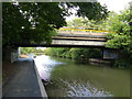
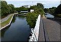
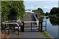
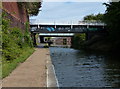
Photos of B11 2JJ


Area Information
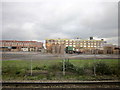
Living in B11 2JJ means being part of a small, densely populated residential cluster in Birmingham’s Sparkbrook and Balsall Heath East ward. This area, with a population of 1,290, sits in the city’s inner south-east, shaped by post-1960s migration from Commonwealth nations. Its character is defined by cultural diversity, with Asian communities forming the predominant ethnic group. The ward’s history as an industrial and economic hub for immigrant populations continues to influence its vibrant food culture, independent retail, and community networks. Despite being Birmingham’s most deprived ward, with the eighth-highest child poverty rate, residents show resilience through entrepreneurial activity along Stratford Road and Ladypool Road. Daily life here is urban and dynamic, with proximity to retail, transport, and community spaces. However, challenges such as high unemployment and underinvestment persist, contrasting with pockets of economic energy. For buyers, the area offers a compact, culturally rich environment, though its infrastructure and services reflect the broader socio-economic dynamics of the city.
- Area Type
- Postcode
- Area Size
- Not available
- Population
- 1290
- Population Density
- 3111 people/km²
The property market in B11 2JJ is shaped by a 45% home ownership rate, indicating that over half of residents rent their homes. Houses, rather than flats, are the primary accommodation type, suggesting a focus on family-sized properties. This contrasts with the broader Birmingham trend of higher flat ownership in inner-city areas. The small area’s limited size means housing stock is constrained, potentially driving up prices for owner-occupiers. For buyers, the market is niche: properties are likely to be larger, with fewer new developments. The rental market is active, supported by the area’s proximity to transport and amenities. However, the ward’s economic challenges may affect property values, with underinvestment limiting long-term appreciation. Buyers should consider the balance between housing availability and the area’s socio-economic context.
House Prices in B11 2JJ
No properties found in this postcode.
Energy Efficiency in B11 2JJ
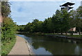
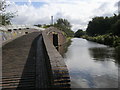
Daily life in B11 2JJ is shaped by its proximity to retail, transport, and community hubs. Nearby amenities include five retail locations, such as Asda Small and Iceland Heybarnes, offering convenience for shopping. The five railway stations—Tyseley, Small Heath, and Spring Road—alongside metro stops like Corporation Street and Bull Street, provide easy access to Birmingham’s transport network. While the area lacks detailed information on parks or leisure facilities, Balsall Heath Park is noted as a nearby community asset. The character of the area is defined by independent shops and small businesses, particularly along Stratford Road and Ladypool Road, which contribute to a sense of local identity. However, the absence of named dining or leisure venues means lifestyle options are inferred rather than specified. Overall, residents have access to essential services and transport links, though the area’s cultural and recreational offerings remain underexplored in the data.
Amenities
Schools
The only school explicitly listed near B11 2JJ is Al-Ameen Primary School, an independent institution with a good Ofsted rating. This suggests a private education option for families, though no state schools or secondary institutions are named in the data. The presence of an independent school may appeal to parents seeking specific curricula or facilities, but it also highlights a lack of publicly funded alternatives. With no other schools detailed, the educational landscape for the area appears limited in scope. Families relying on state education may need to look beyond the immediate vicinity, potentially increasing commuting times. The good Ofsted rating for Al-Ameen indicates quality, but the absence of additional schools underscores the need for broader research into local education options.
| Rank | School | Type | Entry gender | Ages |
|---|
Explore more schools in this area
Go to Schools tabDemographics
The demographic profile of B11 2JJ reflects a young, diverse population. The median age is 22, with the most common age range being adults aged 30–64. Home ownership stands at 45%, lower than the city average, indicating a rental-heavy market. Houses, not flats, dominate the accommodation type, suggesting larger properties. The predominant ethnic group is Asian, contributing to the ward’s cultural vibrancy. However, deprivation is stark: the area is Birmingham’s most deprived ward, with high child poverty rates. This context shapes quality of life, with limited access to high-paying jobs and public services. The younger age profile and higher BAME population mean the community is active, but economic challenges persist, with employment rates below the city average. For residents, this means a mix of community cohesion and systemic barriers to upward mobility.
Household Size
Accommodation Type
Tenure
Ethnic Group
Religion
Household Composition
Age
Household Deprivation
NS-SEC
Explore more demographic insights in this area
Go to Demographics tabPlanning
Planning Constraints
- Flood RiskPremium
- Ramsar Wetland SitesPremium
- Area of Outstanding Natural BeautyPremium
- Protected Nature ReservePremium
- Protected WoodlandPremium