Area Overview for B11 2EX
Photos of B11 2EX
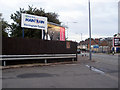
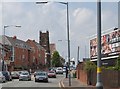
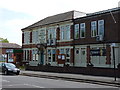
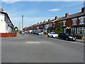
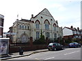
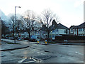
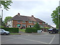
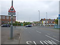
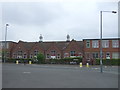
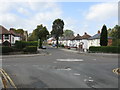
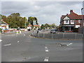
18 photos from this area
Area Information
Key information about the B11 2EX including its size, population, and administrative classification.
- Area Type
- Postcode
- Area Size
- 1.7 hectares
- Population
- 1988
- Population Density
- 6337 people/km²
House Prices in B11 2EX
26
Properties
£76,900
Average Sold Price
£49,000
Lowest Price
£123,000
Highest Price
Showing 26 properties
| Address | Type | Beds | Baths | Last Sale Price | Last Sale Date | |
|---|---|---|---|---|---|---|
| 609 Warwick Road, South Yardley, Birmingham, B11 2EX | Terraced | 2 | 1 | £75,000 | Apr 2018 | |
| 615 Warwick Road, South Yardley, Birmingham, B11 2EX | Terraced | - | - | £84,000 | Nov 2006 | |
| 605 Warwick Road, South Yardley, Birmingham, B11 2EX | Terraced | 2 | 1 | £123,000 | Jun 2006 | |
| 619 Warwick Road, South Yardley, Birmingham, B11 2EX | Terraced | 3 | 1 | £53,500 | Mar 2002 | |
| 617 Warwick Road, South Yardley, Birmingham, B11 2EX | house | - | - | £49,000 | Jun 2001 | |
| First Floor Flat, 561 Warwick Road, South Yardley, Birmingham, B11 2EX | Retail | - | - | - | - | |
| Flat, 547 Warwick Road, South Yardley, Birmingham, B11 2EX | Flat | - | - | - | - | |
| 565 Warwick Road, South Yardley, Birmingham, B11 2EX | Flat | 6 | - | - | - | |
| First Floor, 563-565 Warwick Road, South Yardley, Birmingham, B11 2EX | Flat | - | - | - | - | |
| 553A, 553-555 Warwick Road, South Yardley, Birmingham, B11 2EX | Flat | 1 | 1 | - | - |
Page 1 of 3
Energy Efficiency in B11 2EX
Amenities
Schools
| Rank | School | Type | Entry gender | Ages |
|---|
Explore more schools in this area
Go to Schools tabDemographics
Household Size
Family (3-5 people)
most common
Accommodation Type
Houses
most common
Tenure
52
majority
Ethnic Group
asian_total
most common
Religion
N/A
most common
Household Composition
N/A
most common
Age
22
median
Adults (30-64 years)
most common
Household Deprivation
N/A
with no deprivation
NS-SEC
16
in Lower managerial occupations
Explore more demographic insights in this area
Go to Demographics tabPlanning
Planning Constraints
- Flood RiskPremium
- Ramsar Wetland SitesPremium
- Area of Outstanding Natural BeautyPremium
- Protected Nature ReservePremium
- Protected WoodlandPremium