Area Overview for B11 2BU
Photos of B11 2BU
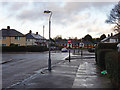
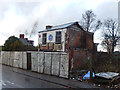
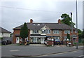
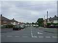
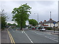
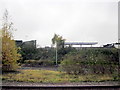
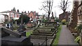
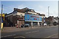
52 photos from this area
Area Information
Key information about the B11 2BU including its size, population, and administrative classification.
- Area Type
- Postcode
- Area Size
- 9866 m²
- Population
- 1789
- Population Density
- 2149 people/km²
House Prices in B11 2BU
43
Properties
£122,489
Average Sold Price
£25,000
Lowest Price
£200,000
Highest Price
Showing 43 properties
| Address | Type | Beds | Baths | Last Sale Price | Last Sale Date | |
|---|---|---|---|---|---|---|
| 58 Blythswood Road, Birmingham, B11 2BU | Terraced | 2 | 1 | £200,000 | Mar 2025 | |
| 133 Blythswood Road, Birmingham, B11 2BU | Terraced | 2 | 1 | £181,000 | Feb 2024 | |
| 10 Blythswood Road, Birmingham, B11 2BU | Terraced | 2 | 1 | £178,000 | Jun 2023 | |
| 32 Blythswood Road, Birmingham, B11 2BU | Terraced | 3 | 1 | £196,000 | May 2023 | |
| 36 Blythswood Road, Birmingham, B11 2BU | house | - | - | £172,500 | Nov 2021 | |
| 38 Blythswood Road, Birmingham, B11 2BU | house | - | - | £146,000 | Apr 2021 | |
| 52 Blythswood Road, Birmingham, B11 2BU | Terraced | 3 | 1 | £155,000 | Feb 2021 | |
| 56 Blythswood Road, Birmingham, B11 2BU | Terraced | 2 | 1 | £127,500 | May 2020 | |
| 139 Blythswood Road, Birmingham, B11 2BU | house | - | - | £164,000 | Nov 2019 | |
| 54 Blythswood Road, Birmingham, B11 2BU | Terraced | 2 | 1 | £148,000 | Oct 2019 |
Page 1 of 5
Energy Efficiency in B11 2BU
Amenities
Schools
| Rank | School | Type | Entry gender | Ages |
|---|
Explore more schools in this area
Go to Schools tabDemographics
Household Size
One person
most common
Accommodation Type
Houses
most common
Tenure
50
majority
Ethnic Group
White
most common
Religion
N/A
most common
Household Composition
N/A
most common
Age
47
median
Adults (30-64 years)
most common
Household Deprivation
N/A
with no deprivation
NS-SEC
21
in Lower managerial occupations
Explore more demographic insights in this area
Go to Demographics tabPlanning
Planning Constraints
- Flood RiskPremium
- Ramsar Wetland SitesPremium
- Area of Outstanding Natural BeautyPremium
- Protected Nature ReservePremium
- Protected WoodlandPremium