Area Overview for B11 1UN
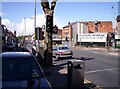
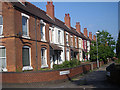
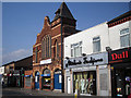
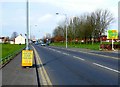
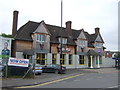
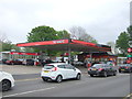
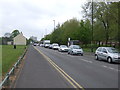
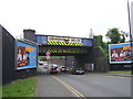
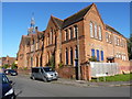
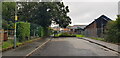
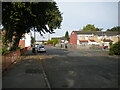
Photos of B11 1UN

Area Information
Living in B11 1UN means being part of a small, tightly knit residential cluster in Birmingham’s Sparkbrook and Balsall Heath East ward. With a population of 1,522, this area is defined by its cultural diversity and historical significance as a hub for post-1960s immigrant communities. The ward’s character is shaped by its urban setting, with a focus on community-driven initiatives and independent retail along Stratford Road and Ladypool Road. Balsall Heath Park offers a green space for residents, while the area’s proximity to Birmingham’s city centre provides access to broader opportunities. However, B11 1UN faces challenges, including high deprivation levels and economic underinvestment. Despite this, the community thrives through local entrepreneurship and a strong sense of cohesion. Daily life here blends the vibrancy of a multicultural environment with the practicalities of an area that prioritises local businesses and community hubs over large-scale developments.
- Area Type
- Postcode
- Area Size
- Not available
- Population
- 1522
- Population Density
- 14278 people/km²
The property market in B11 1UN is characterised by a low home ownership rate (33%) and a predominance of houses over flats. This suggests a market skewed towards rental properties, with limited owner-occupied homes. The presence of houses indicates a focus on family-oriented living, though the small area size means the housing stock is concentrated rather than expansive. Buyers should consider the area’s economic challenges, which may impact property values and long-term investment potential. The rental market is likely competitive, driven by the ward’s proximity to Birmingham’s city centre and its appeal to those seeking affordable housing. However, the high deprivation level and limited infrastructure development may pose risks for property appreciation. Prospective buyers should weigh the community’s strengths against the broader economic context.
House Prices in B11 1UN
No properties found in this postcode.
Energy Efficiency in B11 1UN
Residents of B11 1UN have access to a range of nearby amenities, including five retail outlets such as Aldi Sparkbrook, Spar City, and Lidl Sparkbrook, which provide everyday shopping convenience. Three rail stations—Small Heath, Bordesley, and Tyseley—alongside metro stops like Corporation Street and Bull Street facilitate commuting within Birmingham and beyond. While specific leisure facilities are not detailed, Balsall Heath Park offers a green space for recreation. The area’s character is defined by its independent shops and community hubs, fostering a sense of local identity. However, the lack of named cultural or dining venues means buyers should explore the broader Birmingham area for additional amenities.
Amenities
Schools
The nearest school to B11 1UN is Lloyds Academy, an independent institution. No other schools are listed in the data, meaning families may need to look beyond the immediate area for state schools. The presence of an independent school suggests a focus on private education, though the ward’s deprivation levels may affect access to high-quality schooling for all residents. Families prioritising private education may find Lloyds Academy appealing, but those seeking state-funded options will need to consider nearby districts. The lack of additional schools highlights the importance of transport links to broader educational networks.
| Rank | School | Type | Entry gender | Ages |
|---|
Explore more schools in this area
Go to Schools tabDemographics
The median age in B11 1UN is 47, with the majority of residents falling within the 30-64 age range. Home ownership stands at 33%, significantly lower than the national average, indicating a rental-dominated market. The predominant accommodation type is houses, reflecting a mix of older properties and family homes. The area’s demographic is notably diverse, with the Asian community forming the largest ethnic group. This diversity is a legacy of post-1960s migration from the Commonwealth, shaping the ward’s cultural and social fabric. However, B11 1UN is Birmingham’s most deprived ward, with the 8th highest child poverty rate in the city. This context influences quality of life, with limited economic opportunities and higher unemployment rates. Despite these challenges, the community’s resilience is evident in the proliferation of small businesses and community-led initiatives.
Household Size
Accommodation Type
Tenure
Ethnic Group
Religion
Household Composition
Age
Household Deprivation
NS-SEC
Explore more demographic insights in this area
Go to Demographics tabPlanning
Planning Constraints
- Flood RiskPremium
- Ramsar Wetland SitesPremium
- Area of Outstanding Natural BeautyPremium
- Protected Nature ReservePremium
- Protected WoodlandPremium