Area Overview for B11 1NN
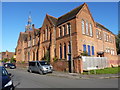
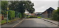
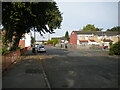
Photos of B11 1NN

Area Information
Living in B11 1NN means being part of a small, densely populated residential cluster in Birmingham’s Sparkbrook and Balsall Heath East ward. With 1,522 residents, the area is a microcosm of Birmingham’s broader urban fabric, shaped by post-1960s migration from the Commonwealth. The community is predominantly Asian, with a median age of 47 and a significant proportion of residents aged 30–64. Daily life here is defined by a blend of cultural diversity and economic challenges. The ward is Birmingham’s most deprived, with the 8th highest child poverty rate, yet it thrives on grassroots entrepreneurship, particularly along Stratford Road and Ladypool Road, where independent shops and community hubs flourish. Despite limited green spaces, Balsall Heath Park offers a rare urban respite. Proximity to rail and metro stations, including Small Heath and Grand Central New Street, ensures connectivity to the city’s core, though local transport infrastructure remains modest. The area’s character is one of resilience: a place where economic deprivation coexists with vibrant cultural traditions and a strong sense of local identity.
- Area Type
- Postcode
- Area Size
- Not available
- Population
- 1522
- Population Density
- 14278 people/km²
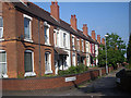
The property market in B11 1NN is characterised by low home ownership, with only 33% of residents owning their homes. This suggests a rental-dominated market, though the area’s small size means housing stock is limited. The accommodation type is predominantly houses, which may appeal to families seeking larger living spaces. However, the ward’s economic challenges—such as high unemployment and underinvestment—could affect property values and desirability. For buyers, the area’s compact nature means competition for homes is likely to be fierce, with limited options for expansion. The focus on independent retail and community hubs indicates a local economy that prioritises small-scale enterprise over large developments, which may influence property trends. Buyers should consider the area’s long-term prospects against its current deprivation levels.
House Prices in B11 1NN
No properties found in this postcode.
Energy Efficiency in B11 1NN
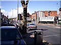
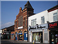
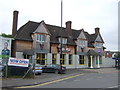
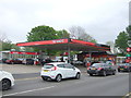
The lifestyle in B11 1NN is shaped by its proximity to retail hubs like Aldi Sparkbrook, Spar City, and Lidl Sparkbrook, offering everyday shopping convenience. The area’s small businesses, particularly along Stratford Road and Ladypool Road, contribute to a distinct entrepreneurial spirit, though economic underinvestment limits broader commercial growth. Balsall Heath Park provides a rare green space for recreation, while nearby rail and metro stations connect residents to cultural and employment opportunities in Birmingham’s city centre. The lack of detailed information on dining or leisure venues suggests a reliance on nearby areas for more varied options. Despite these limitations, the community’s resilience and cultural richness create a dynamic, albeit modest, urban lifestyle.
Amenities
Schools
The only school explicitly listed near B11 1NN is Lloyds Academy, an independent institution. No Ofsted ratings or specific details about its performance are provided in the data. The absence of state schools in the immediate vicinity means families may need to look beyond the area for broader educational options. The presence of a single independent school suggests a limited choice for parents seeking private education, though it may cater to the ward’s culturally diverse population. The lack of additional schools highlights a potential gap in local provision, requiring families to factor in commuting times or broader school catchment areas when considering the area for relocation.
| Rank | A + A* % | School | Type | Entry gender | Ages |
|---|---|---|---|---|---|
| 1 | N/A | Lloyds Academy | independent | N/A | N/A |
Explore more schools in this area
Go to Schools tabDemographics
The population of B11 1NN reflects a community where 33% of residents own their homes, a figure significantly lower than the national average. The area is dominated by houses, though the small population size suggests limited housing stock. The predominant ethnic group is Asian, with a notable absence of detailed breakdowns on specific subgroups. The median age of 47 contrasts with the ward’s broader demographic, which skews younger, but the 30–64 age range remains the most common. This suggests a mature, working-age population, though the area’s high deprivation levels—ranked the most deprived in Birmingham—impact quality of life. Child poverty rates here are among the city’s highest, affecting access to services and opportunities. Despite these challenges, the community’s diversity and historical ties to migration from the Commonwealth continue to shape its social fabric.
Household Size
Accommodation Type
Tenure
Ethnic Group
Religion
Household Composition
Age
Household Deprivation
NS-SEC
Explore more demographic insights in this area
Go to Demographics tabPlanning
Planning Constraints
- Flood RiskLocked
- Ramsar Wetland SitesLocked
- Area of Outstanding Natural BeautyLocked
- Protected Nature ReserveLocked
- Protected WoodlandLocked
- Crime RiskLocked