Area Overview for B11 1JW
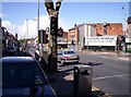
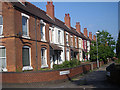
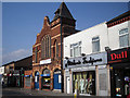
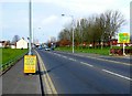
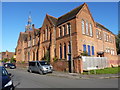
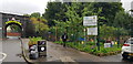
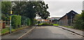
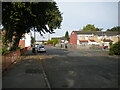
Photos of B11 1JW
Area Information
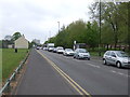
Living in B11 1JW means being part of a small, tightly knit residential cluster in Birmingham’s Sparkbrook and Balsall Heath East ward. With a population of 1,522, this area is characterised by its urban density and cultural diversity. The community is predominantly Asian, reflecting decades of migration from the Commonwealth, which has shaped the area’s identity through food, religion, and entrepreneurship. While the ward is Birmingham’s most deprived, with the 8th highest child poverty rate, it thrives on community spirit and independent retail along Stratford Road and Ladypool Road. Daily life here is defined by proximity to local shops, rail links, and the historic Balsall Heath Park. The area’s compact size means residents are within walking distance of amenities, though challenges like economic underinvestment and high unemployment persist. For those seeking a dynamic, multicultural environment with a strong sense of local identity, B11 1JW offers a distinct contrast to Birmingham’s more affluent districts.
- Area Type
- Postcode
- Area Size
- Not available
- Population
- 1522
- Population Density
- 14278 people/km²
The property market in B11 1JW is shaped by low home ownership (33%) and a focus on houses rather than flats, reflecting a mix of older, family-oriented homes. This suggests the area is not a hotbed for investment properties but rather a place where many residents rent, possibly due to economic constraints. The predominance of houses may indicate a lack of high-density housing, which could limit options for buyers seeking modern or larger properties. For those considering purchase, the small area’s compact nature means competition for available homes is likely, with limited scope for expansion. The market’s character is defined by affordability and local charm, though underinvestment in infrastructure and services may impact long-term value. Buyers should weigh the area’s community assets against its economic challenges.
House Prices in B11 1JW
No properties found in this postcode.
Energy Efficiency in B11 1JW
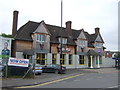
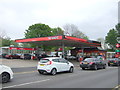
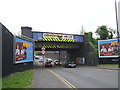
The lifestyle in B11 1JW is shaped by its compact size and proximity to key amenities. Residents have access to five retail outlets, including Aldi Sparkbrook and Lidl Sparkbrook, offering everyday shopping convenience. The area’s rail and metro stations—Small Heath, Bordesley, Tyseley, and others—provide easy access to Birmingham’s business districts and beyond. Balsall Heath Park, a local landmark, offers green space for recreation, complementing the urban environment. The ward’s commercial hubs, such as Stratford Road and Ladypool Road, are lined with small businesses and independent shops, fostering a distinct local character. While the data does not detail dining or leisure options, the presence of community hubs and faith-based organisations suggests a vibrant social fabric. For those prioritising convenience and a mix of urban and green spaces, B11 1JW provides a practical, though economically challenged, lifestyle.
Amenities
Schools
The nearest school to B11 1JW is Lloyds Academy, an independent institution. No Ofsted rating is provided, but the presence of an independent school suggests a focus on private education options. This contrasts with the ward’s broader demographic, where public schooling may be more common. Families seeking independent education will find Lloyds Academy within reach, though the lack of additional schools in the data means other options are not detailed. The school’s role in the area is not specified, but its existence indicates a demand for alternative educational pathways. For parents prioritising state schools, further research would be needed to identify nearby public institutions, as the data does not list them.
| Rank | School | Type | Entry gender | Ages |
|---|
Explore more schools in this area
Go to Schools tabDemographics
The demographic profile of B11 1JW reflects a mature population, with a median age of 47 and the majority of residents aged between 30 and 64. Home ownership is relatively low at 33%, indicating a rental market dominance, while the accommodation type is primarily houses, suggesting a mix of older properties and family homes. The predominant ethnic group is Asian, aligning with the ward’s history as a hub for Commonwealth migrants. This demographic context shapes the area’s social fabric, with a higher proportion of Black, Asian, and Minority Ethnic (BAME) residents than the city average. However, deprivation metrics highlight challenges: the ward is Birmingham’s most deprived, with high child poverty rates affecting quality of life. Despite this, the community’s resilience is evident in its entrepreneurial energy and reliance on local businesses.
Household Size
Accommodation Type
Tenure
Ethnic Group
Religion
Household Composition
Age
Household Deprivation
NS-SEC
Explore more demographic insights in this area
Go to Demographics tabPlanning
Planning Constraints
- Flood RiskPremium
- Ramsar Wetland SitesPremium
- Area of Outstanding Natural BeautyPremium
- Protected Nature ReservePremium
- Protected WoodlandPremium